
Explore
Intelligence
Detailed Route
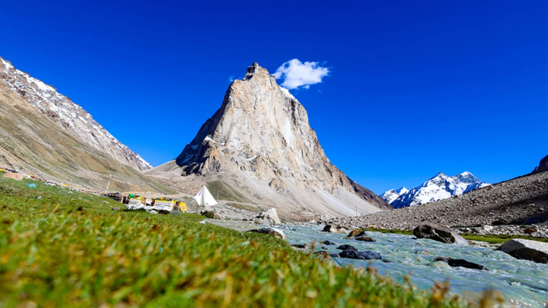
Rangdum Kanji Trail Trek Itinerary — Day by Day Route & Camps
A 5-day wilderness traverse starting from the wide plains of Rangdum, crossing the mighty Kanji La, and descending through multi-colored gorges to the village of Kanji.
Standard RouteThis is the standard mountain pacing for this trek. Specific operators may add an acclimatization day or alter the starting point. Check individual operator schedules for their exact logistics.
Duration
5 Days
Total Distance
41.0 KM
Max Altitude
17,240 FT
Trek Type
linear
Permits Required Before You Go
Permit Cost
Where to Get
DC Office, Leh or Kargil
Documents
Aadhar Card / Passport, Passport Photos
Foreign Nationals
Foreigners must apply for a PAP through a registered travel agent in groups of 2 or more.
Foreigner Process
Protected Area Permit (PAP) may be required depending on the exact approach route near Kargil. Processed by a local agent.
Nearest Embassy Hub
New Delhi
Day by Day Breakdown
Camp Alt
11,998 ft
Day Gain
+3,198 ft
Drive Kargil/Leh to Rangdum
The journey begins with a spectacular drive through the Suru Valley, offering close-up views of the massive Nun Kun massif and its hanging glaciers. Arrive in the marshy, wide plains of Rangdum. Spend the afternoon visiting the 18th-century Rangdum Monastery to aid acclimatization.
Key Landmarks
Staying At
The motorable road navigates deeper into the mountain river corridor, where the landscape transitions from lower foothills into the steep, dense forested valleys.
Camp Alt
14,500 ft
Day Gain
+2,502 ft
Trek Rangdum to Kanji La South Base (Rangdum Pullu)
The trekking begins. You leave the wide plains and enter a narrowing valley heading towards the Zanskar range. The trail ascends steadily alongside a glacial river. You will have to make a few minor river crossings before arriving at the rocky alpine camp at the base of the pass.
Key Landmarks
Staying At
Crossing the high-altitude pass bridges two distinct watershed systems, shifting the expedition over the glaciated divide and down into a new river basin.
Field Notes
KEY ACTIONRiver Crossings
Plan to cross early in the day before snowmelt swells the water levels. Unclip backpack waist belts before crossing.
Use Trekking Poles
Trekking poles are highly recommended to save your knees on the descent.
INFOSlower Progress
Progress will be significantly slower and more taxing on your ankles than trail distance suggests.
Camp Alt
15,100 ft
Day Gain
+600 ft
Today's Objective
🏔 Cross Cross Kanji La To Kanji La
The crux of the expedition. A pre-dawn start is required. The ascent is a brutal, steep climb over loose scree and finally over a small glacier to reach the Kanji La pass at 17,240 ft. The panoramic views of the Karakoram and Zanskar ranges are unparalleled. The descent to Lartsa is equally steep and steep on the knees.
Key Landmarks
Staying At
Crossing the high-altitude pass bridges two distinct watershed systems, shifting the expedition over the glaciated divide and down into a new river basin.
Field Notes
Use Trekking Poles
Trekking poles are highly recommended to save your knees on the descent.
INFOSlower Progress
Progress will be significantly slower and more taxing on your ankles than trail distance suggests.
Camp Alt
12,630 ft
Day Gain
-2,470 ft
Trek Lartsa to Kanji Village
A dramatic descent day. The trail enters the famous Kanji gorge, a narrow, twisting canyon with towering, multi-colored rock walls. This day involves multiple deep and freezing river crossings as the trail switches sides of the river constantly. Finally, the gorge opens up to the beautiful, remote farming village of Kanji.
Key Landmarks
Staying At
The Lartsa basin descends down a steep gorge toward the Kanji Village settlement.
Field Notes
KEY ACTIONRiver Crossings
Plan to cross early in the day before snowmelt swells the water levels. Unclip backpack waist belts before crossing.
Use Trekking Poles
Trekking poles are highly recommended to save your knees on the descent.
INFOSlower Progress
Progress will be significantly slower and more taxing on your ankles than trail distance suggests.
Camp Alt
11,500 ft
Day Gain
-1,130 ft
Drive Kanji Village to Leh
The trekking concludes. Board vehicles in Kanji for the drive back to Leh. The road connects to the main Srinagar-Leh highway, passing through the moonscapes of Lamayuru and Alchi before arriving in Leh.
Key Landmarks
The mountain road traverses the out of the Kanji gorge returning to the Indus valley highway.
Trek Extensions & Add-ons
Lamayuru Monastery Visit
+1 DayAfter reaching Kanji, take a short detour to visit the ancient Lamayuru Monastery, known for its surreal 'moonland' geological formations.
Plan Your Trek:
Ready to book? Compare verified operators for Rangdum Kanji Trail Trek — transparent pricing, no paid rankings.
Still deciding?
Compare routes side-by-side to find the perfect match for your fitness, dates, and budget.
Day by day, camp by camp. Send this to your group so everyone's on the same page.
Step 4: Cost & Logistics
You understand the route.
Now see what services, permits, and logistics actually cost.
View Cost Breakdown