
Explore
Intelligence
Essential Planning Guide
Rangdum Kanji Trail Trek — Complete Guide (2026)
Vibe & Scenery
The Experience
Introduction
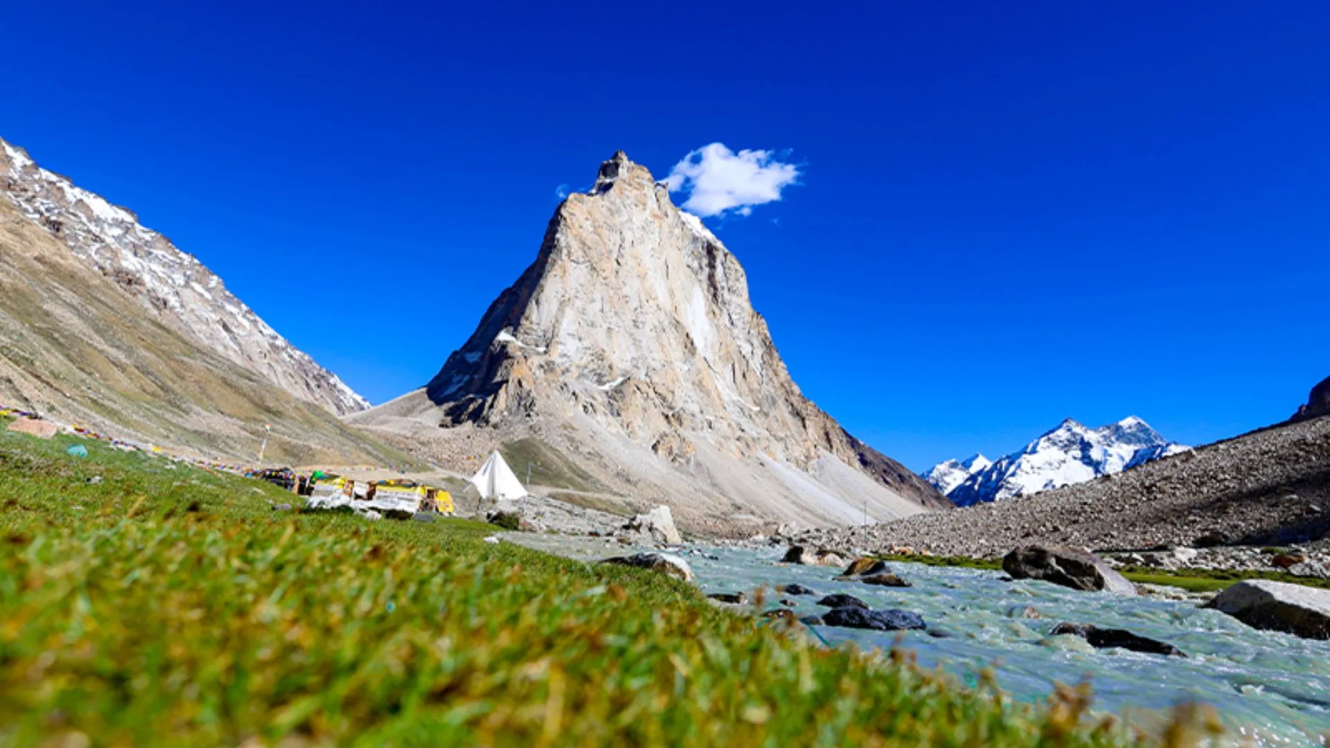
The Rangdum–Kanji Trail is one of Ladakh's great wilderness crossings, linking the broad plains of Rangdum with the remote village of Kanji across the rugged Zanskar Range. For much of the expedition there are no permanent settlements, making self-sufficiency and careful planning essential.
The route gradually climbs through glacial valleys before crossing Kanji La at approximately 17,240 ft, where panoramic views stretch across surrounding Himalayan ranges. Along the way, trekkers negotiate icy streams, glacial moraines, wide alpine plains, and deeply carved river gorges that showcase the raw geology of western Ladakh.
The contrast between the green grazing lands surrounding Rangdum Monastery and the colourful rock formations near Kanji creates one of the most varied landscapes in the trans-Himalayan region. This is a demanding expedition suited to experienced trekkers who are already well acclimatized to high altitude.
Quick Facts
Duration
Max Altitude
Difficulty
Best Time
Trek Distance
Trail Atmosphere
Stargazing
Class 1 Dark Sky
Scent Profile
Silence Level
~15 dB
Vertigo Factor
6 / 10
Iconic Spots
Kanji La Summit
Kanji Gorge
Environment
Nature & Culture
Flora & Fauna
Flora
Fauna
Rangdum Monastery, built in the 18th century, sits like a fortress on a hillock in the valley, serving as a spiritual guardian for the nomadic herdsmen of the region.
— Local folklore
Spiritual & Cultural Significance
Rangdum Monastery is a central spiritual hub for the isolated Suru Valley, belonging to the Gelugpa sect of Tibetan Buddhism.
🕐 Shrine Timings: Rangdum Monastery is open during daylight hours.
Temple Protocols
- •Always walk to the left (clockwise) of Mane walls and Stupas.
- •Dress modestly when visiting the monastery.
Festivals & Dates
Technical Details
Challenge & Preparation
Primarily a cardio demand and altitude exposure challenge
A demanding expedition dominated by extreme cardio demand.
Personal Readiness
Am I ready?
Planning
Logistics & Trail Intel
Getting There
Route to Base
Fly to Leh, drive to Kargil (1 day), then drive to Rangdum (1 day)
Alternatively, a long 2-day drive from Leh directly to Rangdum via the Suru Valley
Base Village
Rangdum / Kanji
11,998 ft
Last ATM
Kargil or Leh
Nearest Medical Facility
SNM Hospital in Leh or District Hospital in Kargil. Basic clinic in Panikhar (near Rangdum).
Mobile Signal
None.
Water Sources
Relies entirely on glacial streams. Must be filtered/purified due to high silt content.
Charging
None. Rely on high-capacity power banks.
For Drivers
Road Condition
The drive to Rangdum via Suru Valley is notoriously bumpy and unpaved. The return from Kanji connects to the excellent Srinagar-Leh highway.
Kargil or Leh
Trail Culinary & Diet
Don't miss the Thukpa and Momo in Leh/Kargil.
Buy specialized diet items at Leh or Kargil
The Content & Remote Hub
No DronesDrones are strictly banned in Ladakh to protect military borders and wildlife.Top Vlog Spots
Video Calls
none
Est. 0 Mbps
UPI Reliability
2/10
Permits and Regulations
Indian nationals require standard identification. Foreign nationals require a Protected Area Permit (PAP) if approaching via certain border zones, but generally, standard trekking permits issued in Leh or Kargil are sufficient. Strict Leave No Trace ethics must be upheld in this pristine environment.
Learn more about how we vet operators and ensure transparency on our why MountRoutes page.
Packing List
Clothing & Outerwear
- Heavy expedition down jacket (-15°C rating)
- Gore-Tex windproof/waterproof hardshell jacket and pants
- Quick-dry, abrasion-resistant trekking pants
- Merino wool baselayers (top and bottom, 2 sets)
- Heavy fleece mid-layers
- Balaclava and UV-protective neck gaiter (Buff)
- Waterproof alpine gloves and thermal liner gloves
Footwear
- High-ankle, stiff-soled waterproof mountaineering/trekking boots
- Sturdy water sandals or neoprene booties (crucial for river crossings)
- Heavy woolen trekking socks (4 pairs)
- Moisture-wicking liner socks
- Waterproof gaiters (essential for the glacier and scree at Kanji La)
Gear & Accessories
- 60-70L expedition backpack with heavy-duty rain cover
- Sleeping bag rated for -15°C comfort
- Anti-shock trekking poles (mandatory for river crossings and descents)
- High-lumen headlamp with spare lithium batteries
- Category 4 UV protection sunglasses (glacier glasses)
- Insulated Nalgene water bottles (2L capacity)
Health & Hygiene
- Comprehensive Altitude First Aid Kit (Diamox, Dexamethasone)
- High SPF (50+) sunscreen and zinc oxide lip balm
- Water purification tablets or mechanical filter
- Biodegradable wet wipes and hand sanitizer
- Personal oximeter and blister care kit
Deep Dives
Explore Further
Editor's Notes
Explore In Detail
Day by Day Itinerary
5-day route reaching 17,240ft. Covers 41.0km of varied terrain.
→ See full itinerary with altitude profileDifficulty & Fitness
Rated challenging. The terrain is incredibly varied: from the marshy plains of Rangdum to glacial ice on Kanji La, and deep, twisting river gorges filled with multi-colored sedimentary rocks.
→ See difficulty breakdown and fitness guideCost & Pricing
Packages range from ₹28,000 - ₹45,000. Inclusions and hidden costs vary by operator tier.
→ See full cost breakdownFrequently Asked Questions
How difficult is the crossing of Kanji La?
It is highly challenging. Kanji La sits at 17,240 ft. The ascent involves navigating steep, loose scree and walking over a small, generally crevasse-free glacier. The descent on the northern (Kanji) side is notoriously steep and requires careful footing to avoid sliding on loose moraine.
Are there river crossings on this trek?
Yes, river crossings are a major feature of this trek, particularly in the Kanji gorge. Depending on the time of year, you may have to cross freezing glacial melt streams up to thigh-deep multiple times a day. Dedicated water footwear is mandatory.
Is acclimatization necessary?
Absolutely. You should spend at least two days in Leh (11,500 ft) or Kargil (8,800 ft) before driving to Rangdum (11,998 ft). The trek gains altitude very rapidly after Rangdum, sleeping at 14,500+ ft on the second night.
Is this a teahouse trek?
No. This is a pure wilderness camping expedition. There are no villages, teahouses, or permanent shelters between Rangdum and Kanji. You must be entirely self-sufficient with an expedition crew.
Is there mobile connectivity?
There is absolutely no mobile connectivity on the trail. You lose signal shortly after Kargil/Leh. Satellite phones carried by operators are the only means of communication.
Do I need special mountaineering gear?
For the peak summer months (August/September), standard high-quality trekking gear and poles are sufficient. In early summer (June/July), the glacier may require microspikes and ropes due to icy conditions.
Which direction is better: Rangdum to Kanji or Kanji to Rangdum?
It can be done in both directions. Rangdum to Kanji allows you to start in the lush Suru valley and end near the Leh-Srinagar highway for an easy return to Leh. Kanji to Rangdum provides a slightly more gradual acclimatization profile.
What wildlife might I encounter?
The remote gorges are prime habitat for Blue Sheep (Bharal), Himalayan Marmots, Golden Eagles, and it is known territory for the elusive Snow Leopard and Himalayan Brown Bear.
Still deciding?
Compare routes side-by-side to find the perfect match for your fitness, dates, and budget.
Everything you need to know, in one place. Someone else in your group needs to see this.
Planning Rangdum Kanji Trail Trek?
Get route conditions, operator updates, and season windows before booking.
Don't miss out! Follow us for route updates@mountroutes|LinkedIn
No spam. Only useful trek updates.
Ready to walk this route?
You’ve read the guide, now find the perfect local team to take you there. Compare our verified list of operators.
Compare verified operators