
Explore
Intelligence
Detailed Route
Ralam Glacier Trek Itinerary — Day by Day Route & Camps
A 10-day immersive expedition traversing diverse Himalayan landscapes and alpine altitudes.
Standard RouteThis is the standard mountain pacing for this trek. Specific operators may add an acclimatization day or alter the starting point. Check individual operator schedules for their exact logistics.
Duration
10 Days
Total Distance
45 KM
Max Altitude
12,800 FT
Trek Type
linear
Permits Required Before You Go
Permit Cost
Where to Get
Munsiyari SDM Office
Documents
Aadhar Card, Medical auto-declaration, Police verification
Foreign Nationals
Extremely difficult to obtain without a registered Indian mountaineering agency lobbying the MHA.
Foreigner Process
Foreigners require Inner Line Permits (ILP) which are obtained in Munsiyari or Pithoragarh.
Nearest Embassy Hub
New Delhi
Day by Day Breakdown
Camp Alt
7,200 ft
Day Gain
+5,700 ft
Arrive in Munsiyari / Permits
A massive 11-hour drive plunging deep into Kumaon. Spend the day gathering the necessary heavy equipment and clearing Inner Line Permits at the SDM office.
Key Landmarks
Staying At
The motorable road navigates deeper into the mountain river corridor, where the landscape transitions from lower foothills into the steep, dense forested valleys.
Camp Alt
6,000 ft
Day Gain
-1,200 ft
Drive to Dhapa & Trek to Lilam
Drive to the roadhead at Dhapa/Chilamdar. Ascend sharply, then descend into the tropical-feeling Gori Ganga gorge to camp at Lilam village.
Key Landmarks
Staying At
Crossing the high-altitude pass bridges two distinct watershed systems, shifting the expedition over the glaciated divide and down into a new river basin.
Camp Alt
8,200 ft
Day Gain
+2,200 ft
Reach Bugdiyar
A punishing, uphill day through the rock-blasted mule track of the Gori Ganga gorge. Reach the massive ITBP camp at Bugdiyar and log your permits.
Key Landmarks
Staying At
The trail follows the mountain river corridor through a narrow, forested gorge, moving past traditional settlements into increasingly dense dense forested valleys.
Field Notes
Use Trekking Poles
Trekking poles are highly recommended to save your knees on the descent.
INFOSlower Progress
Progress will be significantly slower and more taxing on your ankles than trail distance suggests.
Camp Alt
9,500 ft
Day Gain
+1,300 ft
Reach Pinguar / Shama Gwar
The defining turning point. You divergence eastward from the Milam highway into the Ralam valley. The trail degenerates rapidly. Expect thick bamboo, severe gradients, and potentially crossing streams without bridges to reach the high alpine pasture of Pinguar or Shama Gwar.
Key Landmarks
Staying At
The trail follows the mountain river corridor through a narrow, forested gorge, moving past traditional settlements into increasingly dense dense forested valleys.
Field Notes
KEY ACTIONRiver Crossings
Plan to cross early in the day before snowmelt swells the water levels. Unclip backpack waist belts before crossing.
Camp Alt
12,000 ft
Day Gain
+2,500 ft
Reach Ralam Village
Ascend viciously out of the dense forest into the barren, lunar landscape of the high Himalayas. Arrive at Ralam, an incredibly isolated village inhabited only in summer by locals trading medicinal herbs and grazing sheep.
Key Landmarks
Staying At
Crossing the high-altitude pass bridges two distinct watershed systems, shifting the expedition over the glaciated divide and down into a new river basin.
Camp Alt
12,000 ft
Day Gain
0 ft
Today's Objective
🧊 Reach Ralam Glacier
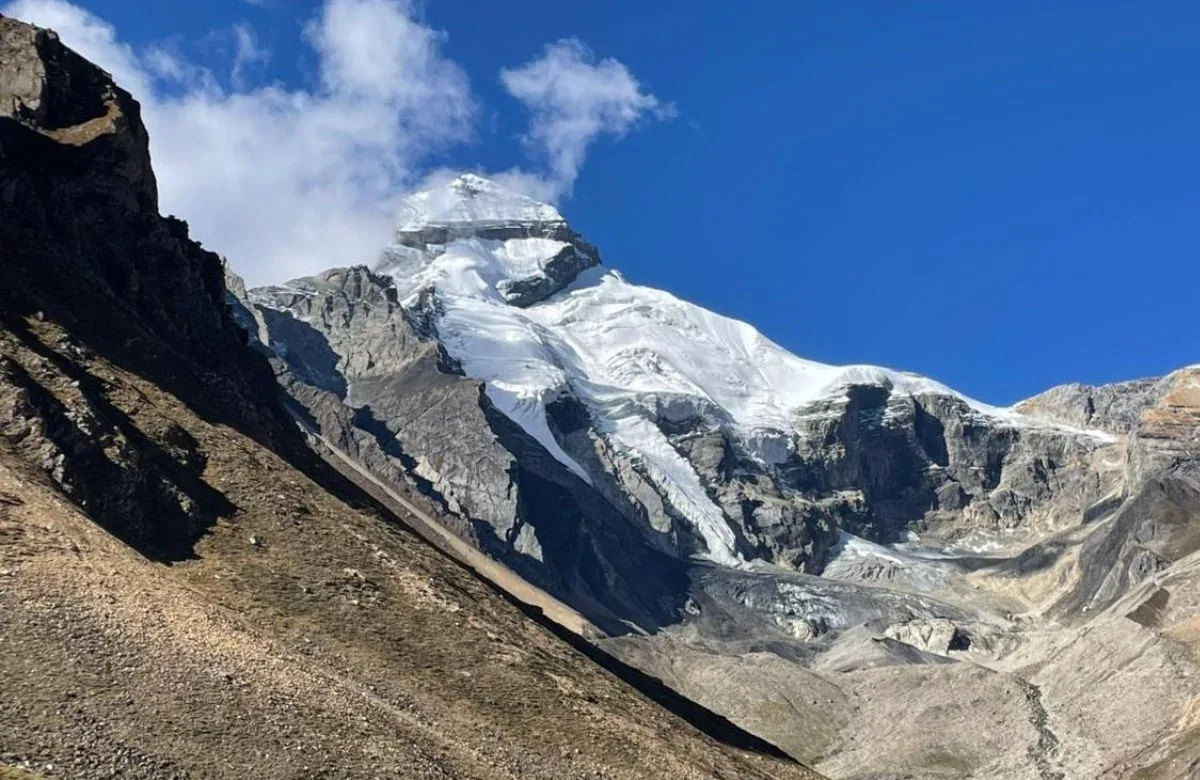
Leave heavy gear at the village. Hike deep into the moraine rubble field to exactly where the three massive ice sheets converge. Stand beneath vertical spires before hiking back to Ralam village.
Key Landmarks
Staying At
Crossing the high-altitude pass bridges two distinct watershed systems, shifting the expedition over the glaciated divide and down into a new river basin.
Field Notes
Use Trekking Poles
Trekking poles are highly recommended to save your knees on the descent.
INFOSlower Progress
Progress will be significantly slower and more taxing on your ankles than trail distance suggests.
Camp Alt
9,500 ft
Day Gain
-2,500 ft
Return to Pinguar / Shama Gwar
Begin the long retreat. The steep descent from the village back into the dense lower bamboo forests is steep on the knees. Use double trekking poles.
Key Landmarks
Staying At
The moraine basin is left behind as the route returns to the alpine pastures.
Field Notes
Use Trekking Poles
Trekking poles are highly recommended to save your knees on the descent.
INFOSlower Progress
Progress will be significantly slower and more taxing on your ankles than trail distance suggests.
Camp Alt
8,200 ft
Day Gain
-1,300 ft
Return to Bugdiyar
Follow the Ralam river back to the central Gori Ganga gorge, checking back in with the ITBP at Bugdiyar to log your successful return from the remote eastern valley.
Key Landmarks
Staying At
The high alpine meadows narrow into forested river terraces as tree line vegetation reappears in the lower mountain river corridor.
Field Notes
KEY ACTIONRiver Crossings
Plan to cross early in the day before snowmelt swells the water levels. Unclip backpack waist belts before crossing.
Camp Alt
7,200 ft
Day Gain
-1,000 ft
Trek to Dhapa & Drive to Munsiyari
Burn through the rest of the Gori Ganga trail back to Lilam, climb up to the roadhead at Dhapa, and board the jeeps for Munsiyari to celebrate.
Key Landmarks
Staying At
The route navigates the final stretch of the river gorge before ascending to the settlement.
Camp Alt
1,500 ft
Day Gain
-5,700 ft
Drive Munsiyari to Kathgodam
The final driving day back to the railway station, ending the expedition.
Key Landmarks
The mountain valley topography transitions back into the lower foothill river plains.
Trek Extensions & Add-ons
Brijganga Pass Exploration
+2 DaysMountaineers with technical gear often attempt pushing towards Brijganga Dhura to view the backside of the Panchachuli range.
Plan Your Trek:
Ready to book? Compare verified operators for Ralam Glacier Trek — transparent pricing, no paid rankings.
Still deciding?
Compare routes side-by-side to find the perfect match for your fitness, dates, and budget.
Day by day, camp by camp. Send this to your group so everyone's on the same page.
Step 4: Cost & Logistics
You understand the route.
Now see what services, permits, and logistics actually cost.
View Cost Breakdown