
Explore
Intelligence
Detailed Route
Pushtar Bugyal Trek Itinerary — Day by Day Route & Camps
A 6-day journey from Sankri, climbing through dense forests to the 12,150 ft Phulara Ridge, and descending into the massive alpine expanse of Pushtara Bugyal.
Standard RouteThis is the standard mountain pacing for this trek. Specific operators may add an acclimatization day or alter the starting point. Check individual operator schedules for their exact logistics.
Duration
6 Days
Total Distance
28.5 KM
Max Altitude
12,150 FT
Trek Type
circuit
Permits Required Before You Go
Permit Cost
Where to Get
Forest Check Post, Netwar (usually handled by the operator).
Documents
Aadhar Card / Passport, Passport size photos, Medical Fitness Certificate
Foreign Nationals
Foreigners require a standard visa. The forest entry fee is significantly higher for non-Indians (approx. ₹1500+).
Foreigner Process
Foreigners pay a significantly higher forest entry fee at Netwar. Bring your physical passport and visa.
Nearest Embassy Hub
New Delhi
Day by Day Breakdown
Camp Alt
6,400 ft
Day Gain
+4,300 ft
Drive Dehradun to Sankri
A long, winding drive through the beautiful Garhwal Himalayas. You will pass through the hill station of Mussoorie, the pine forests of Purola, and follow the roaring Tons River. Arrive at the bustling trekking hub of Sankri by late afternoon to rest and sort gear.
Key Landmarks
Staying At
The motorized route ascends from the plains into the Tons river valley.
Camp Alt
9,300 ft
Day Gain
+2,900 ft
Trek: Sankri to Sikolta
The trek begins with a steady ascent through a beautiful, dense forest. Unlike the Kedarkantha crowd heading to Juda-ka-Talab, you will likely diverge toward the quieter campsite of Sikolta. The forest is rich in birdlife and offers glimpses of the snow-capped peaks through the canopy.
Key Landmarks
Staying At
The trail follows the mountain river corridor through a narrow, forested gorge, moving past traditional settlements into increasingly dense dense forested valleys.
Camp Alt
11,100 ft
Day Gain
+1,800 ft
Trek: Sikolta to Bhoj Gadi
The trail continues upward, eventually breaking out of the dense tree line into high-altitude meadows. The views begin to open up dramatically. Bhoj Gadi is a stunning campsite situated just below the Phulara Ridge, offering excellent evening views of the Kedarkantha peak and Swargarohini.
Key Landmarks
Staying At
Tree line disappears as the valley broadens into a spectacular high-altitude alpine meadow basin, replacing the dense forests with expansive grazing pastures.
Camp Alt
9,500 ft
Day Gain
-1,600 ft
Today's Objective
🏔 Summit Bhoj Gadi To Pushtara Via Phulara Ridge Pushtara Bugyal
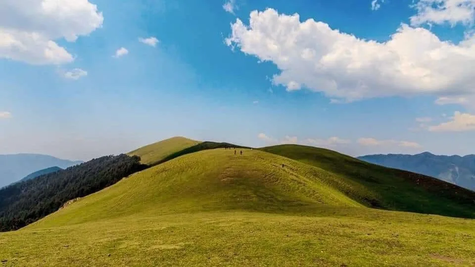
The climax of the trek. You ascend sharply from camp to hit the crest of the Phulara Ridge. For the next few hours, you will walk along the knife-edge of the mountain with nothing blocking your view of the Greater Himalayas. After traversing the ridge, the trail drops steeply into the massive, sweeping green expanse of Pushtara Bugyal.
Key Landmarks
Staying At
The route navigates the Phulara Ridge before dropping into the Pushtara alpine meadow.
Camp Alt
6,400 ft
Day Gain
-3,100 ft
Descend to Taluka and Drive to Sankri
The final trekking day is a continuous descent. You leave the high bugyals behind and plunge back into the thick pine and walnut forests. The descent can be tough on the knees. You emerge at the small village of Taluka, where a 4x4 jeep will be waiting to drive you the dusty 12km back to Sankri.
Key Landmarks
Staying At
The Pushtara meadow plunges through the forest back to the Taluka roadhead.
Camp Alt
2,100 ft
Day Gain
-4,300 ft
Drive Sankri to Dehradun
Board your vehicles early in the morning for the long drive back to Dehradun. You will be dropped off at the ISBT or Railway Station by late afternoon, concluding the expedition.
Key Landmarks
The mountain road descends from the Tons river valley back to Dehradun.
Trek Extensions & Add-ons
Kedarkantha Summit Loop
+1 DaySome highly customized itineraries start by summiting Kedarkantha first, then traversing directly across the high passes to join the Phulara Ridge.
Plan Your Trek:
Ready to book? Compare verified operators for Pushtar Bugyal Trek — transparent pricing, no paid rankings.
Still deciding?
Compare routes side-by-side to find the perfect match for your fitness, dates, and budget.
Day by day, camp by camp. Send this to your group so everyone's on the same page.
Step 4: Cost & Logistics
You understand the route.
Now see what services, permits, and logistics actually cost.
View Cost Breakdown