
Explore
Intelligence
Essential Planning Guide
Padum Darcha Trek — Complete Guide (2026)
Vibe & Scenery
The Experience
Introduction
For generations, the Padum–Darcha route served as one of the principal seasonal links between Zanskar and Lahaul before modern road construction gradually improved access to the region. Despite these changes, substantial sections of the traditional trekking route remain intact and continue to offer a remarkable journey through one of the Himalayas' most remote cultural landscapes.
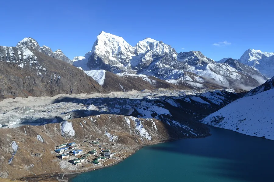
The trail follows the Lungnak River past isolated villages and ancient monasteries—including the spectacular Phuktal Monastery—before climbing steadily towards Shingo La (Shinku La) at approximately 16,700 ft.
Long walking days, sustained altitude, and remote logistics make this trek well suited to experienced trekkers interested in both Himalayan history and high-altitude wilderness.
Quick Facts
Duration
Max Altitude
Difficulty
Best Time
Trek Distance
Trail Atmosphere
Stargazing
Class 1 Dark Sky
Scent Profile
Silence Level
~20 dB
Vertigo Factor
4 / 10
Iconic Spots
Phuktal Monastery
Gumburanjon Peak
Shingo La Pass
Environment
Nature & Culture
Flora & Fauna
Flora
Fauna
The route was part of the ancient Silk Road network. Traders would risk the treacherous Shingo La to bring salt, wool, and turquoise into the lush valleys of Himachal.
— Local folklore
Spiritual & Cultural Significance
Deeply significant Tibetan Buddhist route. The monasteries of Bardan, Mune, and Phuktal are active centers of learning.
🕐 Shrine Timings: Daylight hours for monastery visits.
Temple Protocols
- •Dress modestly when entering monasteries.
- •Remove shoes before entering the main prayer halls.
Festivals & Dates
Technical Details
Challenge & Preparation
Primarily a cardio demand and cumulative fatigue challenge
A demanding expedition with extreme cardio demand and cumulative fatigue.
Personal Readiness
Am I ready?
Planning
Logistics & Trail Intel
Getting There
Route to Base
Fly to Leh
From Leh, take a shared taxi or private vehicle via Kargil and the Suru Valley to Padum (a 2-day journey)
Alternatively, the new Nimmu-Padum road may allow for a 1-day drive depending on road status
Base Village
Padum
11,800 ft
Last ATM
Padum
Nearest Medical Facility
Padum Community Health Center (Start). Keylong Hospital (End).
Mobile Signal
Total blackout between Padum and Darcha.
Water Sources
Abundant from side streams. Do not drink the silty main river water.
Charging
Some homestays (Mune, Purne) may have basic solar charging, but do not rely on it.
For Drivers
Road Condition
Reaching Padum from Leh involves a very long, multi-day drive. The return from Darcha to Manali is a smooth 4-5 hour drive on the highway.
Padum / Keylong
Trail Culinary & Diet
Don't miss the Skyu (Zanskari pasta stew)
Buy specialized diet items at Leh / Padum
The Content & Remote Hub
Top Vlog Spots
Video Calls
low
Est. 1 Mbps
UPI Reliability
3/10
Base WiFi Available
Permits and Regulations
Indian nationals do not require special permits for this route. Foreign nationals must carry a standard passport and visa. If traveling to Padum via Kargil, standard police checkpoints will require registration.
Learn more about how we vet operators and ensure transparency on our why MountRoutes page.
Packing List
Core Clothing Layers
- Lightweight dry-fit t-shirts (x3) for hot valley walks
- Fleece jacket (for evening camps)
- Down jacket (essential for the Shingo La high camps)
- Waterproof hard-shell jacket (wind and rain protection)
- Trekking pants with zip-off legs (highly useful for river crossings)
Footwear & Protection
- Mid-ankle waterproof trekking boots (well broken-in)
- Sturdy water sandals (Crocs or Tevas for multiple river crossings)
- Merino wool trekking socks (x4 pairs)
- Basic gaiters (if trekking in early July)
Head & Hands
- Wide-brimmed sun hat (the Zanskar sun is brutal)
- UV 400 polarized sunglasses
- Fleece beanie
- Lightweight windproof gloves
Gear & Accessories
- 50-60 litre backpack with a robust rain cover
- Trekking poles (mandatory for the steep descent off Shingo La)
- Water purification system (Lifestraw or chlorine tablets)
- Personal first aid kit with Diamox and blister tape
- Power bank (minimum 20,000 mAh)
- Buff or dust mask (essential for road-walking sections)
Deep Dives
Explore Further
Editor's Notes
Explore In Detail
Day by Day Itinerary
9-day route reaching 16,700ft. Covers 134.0km of varied terrain.
→ See full itinerary with altitude profileDifficulty & Fitness
Rated challenging. The trail is a mix of ancient village paths, newly blasted dirt roads, and high-altitude scree slopes. The road sections are easy to walk but mentally tedious due to dust.
→ See difficulty breakdown and fitness guideCost & Pricing
Packages range from 25,000 - 40,000 INR. Inclusions and hidden costs vary by operator tier.
→ See full cost breakdownFrequently Asked Questions
Has the new road ruined the trek?
The new Nimmu-Padum-Darcha road has definitely altered the experience. You will be walking on or adjacent to a dirt road for several sections, especially near Padum and Darcha. However, the sheer scale of the landscape and the isolation of the high camps near Shingo La remain spectacular.
Why start in Padum and end in Darcha instead of the other way around?
Starting in Padum allows for a much better acclimatization profile. You spend 4-5 days gradually gaining altitude in the Zanskar valley before hitting the 16,700 ft pass. If you start in Darcha, you hit the pass on day 3, leading to a massive spike in AMS cases.
Is the detour to Phuktal Monastery worth it?
Absolutely. Phuktal is built directly into a massive cave on a cliff face. Taking an extra day at Purne to hike to the monastery is often considered the cultural highlight of the entire expedition.
Are there homestays available?
Yes, for the first few days in the Lungnak valley (Mune, Ichar, Purne, Kargyak), basic homestays are available. However, for the high camps near Shingo La (Lakham, Chuminakpo), you must have camping equipment.
How difficult is the Shingo La pass crossing?
The crossing is non-technical but physically exhausting due to the 16,700 ft altitude. The descent toward Chuminakpo on the Lahaul side is steep and filled with loose scree, requiring careful footing.
Is it safe to drink the river water?
Do not drink directly from the main rivers, as they carry heavy glacial silt and run-off from the new road construction. Filter and purify water from side streams.
How do I get to Padum to start the trek?
You must fly into Leh, acclimatize, and then take a 2-day drive via Kargil and the Suru Valley to reach Padum. Alternatively, the new Nimmu-Padum road allows for a much faster direct drive from Leh.
Will I encounter snow?
If you trek in late June or early July, expect significant snow on both sides of Shingo La. By August, the pass is generally a dry, rocky scree slope.
Still deciding?
Compare routes side-by-side to find the perfect match for your fitness, dates, and budget.
Everything you need to know, in one place. Someone else in your group needs to see this.
Planning Padum Darcha Trek?
Get route conditions, operator updates, and season windows before booking.
Don't miss out! Follow us for route updates@mountroutes|LinkedIn
No spam. Only useful trek updates.
Ready to walk this route?
You’ve read the guide, now find the perfect local team to take you there. Compare our verified list of operators.
Compare verified operators