Detailed Route
Manimahesh Kailash Trek Itinerary — Day by Day Route & Camps
Standard RouteThis is the standard mountain pacing for this trek. Specific operators may add an acclimatization day or alter the starting point. Check individual operator schedules for their exact logistics.
Duration
3 Days
Total Distance
26 KM
Max Altitude
13,500 FT
Trek Type
circuit
Day by Day Breakdown
Drive: Chamba / Bharmour to Hadsar & Trek to Dhancho
Basic shelters and dhabas at Dhancho. Government medical camp usually operational here. Technical: Drive from Chamba to Bharmour (3 hours). Bharmour is the ancient capital of Chamba and home to the Chaurasi (84) temple complex — a UNESCO tentative world heritage site. Trek from Hadsar to Dhancho is a gentle forest walk. Landscape: Bharmour's Chaurasi temple complex dates back to the 7th century. The 84 temples are dedicated to various Hindu deities and are built in the Nagara architectural style. The Manimahesh temple here is the starting point of the yatra's spiritual journey. Safety: Gentle day. Hydrate well. If starting during yatra, the trail can be crowded.
Key Landmarks
Staying At
Trek: Dhancho to Manimahesh Lake (Dal Lake) & Return to Dhancho
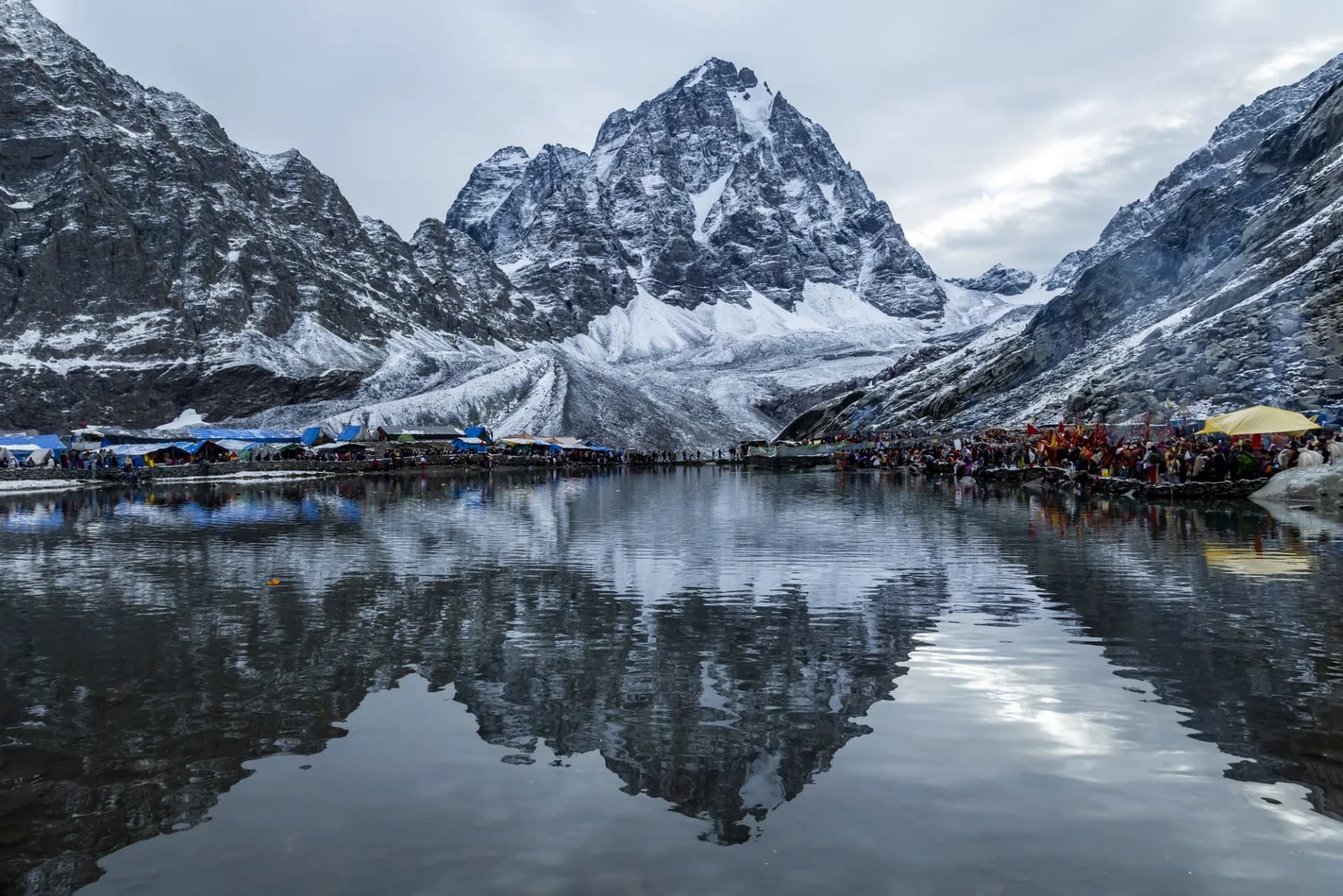
Return to Dhancho by evening. Government rescue helicopters available during yatra in case of emergencies. Technical: The crux day. 7 km uphill to the lake, 4,000 ft gain. The first half is through forest and meadows. Above the tree line, the trail becomes steep switchbacks on rocky terrain. The last 2 km to the lake (Bhairav Ghati) is the steepest section. At the lake, pilgrims take a holy dip in the freezing glacial water (4-5°C). The Kailash peak rises directly above, reflected in the still morning water. Landscape: Gauri Kund, at 11,800 ft, is believed to be the spot where Goddess Parvati bathed before visiting Lord Shiva at the summit. Female devotees consider a dip here spiritually equivalent to visiting the main lake. The Manimahesh Lake itself is believed to have a 'mani' (jewel) at its bottom, placed by Shiva — hence the name 'Mani-mahesh' (Jewel of the Lord). Safety: AMS alert at 13,500ft. The rapid altitude gain is the main risk. Carry ORS, warm fluids, and Diamox if prescribed. Do not spend more than 1 hour at the lake — the descent is long. Turnback time: 12 PM.
Key Landmarks
Staying At
Descent: Dhancho to Hadsar & Drive to Chamba / Bharmour
Descent and drive. Yatra concludes. Visit Bharmour Chaurasi temples if time permits.
Trek Extensions & Add-ons
Kugti Pass Traverse
+4 DaysExtend the trek from Manimahesh to Lahaul valley via the legendary Kugti Pass for a true trans-Himalayan experience.
Also on this trek
Ready to book? Compare verified operators for Manimahesh Kailash Trek — transparent pricing, no paid rankings.
Still deciding?
Compare routes side-by-side to find the perfect match for your fitness, dates, and budget.
Day by day, camp by camp. Send this to your group so everyone's on the same page.
Love this itinerary?
Find operators who follow this exact route with verified acclimatization days.
Find matching operators