
Explore
Intelligence
Essential Planning Guide
Lambri Top Trek — Complete Guide (2026)
Vibe & Scenery
The Experience
Introduction
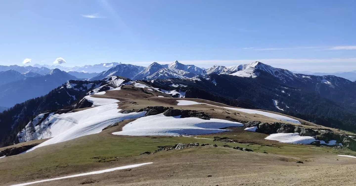
The Lambri Top Trek ascends from the Jalori Pass–Shoja region through mixed forests before emerging onto broad alpine ridges overlooking the Tirthan Valley. At approximately 11,600 ft, Lambri Top provides sweeping views across the Great Himalayan National Park, the surrounding mountain ranges, and the ridges separating Kullu and Shimla districts.
Unlike many forest-focused routes in the region, the upper section follows open grassy ridgelines that remain popular with local shepherds during the summer months. The combination of forests, meadows, and panoramic viewpoints creates a varied and rewarding trekking experience.
Ideal for trekkers seeking scenic ridgeline walking without technical difficulty, Lambri Top offers one of the region's most accessible high viewpoints.
Quick Facts
Duration
Max Altitude
Difficulty
Best Time
Trek Distance
Trail Atmosphere
Stargazing
Class 1 Dark Sky
Scent Profile
Silence Level
~20 dB
Vertigo Factor
2 / 10
Iconic Spots
Lambri Top Ridge 360-Degree Panorama
Environment
Nature & Culture
Flora & Fauna
Flora
Fauna
Lambri Top is a traditional shepherd observation point — from here, herders could track the movement of their entire flock across multiple valleys simultaneously. The 360-degree view was practically essential for Pangi-Kullu shepherd valley management.
— Local folklore
Spiritual & Cultural Significance
No formal religious significance. Traditional shepherd observation ridge.
🕐 Shrine Timings: N/A
Temple Protocols
Technical Details
Challenge & Preparation
Primarily a cardio demand challenge
A capable trekker's route that balances cardio demand and joint & muscle impact.
Personal Readiness
Am I ready?
Planning
Logistics & Trail Intel
Getting There
Route to Base
Drive from Aut via Banjar (2.5 hrs)
Shoja is just below Jalori Pass on the Kullu side
Base Village
Shoja Village, Jalori Pass Road
8,800 ft
Last ATM
Banjar (35 km)
Nearest Medical Facility
Banjar CHC
Mobile Signal
Shoja patchy. Zero on ridge.
Water Sources
Forest springs on approach. Carry 2L for open ridge section.
Charging
Shoja guesthouse only.
For Drivers
Road Condition
Shoja accessible from Aut via Banjar. Good road.
Banjar
Trail Culinary & Diet
Don't miss the Fresh apple juice from Shoja orchards
Buy specialized diet items at Shoja village cafes
The Content & Remote Hub
Top Vlog Spots
Video Calls
none
Est. 0 Mbps
UPI Reliability
3/10
Base WiFi Available
Permits and Regulations
No permits required. Open buffer zone access.
Learn more about how we vet operators and ensure transparency on our why MountRoutes page.
Packing List
Panoramic Photography
- Wide-angle lens covering the full 360-degree view
- Telephoto for picking out GHNP peaks in the distance
- Tripod for dawn/dusk shots from the open ridge
Short Moderate Trek Essentials
- Wind stopper layer (the ridge is exposed and the cross-valley wind is consistent)
- Trekking poles for the meadow ascent
- Sun protection (UV exposure is significant on the open ridge)
Deep Dives
Explore Further
Editor's Notes
Your guide can point out Deo Tibba (21,340 ft) due north, the Pir Panjal chain to the east, the Shimla foothills to the south, and the Kullu valley floor to the west simultaneously. Standing on Lambri Top, you are at the geographic center of a vast panoramic map.
Explore In Detail
Day by Day Itinerary
2-day route reaching 11,600ft. Covers 14km of varied terrain.
→ See full itinerary with altitude profileDifficulty & Fitness
Rated moderate. Forest trail transitioning to open meadow. No technical terrain. Main challenge is wind exposure on the ridge.
→ See difficulty breakdown and fitness guideCost & Pricing
Packages range from ₹3,500 – ₹9,000. Inclusions and hidden costs vary by operator tier.
→ See full cost breakdownFrequently Asked Questions
What are the views from Lambri Top?
North: GHNP core zone ridges including Rakhundi Top and Shilt. East: Shinkal Dhar ridge. South: Shimla hills and Pabbar valley. West: Full length of the Tirthan valley to the Kullu-Beas plains. One of the most genuinely 360-degree viewpoints in the Kullu hills.
Is it a day trek or overnight?
Can be done as a long day hike from Shoja or Gushaini area. Overnighting on or near the ridge for the sunrise is highly recommended.
Is a permit needed?
No. Lambri Top sits in the GHNP buffer zone, not the core zone. No permit required.
Is there a trail?
The lower forest section has a reasonable trail. The upper meadow section is open grazing land — the ridge crest is obvious visually.
What is the best time for views?
Early morning before 10am on October-November days. The atmospheric clarity is extraordinary and the Greater Himalayan peaks (Deo Tibba, Indrasan) are visible 100+ km north.
Can I see both Deo Tibba and the Shimla hills?
Yes. Standing on the Lambri ridge, you have the 21,340 ft Deo Tibba dead ahead in one direction and the Shimla hills rolling away in the other. This dual-hemisphere view is the signature of the Lambri Top experience.
Is there water on the trail?
Streams in the forest section. No water on the open ridge — carry 2L from the last forest spring.
Is it suitable for children?
Yes for older children (12+) with good walking fitness. The ridge section is exposed but not dangerous.
What is the best base for this trek?
Shoja village (8,800 ft) is the most convenient base — reduces the elevation gain required.
Can I combine this with Serolsar Lake?
Yes. Lambri Top and Serolsar Lake are both accessible from the Shoja/Jalori area and can be combined in a 3-day loop.
Still deciding?
Compare routes side-by-side to find the perfect match for your fitness, dates, and budget.
Everything you need to know, in one place. Someone else in your group needs to see this.
Planning Lambri Top Trek?
Get route conditions, operator updates, and season windows before booking.
Don't miss out! Follow us for route updates@mountroutes|LinkedIn
No spam. Only useful trek updates.
Ready to walk this route?
You’ve read the guide, now find the perfect local team to take you there. Compare our verified list of operators.
Compare verified operators