Difficulty & Readiness Guide
Is Krishna Temple Yulla Kanda Trek Difficult? — Fitness & Altitude Guide
Preparation Required
Intermediate
Prior Experience
Recommended: 1-2 easy Himalayan treks or regular hiking experience.
Score Engine v3
Why This Score?
Stamina
41/100
Based on average nightly altitude gain, highest campsite, and daily distance. Reflects how hard the average day feels.
Spike Day
30/100
Based on max altitude reached, summit day elevation gain, and summit day distance. Reflects the hardest single day.
Why Krishna Temple Yulla Kanda Trek Feels Difficult
A capable trekker's route that balances joint & muscle impact and altitude exposure.
Physiological Demand
Steep, punishing ascents and descents that will heavily tax your knees, ankles, and overall joint stability.
Significant time spent above 12,000ft. Expect shortness of breath and slower pacing.
Rough, uneven trails with occasional scrambling or minor exposure.
Challenging daily distances and steady climbs. Good cardiovascular fitness is required.
Comfortable pacing with good recovery options.
Crux Section
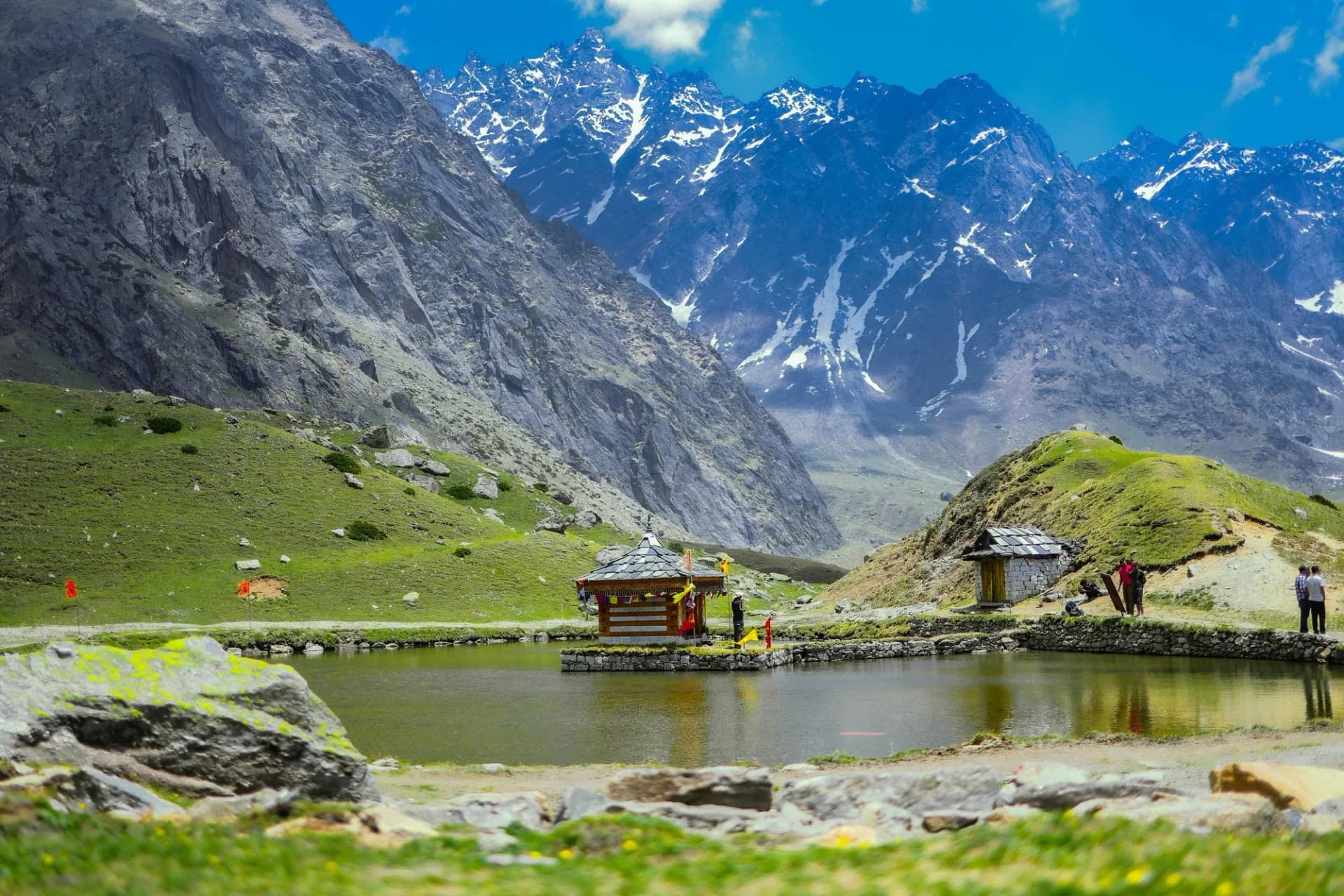
Day 3 — Oxygen Peak
Highest exposure point at 12,779ft.
Krishna Temple Yulla Kanda Trek/ 46
The Grassy Ridge Trap
Caution
The grassy slope descent after rain is deceptively slippery. It's not rocky terrain that causes falls here — it's the thick, wet mountain grass. Trekking poles and slow movement prevent the otherwise common ankle roll.
Terrain Breakdown
Good trail through forest, transitioning to open grassy ridge. No technical terrain. Steepness is the main challenge.
Summit Day Notes
The ridge walk to the temple is exposed to wind but on a clear grassy path. No scrambling required.
The Descent
The steep 4,600 ft descent from ridge to Yulla Khas via grassy slopes and forest trail is knee-intensive. Poles essential.
Preparation
The 4,600 ft gain on Day 2 requires good cardiovascular fitness. Staircase training for 2 weeks prior is ideal.
Altitude Profile
13,800 ft is well within the moderate AMS risk zone. Monitor for headache at the ridge camp and descend if needed.
Run AMS Risk Audit →Route Stress Forecast
Highest exposure point at 12,779ft.
Deep 2,600ft descent will test joint stability.
First major altitude jump occurs on Day 2.
*Forecast derived from route geometry and altitude profile. External variables (weather/group) remain the final authority.
Trail Performance Data
Max Gradient
55%
Hydration
0.35L per km recommended
Loose Surface Sections
- •Grassy ridge descent (slippery when wet)
- •Scree near ridge crest
Common Mistakes on Krishna Temple Yulla Kanda Trek
Most injuries and failures on this trail can be avoided by making smarter decisions early on.
Attempting as a long day hike — underestimating cumulative elevation gain
Not carrying enough water for the dry upper ridge section
Safety & Medical Risks
Key Risks
Slipping on wet grassy ridge descent
Wind exposure on upper ridge — hypothermia risk if underprepared
Lightning risk on open ridge during afternoon storms
AMS (Altitude Sickness)
Sleeping at 11,500 ft on Day 2 is manageable for acclimatized visitors from Manali. Monitor for AMS symptoms before ridge push.
Evacuation Route
Retrace to Yulla Khas. Helicopter landing feasible in upper meadow.
Solo Trekking
Upper trail is faint above treeline. Local guide strongly recommended.
Common Trail Ailments
🏥 Nearest ICU: Regional Hospital Reckong Peo (Stabilization) / Dr. RPGMC Tanda (Specialized ICU)
Tactical Emergency Hub
> Upper meadow (11,500 ft) is helicopter-accessible in clear weather. Otherwise evacuation on foot to Yulla Khas is 4-5 hours.
Who Can Do This Trek?
Min Age
12+
Max Age
60
Western Toilets at Base
Yes
Solo Female Travelers
Yulla Khas is one of the safest and most welcoming communities in Himachal. Extremely safe for solo women. Guided group recommended on trail.
Expert Verdict
Highly technical trek requiring physical and mental preparation.
Ready to book? Compare verified operators for Krishna Temple Yulla Kanda Trek — transparent pricing, no paid rankings.
Want to know which operators carry certified guides and medical support? See operator safety ratings for Krishna Temple Yulla Kanda Trek
Also on this trek
Still deciding?
Compare routes side-by-side to find the perfect match for your fitness, dates, and budget.
Still think it's doable? Share this with your trek mate and see if they agree.
Fit for the challenge?
For challenging treks, safety is paramount. Find operators prioritizing medical support and guide expertise.
Compare operator safety scores