
Explore
Intelligence
Detailed Route
Kareri Lake Trek Itinerary — Day by Day Route & Camps
A 3-day immersive expedition traversing diverse Himalayan landscapes and alpine altitudes.
Standard RouteThis is the standard mountain pacing for this trek. Specific operators may add an acclimatization day or alter the starting point. Check individual operator schedules for their exact logistics.
Duration
4 Days
Total Distance
26 KM
Max Altitude
9,650 FT
Trek Type
linear
Day by Day Breakdown
Camp Alt
6,500 ft
Day Gain
+1,900 ft
Drive to Kareri Village
Homestay or tent stay at Kareri Village. Evening visit to the Shiva temple is recommended. Technical: Drive from Dharamshala to Kareri village is a gentle uphill through dense forest. Well-marked road. The last km involves crossing the Kareri Nallah on a wooden bridge. Landscape: Kareri village is a traditional Gaddi settlement. The Shiva temple near the village dates back several centuries and is built in the distinctive Himalayan wooden-and-stone style. During the Kartik Purnima fair (November), thousands of devotees walk up from the plains. Safety: Hydrate well. The forest canopy keeps the trail cool but humid. Check for ticks after the forest walk. Set up camp by 4 PM or stay in guesthouse
Key Landmarks
Staying At
The route ascends through the lower Kangra valley, transitioning into dense pine forests surrounding the village.
Camp Alt
9,650 ft
Day Gain
+3,150 ft
Today's Objective
🏔 Cross Kareri Lake
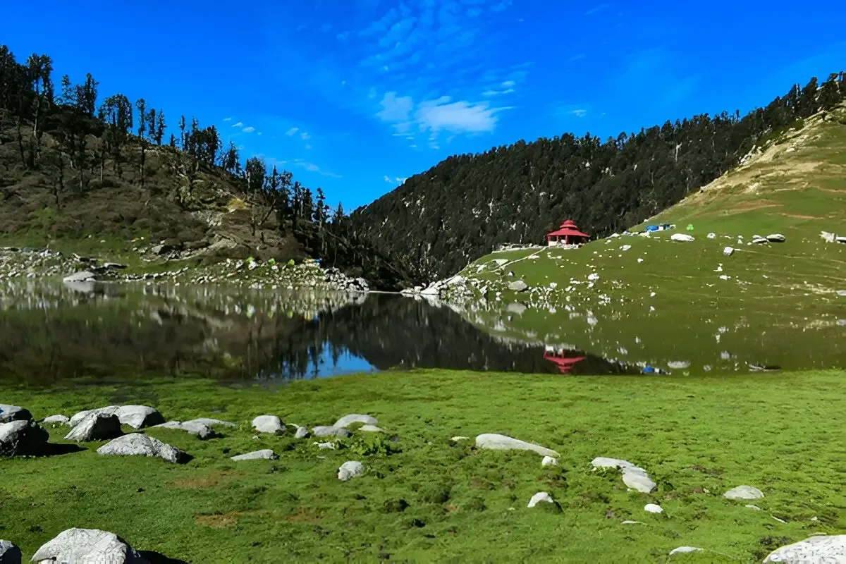
Camping near the lake shore. Sunrise over the lake is a must-see. Stars at 9,650ft without light pollution are extraordinary. Technical: The trail steepens significantly after Lioti. You cross from forest into open moraine and rocky terrain. The final approach to the lake is across a boulder field — use trekking poles and step carefully. In May-June, the trail may have snow patches. The lake sits in a glacial cirque, surrounded by high walls. Landscape: Kareri Lake is believed by locals to be the abode of Nagas (serpent deities). Gaddi shepherds leave offerings of flour and butter at the lake shore before crossing to their summer grazing grounds. The lake changes color with the seasons — deep blue in summer, pale green in autumn. Safety: AMS Alert: 9,650ft is moderate altitude. The 3,150ft gain in one day requires good pacing. Drink at least 4L of water. Oximeter check at the lake. The lake shore is exposed to wind — layer up immediately upon arrival.
Key Landmarks
Staying At
The trail leaves the village settlement and enters a dense, humid river gorge environment.
Field Notes
KEY ACTIONRiver Crossings
Plan to cross early in the day before snowmelt swells the water levels. Unclip backpack waist belts before crossing.
Use Trekking Poles
Trekking poles are highly recommended to save your knees on the descent.
INFOSlower Progress
Progress will be significantly slower and more taxing on your ankles than trail distance suggests.
Camp Alt
4,600 ft
Day Gain
-5,050 ft
Trek to Kareri Village & Drive to Dharamshala
Reach Dharamshala by 5 PM. McLeodganj cafes and the Dalai Lama Temple are nearby. Technical: Full descent in one day. Take breaks every 45 minutes. Use two poles. The descent through the forest is easier on the knees than the moraine. Reach Ghera by 2 PM for the drive back. Landscape: The descent offers views of the Kangra Valley spread below — one of the widest valleys in the Himalayas, with the Dhauladhar on one side and the Shivalik hills on the other. Safety: Knee Fatigue Alert. Take it slow. The descent is long (5,050ft drop). Hydrate and eat well.
Key Landmarks
The dense forest transitions entirely into an open alpine basin characterized by rock and glacial meltwater.
Field Notes
Use Trekking Poles
Trekking poles are highly recommended to save your knees on the descent.
INFOSlower Progress
Progress will be significantly slower and more taxing on your ankles than trail distance suggests.
Trek Extensions & Add-ons
Minkiani Pass Exploration
+1 DayShort extension to a higher pass for views of the Chamba valley.
Plan Your Trek:
Ready to book? Compare verified operators for Kareri Lake Trek — transparent pricing, no paid rankings.
Still deciding?
Compare routes side-by-side to find the perfect match for your fitness, dates, and budget.
Day by day, camp by camp. Send this to your group so everyone's on the same page.
Step 4: Cost & Logistics
You understand the route.
Now see what services, permits, and logistics actually cost.
View Cost Breakdown