Difficulty & Readiness Guide
Is Jorkanden Base Camp Trek Difficult? — Fitness & Altitude Guide
Preparation Required
Elite
Prior Experience
Mandatory: Prior high-altitude trekking (16,000ft+) and basic technical knowledge.
Score Engine v3
Why This Score?
Stamina
70/100
Based on average nightly altitude gain, highest campsite, and daily distance. Reflects how hard the average day feels.
Spike Day
82/100
Based on max altitude reached, summit day elevation gain, and summit day distance. Reflects the hardest single day.
Why Jorkanden Base Camp Trek Feels Difficult
An elite-level undertaking with extreme joint & muscle impact, cardio demand, and altitude exposure. This route will push every dimension of your physical and mental endurance to the limit.
Physiological Demand
Steep, punishing ascents and descents that will heavily tax your knees, ankles, and overall joint stability.
Expect long, exhausting days of sustained climbing at high intensity. Your cardiovascular system will be pushed to its absolute limit.
Extreme high altitude exposure. Severe oxygen depletion requires careful acclimatization and peak cardiovascular health.
Rough, uneven trails with occasional scrambling or minor exposure.
Multi-day camping requiring mental toughness to handle weather and fatigue debt.
Crux Section
Day 3 — Oxygen Peak
Highest exposure point at 16,800ft.
Jorkanden Base Camp Trek/ 78
Day 2 Reality
Caution
Day 2 gains 4,800 ft — among the highest single-day gains in this database's listings. The moraine section at the end (14,000-16,300 ft) is laborious and at altitude. Plan a 10+ hour day with maximum 4 km/hr pace and frequent rest.
Terrain Breakdown
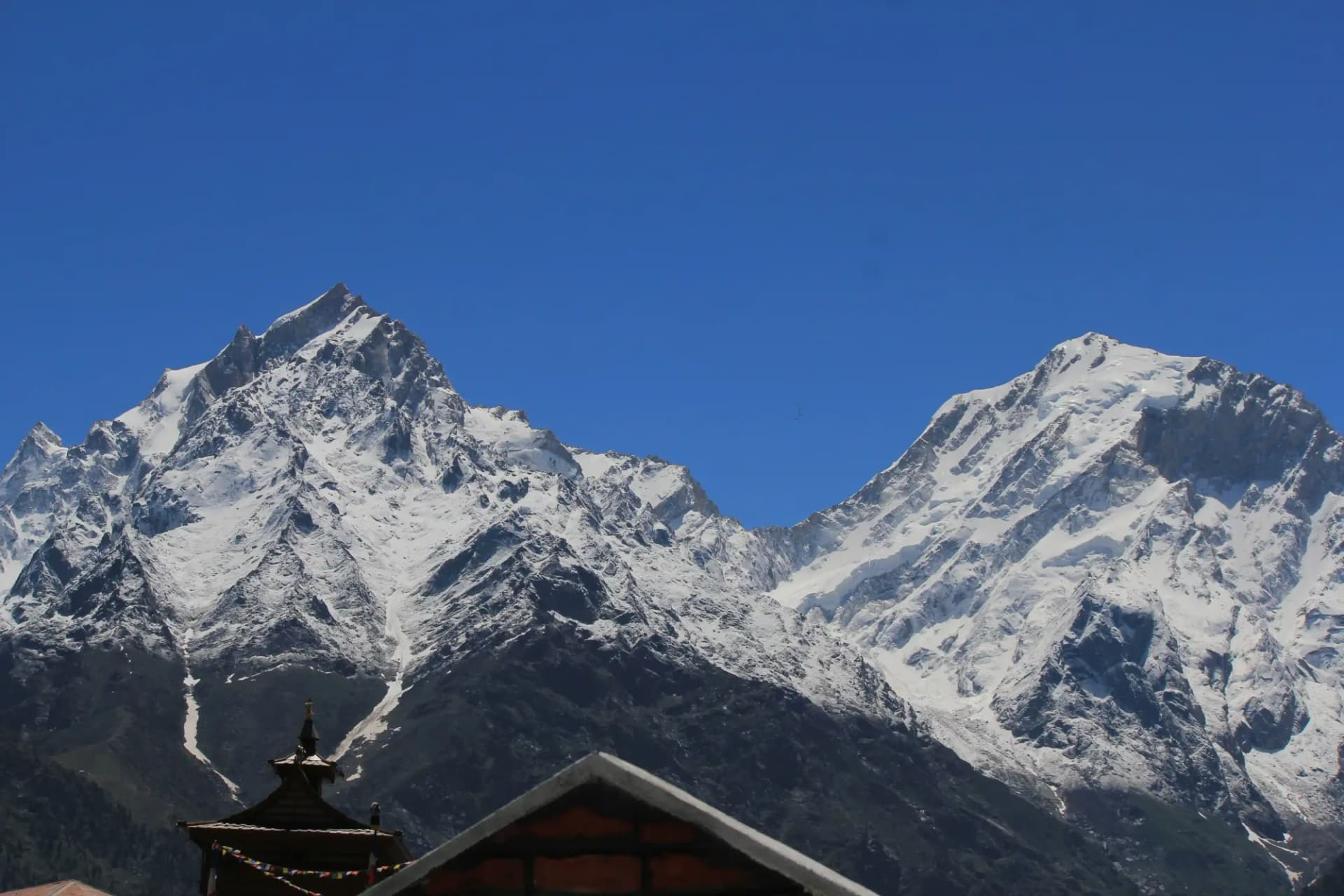
Rugged, steep ascents in the Kinnaur region. Moraines and glacial terrain near the base camp.
Summit Day Notes
The hike to the base of Jorkanden (the highest peak in the Kinner Kailash range) is an alpine challenge.
The Descent
Steep and rocky; good knee support is vital.
Preparation
High fitness required due to steep gradients and altitude.
Route Stress Forecast
Highest exposure point at 16,800ft.
Deep 7,370ft descent will test joint stability.
First major altitude jump occurs on Day 1.
*Forecast derived from route geometry and altitude profile. External variables (weather/group) remain the final authority.
Trail Performance Data
Max Gradient
40%
Hydration
0.4L per km recommended
Loose Surface Sections
- •Rocky pass scree zones
- •Forest slippery switchbacks
Common Mistakes on Jorkanden Base Camp Trek
Most injuries and failures on this trail can be avoided by making smarter decisions early on.
Ignoring the constant rockfall hazards near the upper moraine sections.
Pushing through altitude sickness symptoms during the steep acclimatization days.
Safety & Medical Risks
Key Risks
AMS at 16,300 ft base camp
Day 2 exhaustion causing high-altitude camp accidents
Navigation in upper moraine
AMS (Altitude Sickness)
2 nights in Sangla (8,930 ft) mandatory before start. Monitor blood oxygen at camp.
Evacuation Route
Retrace to Sangla — 1.5 days from base camp.
Solo Trekking
Local guide essential for upper moraine navigation.
Common Trail Ailments
🏥 Nearest ICU: Indira Gandhi Medical College (IGMC), Shimla
Tactical Emergency Hub
> Evacuation by foot.
Who Can Do This Trek?
Min Age
18+
Max Age
55
Western Toilets at Base
Yes
Solo Female Travelers
Safe. Sangla is a tourist-oriented valley.
Expert Verdict
Highly technical trek requiring physical and mental preparation.
Ready to book? Compare verified operators for Jorkanden Base Camp Trek — transparent pricing, no paid rankings.
Want to know which operators carry certified guides and medical support? See operator safety ratings for Jorkanden Base Camp Trek
Also on this trek
Still deciding?
Compare routes side-by-side to find the perfect match for your fitness, dates, and budget.
Still think it's doable? Share this with your trek mate and see if they agree.
Fit for the challenge?
For challenging treks, safety is paramount. Find operators prioritizing medical support and guide expertise.
Compare operator safety scores