
Explore
Intelligence
Essential Planning Guide
GHNP Tirth Source Trek — Complete Guide (2026)
Vibe & Scenery
The Experience
Introduction
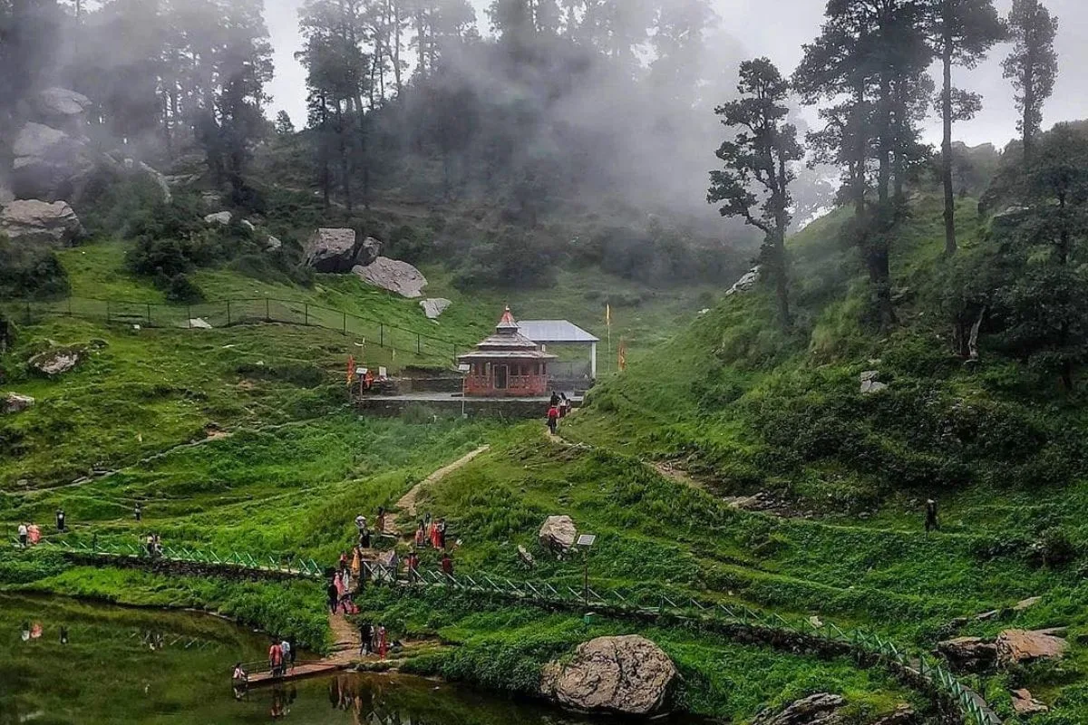
The Tirth Source Trek follows the Tirthan River deep into the protected wilderness of the Great Himalayan National Park (GHNP), one of India's most important biodiversity reserves. Extending well beyond the park's commonly visited trails, the expedition enters remote alpine valleys where forests gradually give way to high meadows and glacial landscapes.
Along the route, trekkers pass established wilderness camps such as Rolla and Shilt while travelling through habitat that supports species including Himalayan tahr, musk deer, Himalayan black bear, and the endangered Western Tragopan. The final stages reach the upper glacial basin where the Tirthan River originates.
Entry into the GHNP core zone requires permits, registered local guides, and adherence to strict conservation regulations, making this a true wilderness expedition rather than a conventional trekking route.
Quick Facts
Duration
Max Altitude
Difficulty
Best Time
Trek Distance
Trail Atmosphere
Stargazing
Class 1 Dark Sky
Scent Profile
Silence Level
~3 dB
Vertigo Factor
1 / 10
Iconic Spots
Primary Glacier Snout (Tirthan Source, 14,500 ft)
Upper Tirthan Basin from 13,800 ft Camp
Environment
Nature & Culture
Flora & Fauna
Flora
Fauna
In Gushaini village tradition, the source of the Tirthan is the 'Eye of God' — the point where divine water first enters the mortal world. The river's purity is directly linked to the inviolability of the source zone.
— Local folklore
Spiritual & Cultural Significance
The Tirthan source is considered one of the most sacred natural points in the Kullu valley tradition — a 'tirth' (sacred ford) by origin. The river name means 'sacred water ford.'
🕐 Shrine Timings: No formal shrine at the source. Gushaini village conducts an annual puja at the river mouth.
Temple Protocols
Festivals & Dates
Technical Details
Challenge & Preparation
Primarily a cardio demand challenge
A capable trekker's route that balances cardio demand and altitude exposure.
Personal Readiness
Am I ready?
Planning
Logistics & Trail Intel
Getting There
Route to Base
Bus from Delhi to Aut (11 hrs) then taxi to Gushaini
Or fly to Bhuntar and taxi
Base Village
Gushaini, Tirthan Valley
6,400 ft
Last ATM
Banjar. All cash for GHNP fees must be carried.
Nearest Medical Facility
Banjar CHC. Emergency: Kullu hospital.
Mobile Signal
Gushaini only. Total blackout for 7 days inside GHNP.
Water Sources
Tirthan river throughout. Glacial streams in upper basin. Purify all.
Charging
Gushaini homestay only.
For Drivers
Road Condition
Access road to Gushaini is good.
Banjar
Trail Culinary & Diet
Don't miss the GHNP-regulation camp meal: khichdi in the upper basin — rice and lentil one-pot cooked on gas
Buy specialized diet items at Gushaini and Banjar. Carry 7-day expedition rations from here.
The Content & Remote Hub
No DronesSTRICTLY BANNED inside GHNP. Serious fine.Top Vlog Spots
Video Calls
none
Est. 0 Mbps
UPI Reliability
1/10
Base WiFi Available
Permits and Regulations
Special GHNP core-zone permissions may be required depending on route depth and camping locations. Apply at GHNP Wildlife Warden Office, Shamshi, Kullu — allow 4-6 weeks. Mandatory GHNP-certified expedition guide. Strict plastic accounting. No camping within 30m of water source. All waste carry-out enforced.
Learn more about how we vet operators and ensure transparency on our why MountRoutes page.
Packing List
GHNP Deep Core Zone Rules
- ALL plastics pre-declared — detailed item count per wrapper (GHNP enforces most strictly in deep permits)
- Gas fuel stoves with at least 4 canisters per person (7-day cooking obligation)
- Waste carry-out protocol: ALL human waste must be buried at minimum 30m from any water source
High Altitude & Glacier
- Crampons (glacier approach in the upper Tirthan basin has permanent ice patches)
- Trekking poles (mandatory for the root forest sections and glacial moraine)
- Expedition sleeping bag rated to -15C for upper valley nights above 12,000 ft
Navigation
- Offline GPS (the upper Tirthan basin trail is unmapped and faint)
- GHNP-authorized guide with prior Tirth Source experience (requirement, not suggestion)
- Emergency PLB device
Deep Dives
Explore Further
Editor's Notes
Standing at the primary glacier snout on Day 6, you can point back south to Gushaini 33 km away where the same water you're looking at originated here will reach within 48 hours. The river geography of the Himalaya becomes physically comprehensible in a way no description can achieve.
Explore In Detail
Day by Day Itinerary
8-day route reaching 14,500ft. Covers 79km of varied terrain.
→ See full itinerary with altitude profileDifficulty & Fitness
Rated moderate. Full spectrum — flat river trail, brutal root forest, open alpine meadow, moraine, and glacier snout. Every terrain type in the Indian Himalayan repertoire.
→ See difficulty breakdown and fitness guideCost & Pricing
Packages range from ₹22,000 – ₹38,500. Inclusions and hidden costs vary by operator tier.
→ See full cost breakdownFrequently Asked Questions
Has the Tirthan river source been properly mapped?
The origin glaciers have been identified by GHNP biodiversity surveys, but the precise 'source point' (as opposed to multiple contributing glaciers) is not formally marked. The trek targets the primary glacial basin at approximately 14,500 ft.
How many people do this trek each year?
Very rarely attempted compared to mainstream Himachal treks. complete the full route to the Tirth source zone in a typical year, making it among the rarest permitted trekking experiences in India.
Does the GHNP allow this trek?
Yes, with a special deep-core permit from the GHNP Wildlife Warden's office in Shamshi. This is different from the standard Rolla-Shilt permit and takes longer to process.
What wildlife is in the upper Tirthan zone?
Snow Leopard, Himalayan Brown Bear (rare in this zone), Himalayan Ibex, Blue Sheep, Musk Deer, and multiple raptors including possible Gyps vultures and eagles.
Can I drink the water at the source?
The water at the primary glacier-origin point is considered some of the purest on Earth. However, even here, Giardia is possible from upstream wildlife. Purify as a precaution.
Is this a loop or point-to-point?
Point-to-return. You ascend to the source and return the same route. The alternative of crossing into another valley from the upper basin requires a different high pass permit.
How do I get the special GHNP deep-core permit?
Apply to the GHNP Wildlife Warden's office in Shamshi (Kullu). Allow 4-6 weeks processing time. A certified GHNP approved expedition guide must co-sign the application.
What is the main physical challenge?
The cumulative altitude gain over 7 days to 14,500 ft through demanding forest and moraine terrain. Days 1-3 are physically harder than most high-pass treks. Days 4-5 at altitude require AMS vigilance.
Is the Tirthan river continuous all the way to the source?
Yes. You follow the same river for all 7 days — from the crystal-clear fast-flowing valley river at Gushaini to the braided glacial streams in the upper basin. The river's character transforms completely over this distance.
Can I extend this into a high pass crossing?
Theoretically yes — the upper Tirthan basin connects to high passes toward the Parvati valley and Kullu-Spiti divide. These require separate permits and glacier expedition experience.
Still deciding?
Compare routes side-by-side to find the perfect match for your fitness, dates, and budget.
Everything you need to know, in one place. Someone else in your group needs to see this.
Planning GHNP Tirth Source Trek?
Get route conditions, operator updates, and season windows before booking.
Don't miss out! Follow us for route updates@mountroutes|LinkedIn
No spam. Only useful trek updates.
Ready to walk this route?
You’ve read the guide, now find the perfect local team to take you there. Compare our verified list of operators.
Compare verified operators