
Explore
Intelligence
Detailed Route
Dayara Bugyal Trek Itinerary — Day by Day Route & Camps
Dayara Bugyal Trek is a 5-day loop from Barsu, with the vast 28km² alpine meadow plateau reached on Day 3.
Standard RouteThis is the standard mountain pacing for this trek. Specific operators may add an acclimatization day or alter the starting point. Check individual operator schedules for their exact logistics.
Duration
6 Days
Total Distance
28 KM
Max Altitude
12,100 FT
Trek Type
circuit
Day by Day Breakdown
Camp Alt
7,100 ft
Day Gain
+5,000 ft
Drive to Raithal
Pick up from Dehradun Railway Station at 7:00 AM. The drive passes through Mussoorie and follows the Bhagirathi river near Uttarkashi. Raithal is one of the most beautiful heritage villages in Uttarakhand. Night stay in a homestay to experience local Garhwali culture and food. Last reliable ATM at Uttarkashi.
Key Landmarks
The road journey links the from the plains into the Bhagirathi river valley.
Camp Alt
9,500 ft
Day Gain
+2,400 ft
Reach Gui Campsite
The trail starts directly from the village. It is a well-paved stone path that soon enters a thick forest. The ascent is very gentle and consistent. Gui is a sheltered campsite in a forest clearing. You can see the Bandarpoonch peaks on a clear evening from here. Tents pitched on a level forest clearing.
Key Landmarks
Staying At
The trail follows the mountain river corridor through a narrow, forested gorge, moving past traditional settlements into increasingly dense dense forested valleys.
Camp Alt
10,500 ft
Day Gain
+1,000 ft
Reach Chilapada
A very short 'E-Z' day designed for acclimatisation. You move higher into the forest, getting closer to the edge of the Dayara meadows. Chilapada has a small perennial stream. The afternoon is spent resting or exploring the nearby forest trails. This saves energy for the large meadow exploration tomorrow.
Key Landmarks
Staying At
Crossing the high-altitude pass bridges two distinct watershed systems, shifting the expedition over the glaciated divide and down into a new river basin.
Field Notes
KEY ACTIONRiver Crossings
Plan to cross early in the day before snowmelt swells the water levels. Unclip backpack waist belts before crossing.
Camp Alt
9,500 ft
Day Gain
-1,000 ft
Today's Objective
🏔 Summit Dayara Top
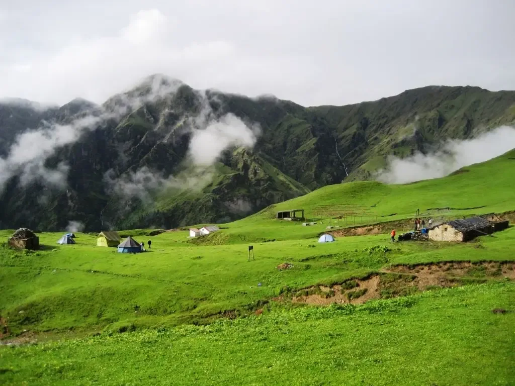
The 'Big Bugyal' day. As you exit the forest at Chilapada, the massive meadows of Dayara open up. It’s like an endless green (or white in winter) carpet. Trek to the highest point (Dayara Top) for an panoramic view of the Greater Himalayas. Spend 2-3 hours just relaxing on the grass before heading back down to the sheltered Gui campsite.
Key Landmarks
Staying At
Crossing the high-altitude pass bridges two distinct watershed systems, shifting the expedition over the glaciated divide and down into a new river basin.
Camp Alt
7,100 ft
Day Gain
-2,400 ft
Reach Raithal
Easy descent back to the base village. You'll reach Raithal by lunch. Afternoon free to explore the village architecture and talk to the locals. Raithal is famous for its sustainable homestay model. Hot shower and a warm bed today!
Key Landmarks
The high alpine meadows narrow into forested river terraces as tree line vegetation reappears in the lower mountain river corridor.
Camp Alt
2,100 ft
Day Gain
-5,000 ft
Drive to Dehradun
Return drive. Reach Dehradun by 6:00 PM. Highly recommended to book your onward travel after 8:00 PM.
Key Landmarks
The mountain valley topography transitions back into the lower foothill river plains.
Trek Extensions & Add-ons
Bakaria Top Peak Hike
+1 DayShort extension to the highest point of the meadow for 360-degree Himalaya views.
Plan Your Trek:
Ready to book? Compare verified operators for Dayara Bugyal Trek — transparent pricing, no paid rankings.
Still deciding?
Compare routes side-by-side to find the perfect match for your fitness, dates, and budget.
Day by day, camp by camp. Send this to your group so everyone's on the same page.
Step 4: Cost & Logistics
You understand the route.
Now see what services, permits, and logistics actually cost.
View Cost Breakdown