
Explore
Intelligence
Essential Planning Guide
Chandrabhaga Glacier Trek — Complete Guide (2026)
Vibe & Scenery
The Experience
Introduction
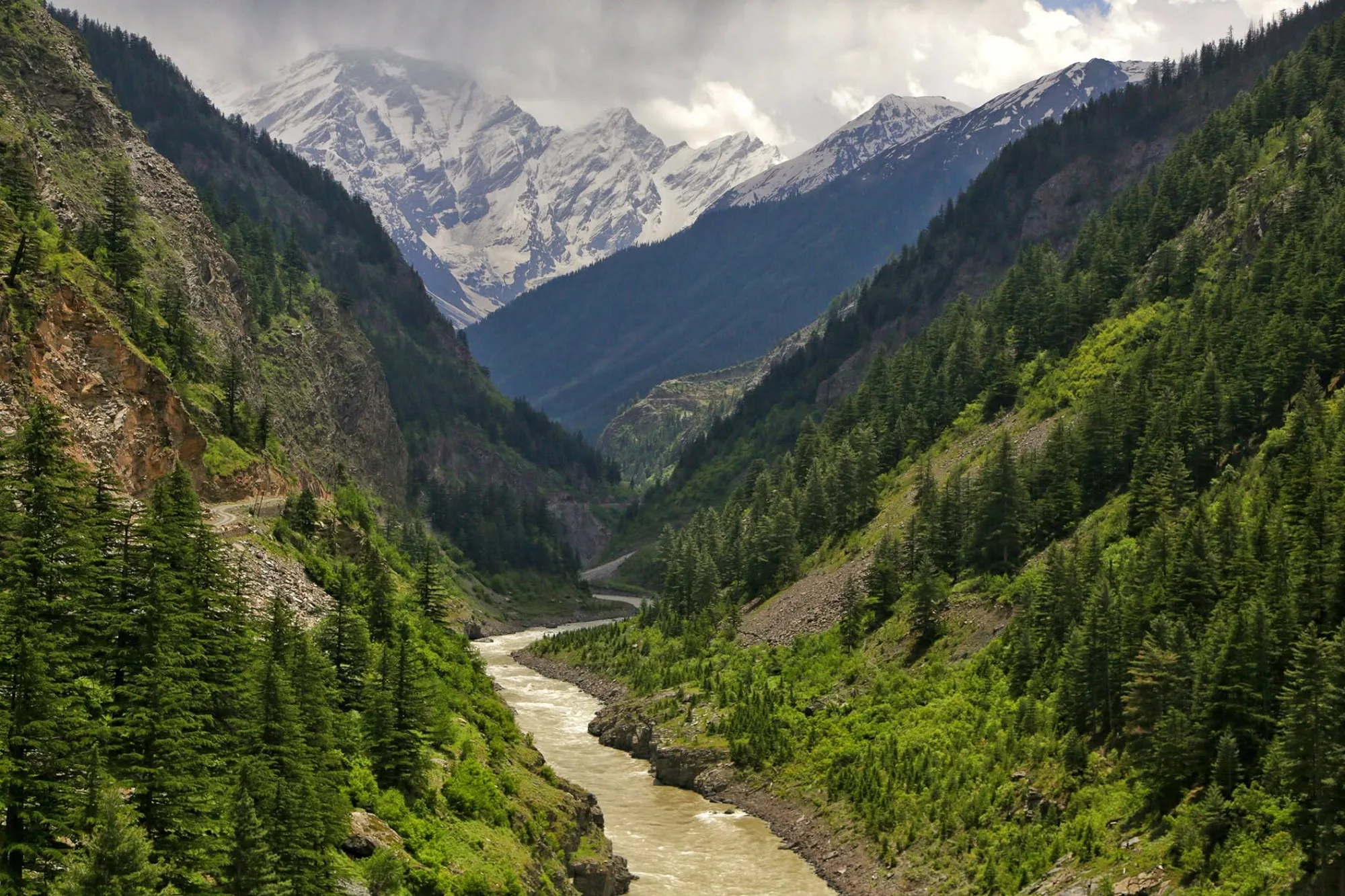
Far removed from Himachal Pradesh's popular trekking routes, the Chandrabhaga Glacier Trek offers a true expedition into one of the most dramatic glacial landscapes of the western Himalayas. Starting near Baralacha La, the trail immediately enters barren high-altitude terrain where vegetation gives way to rock, ice, and glacier debris.
The objective is the immense Chandrabhaga Glacier, source of the Chandrabhaga (Chenab) River and gateway to the celebrated CB mountain group. Trekkers navigate unstable moraines, loose scree, and glacier-fed streams while surrounded by towering peaks and permanent snowfields.
Sustained altitude above 16,000 ft, rough terrain, and complete remoteness make this trek suitable only for experienced Himalayan trekkers with excellent acclimatization.
Quick Facts
Duration
Max Altitude
Difficulty
Best Time
Trek Distance
Trail Atmosphere
Stargazing
Class 1 Dark Sky
Scent Profile
Silence Level
~15 dB
Vertigo Factor
3 / 10
Iconic Spots
Chandrabhaga Glacier Snout
Kya Tso Lake
Baralacha La / Suraj Tal
Environment
Nature & Culture
Flora & Fauna
Flora
Fauna
The Chandrabhaga mountain range is deeply respected by the Lahauli people. The Chandra and Bhaga rivers meet at Tandi, a site considered as sacred as Haridwar.
— Local folklore
Spiritual & Cultural Significance
The high passes of Lahaul are adorned with Tibetan prayer flags, marking safe passage through the dangerous mountains.
Temple Protocols
Technical Details
Challenge & Preparation
Primarily a altitude exposure challenge
A capable trekker's route that balances altitude exposure and cardio demand.
Personal Readiness
Am I ready?
Planning
Logistics & Trail Intel
Getting There
Route to Base
Fly to Kullu/Bhuntar or take an overnight Volvo from Delhi to Manali
From Manali, it is a 7-hour drive via the Atal Tunnel and Baralacha La to Bharatpur
Base Village
Bharatpur (Lahaul)
15,000 ft
Last ATM
Manali / Keylong
Nearest Medical Facility
Keylong District Hospital (3 hours drive from Bharatpur).
Mobile Signal
Total blackout.
Water Sources
Glacial streams. Must be filtered/boiled. The water is freezing and will numb your hands.
Charging
Total blackout.
For Drivers
Road Condition
The Manali to Darcha road via Atal Tunnel is excellent. The climb to Baralacha La is steep, winding, and prone to traffic jams.
Tandi / Keylong
Trail Culinary & Diet
Don't miss the Thukpa at the Bharatpur dhabas
Buy specialized diet items at Manali
The Content & Remote Hub
Top Vlog Spots
Video Calls
none
Est. 0 Mbps
UPI Reliability
1/10
Permits and Regulations
No special border permits are required, but a standard forest/trekking permit must be acquired in Manali or Keylong. Ensure your operator registers your group at the Darcha police checkpost.
Learn more about how we vet operators and ensure transparency on our why MountRoutes page.
Packing List
Extreme Cold Clothing
- Heavyweight expedition down jacket (-10°C rating)
- Gore-Tex windproof/waterproof hard shell
- Merino wool thermal base layers (2 sets)
- Fleece mid-layer
- Waterproof trekking trousers
Glacier Footwear
- Rigid, waterproof mountaineering or heavy trekking boots
- Merino wool trekking socks (x3 pairs)
- Microspikes (for hard ice on the moraine)
- Waterproof gaiters (mandatory)
Expedition Gear
- 4-season sleeping bag (-10°C to -15°C comfort)
- Trekking poles with snow baskets
- High-altitude UV Category 4 sunglasses (Snow blindness risk is high)
- Headlamp with lithium batteries (alkaline drains fast in the cold)
Health & Survival
- Diamox (Acetazolamide) for AMS prevention
- High SPF 50+ sunscreen and zinc lip balm
- Thermos flask for hot water
- Personal blister tape and heavy-duty first aid kit
Deep Dives
Explore Further
Editor's Notes
Explore In Detail
Day by Day Itinerary
5-day route reaching 17,200ft. Covers 20.0km of varied terrain.
→ See full itinerary with altitude profileDifficulty & Fitness
Rated moderate. There is virtually no soft grass on this trek. You will be walking entirely on loose scree, large unstable boulders, and glacial ice.
→ See difficulty breakdown and fitness guideCost & Pricing
Packages range from 16,000 - 22,000 INR (Manali to Manali). Inclusions and hidden costs vary by operator tier.
→ See full cost breakdownFrequently Asked Questions
How does this compare to the Chandratal Lake trek?
They are completely different. Chandratal is a lower-altitude, highly commercialized lake walk. The Chandrabhaga Glacier trek is a remote, raw expedition across dangerous glacial moraine reaching over 17,000 ft.
Is this a technical mountaineering expedition?
No, it is a non-technical glacier approach. You do not need ice axes or ropes for the main trail. However, navigating the loose rocks and ice requires microspikes and excellent balance.
What is the risk of Acute Mountain Sickness (AMS)?
Extremely high. You drive from Manali (6,700 ft) to Bharatpur near Baralacha La (15,000 ft) in a single day. You must spend a full day acclimatizing before trekking higher.
Will there be any greenery or trees?
No. Once you cross the Rohtang/Atal tunnel into Lahaul, you enter a high-altitude cold desert. The trek is entirely composed of rock, ice, snow, and glacial lakes.
Is there mobile connectivity?
You will lose all cellular network shortly after crossing into Lahaul. Expect a total blackout for the entire 5 days.
Are there river crossings?
Yes, you will cross streams emerging directly from the glacier. These must be crossed early in the morning before the sun melts the ice and raises the water levels.
How cold does it get?
Even in August, temperatures at the Silver Moraine camp (16,000 ft) will easily drop to -5°C or -10°C at night.
Can beginners do this trek?
Absolutely not. The extreme altitude, lack of oxygen, and harsh rocky terrain make this suitable only for experienced high-altitude trekkers.
Still deciding?
Compare routes side-by-side to find the perfect match for your fitness, dates, and budget.
Everything you need to know, in one place. Someone else in your group needs to see this.
Planning Chandrabhaga Glacier Trek?
Get route conditions, operator updates, and season windows before booking.
Don't miss out! Follow us for route updates@mountroutes|LinkedIn
No spam. Only useful trek updates.
Ready to walk this route?
You’ve read the guide, now find the perfect local team to take you there. Compare our verified list of operators.
Compare verified operators