Detailed Route
Chanderkhani Pass Trek Itinerary — Day by Day Route & Camps
Standard RouteThis is the standard mountain pacing for this trek. Specific operators may add an acclimatization day or alter the starting point. Check individual operator schedules for their exact logistics.
Duration
5 Days
Total Distance
36 KM
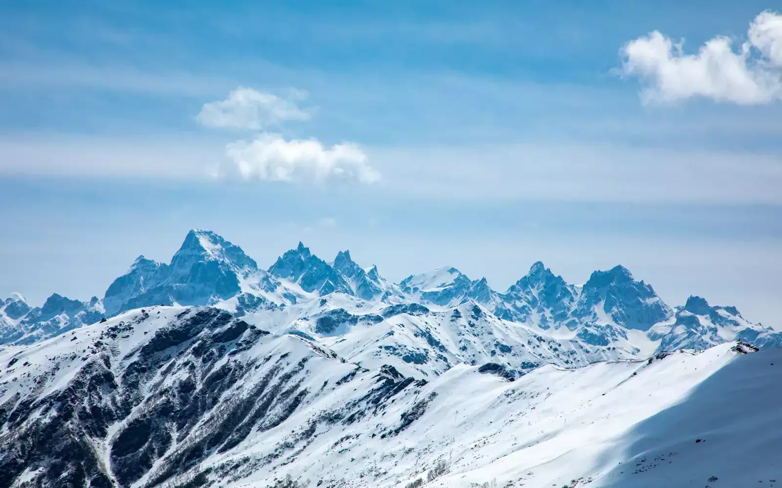
Max Altitude
12,000 FT
Trek Type
linear
Permits Required Before You Go
Permit Cost
Where to Get
Naggar Forest Office
Documents
Aadhar Card / Passport, Medical Fitness Certificate
Foreign Nationals
No restrictions.
Foreigner Process
N/A
Nearest Embassy Hub
New Delhi (500km away)
Day by Day Breakdown
Arrive at Naggar
Acclimatize in the historic capital of Kullu.
Key Landmarks
Staying At
Trek Naggar to Chaklani / Rumsu
Steep steady climb passing through the traditional wooden village of Rumsu, breaking out onto the Chaklani meadows.
Key Landmarks
Staying At
Trek Chaklani to Chanderkhani Pass and descend to Nagroni
Climb to the pass. Enjoy sweeping views. Begin the long descent down the other side of the valley towards the Malana watershed.
Key Landmarks
Staying At
Trek Nagroni to Malana
Descend into the heart of the deeply restrictive Malana village. Follow strict guide instructions.
Key Landmarks
Staying At
Trek Malana to Jari Dam, Drive to Kullu
Short rapid descent to the roadhead. Take a taxi back to Kullu/Bhuntar.
Key Landmarks
Trek Extensions & Add-ons
Kheerganga Push
+2 DaysAfter reaching the Malana Dam, take a taxi deeper into Parvati Valley to hike up to the Kheerganga hot springs.
Also on this trek
Ready to book? Compare verified operators for Chanderkhani Pass Trek — transparent pricing, no paid rankings.
Still deciding?
Compare routes side-by-side to find the perfect match for your fitness, dates, and budget.
Day by day, camp by camp. Send this to your group so everyone's on the same page.
Love this itinerary?
Find operators who follow this exact route with verified acclimatization days.
Find matching operators