
Explore
Intelligence
Detailed Route
Chadar Trek Itinerary — Day by Day Route & Camps
The Chadar Trek is a 9-day journey starting from Leh, peaking on Day 6 at the highest camp.
Standard RouteThis is the standard mountain pacing for this trek. Specific operators may add an acclimatization day or alter the starting point. Check individual operator schedules for their exact logistics.
Duration
9 Days
Total Distance
—
Max Altitude
11,500 FT
Trek Type
Standard
Permits Required Before You Go
Permit Cost
Where to Get
Leh DC Office (Online Portal)
Documents
Aadhar/Passport Copy, 2 Passport Photos, Medical Certificate, Disclaimer Form
Foreign Nationals
Yes, Inner Line Permit is mandatory; must be booked via a registered local travel agency with a group of at least 2.
Foreigner Process
Foreigners need a Protected Area Permit and must undergo the same ALTOA medical checks.
Nearest Embassy Hub
New Delhi
Day by Day Breakdown
Camp Alt
11,500 ft
Day Gain
+820 ft
Arrive in Leh
Strict, mandatory 24-hour room rest for initial altitude acclimatization.
Key Landmarks
The motorable road navigates deeper into the mountain river corridor, where the landscape transitions from lower foothills into the steep, dense forested valleys.
Camp Alt
11,500 ft
Day Gain
0 ft
Today's Objective
☕ Acclimatization & Recovery
Gentle walk to the stupa to test lung capacity.
Key Landmarks
The team holds position within the alpine meadow basin, monitoring weather patterns and adapting to the thinning atmosphere.
Camp Alt
11,500 ft
Day Gain
0 ft
Today's Objective
☕ Acclimatization & Recovery
Blood pressure and oxygen saturation testing for administrative permit.
Key Landmarks
The team holds position within the alpine meadow basin, monitoring weather patterns and adapting to the thinning atmosphere.
Camp Alt
10,400 ft
Day Gain
-1,100 ft
Drive to Shingra Koma & Trek to Tsomo Paldar
Drive 70 km to road-head, trek 3 km on ice to learn the "penguin walk".
Key Landmarks
The vehicle route transitions onto the frozen ice sheets of the Zanskar river gorge.
Field Notes
KEY ACTIONRiver Crossings
Plan to cross early in the day before snowmelt swells the water levels. Unclip backpack waist belts before crossing.
Camp Alt
10,760 ft
Day Gain
+360 ft
Reach Tibb Cave
Walk on glassy ice chadar between towering vertical cliffs.
Key Landmarks
The trail follows the mountain river corridor through a narrow, forested gorge, moving past traditional settlements into increasingly dense dense forested valleys.
Field Notes
KEY ACTIONRiver Crossings
Plan to cross early in the day before snowmelt swells the water levels. Unclip backpack waist belts before crossing.
Camp Alt
11,150 ft
Day Gain
+390 ft
Today's Objective
🏔 Summit Naerak Frozen Waterfall
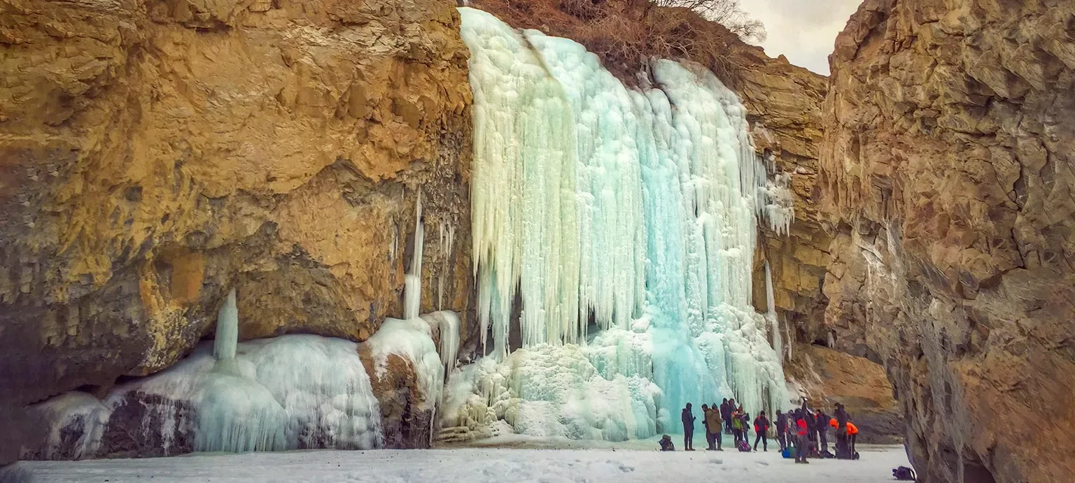
Summit/Goal Day. Stand under the spectacular 100-foot solid frozen waterfall.
Key Landmarks
Crossing the high-altitude pass bridges two distinct watershed systems, shifting the expedition over the glaciated divide and down into a new river basin.
Camp Alt
10,760 ft
Day Gain
-390 ft
Return to Tibb Cave
The chadar changes daily; watch for fresh cracking ice.
Key Landmarks
The high alpine meadows narrow into forested river terraces as tree line vegetation reappears in the lower mountain river corridor.
Field Notes
KEY ACTIONRiver Crossings
Plan to cross early in the day before snowmelt swells the water levels. Unclip backpack waist belts before crossing.
Camp Alt
11,500 ft
Day Gain
+740 ft
Trek to Shingra Koma & Drive to Leh
Final ice trek of 14 km, then drive back to warm guesthouse in Leh.
Key Landmarks
Tree line disappears as the valley broadens into a spectacular high-altitude alpine meadow basin, replacing the dense forests with expansive grazing pastures.
Camp Alt
10,680 ft
Day Gain
-820 ft
Departure
Flight out of Ladakh.
Key Landmarks
The motorable road navigates deeper into the Indus and Zanskar valleys, where the landscape transitions from lower foothills into the steep, high-altitude cold desert.
Trek Extensions & Add-ons
Explore local culture in Leh
+1 DayAdd a buffer day to explore local temples, cultural spots, and try signature local dishes like local breads and chutneys.
Plan Your Trek:
Ready to book? Compare verified operators for Chadar Trek — transparent pricing, no paid rankings.
Still deciding?
Compare routes side-by-side to find the perfect match for your fitness, dates, and budget.
Day by day, camp by camp. Send this to your group so everyone's on the same page.
Step 4: Cost & Logistics
You understand the route.
Now see what services, permits, and logistics actually cost.
View Cost Breakdown