
Explore
Intelligence
Essential Planning Guide
Bhubhu Pass Trek — Complete Guide (2026)
Vibe & Scenery
The Experience
Introduction
Long before roads connected Himachal's mountain valleys, Bhubhu Pass served as an important trade link between the Chuhar Valley in Mandi and the Lagh Valley near Kullu. Today, this historic route offers trekkers the chance to walk the same mountain paths once used by traders and local communities.
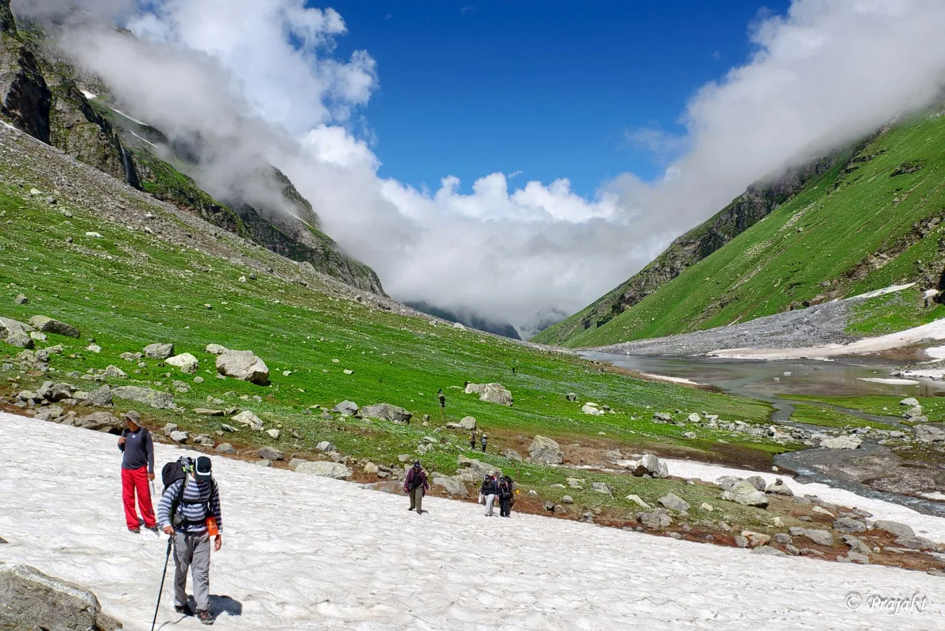
The trail climbs gradually through dense forests of cedar, oak, and pine before reaching the broad saddle of Bhubhu Pass at approximately 9,840 ft. Along the way, traditional Himachali villages, grazing meadows, and quiet forest sections create a journey that feels distinctly different from the state's more commercial trekking routes.
While the altitude remains relatively moderate, the trek still provides rewarding mountain scenery with views towards the Dhauladhar range and surrounding valleys. Bhubhu Pass is particularly well suited to first-time multi-day trekkers looking for history, culture, and Himalayan landscapes without the challenges of extreme altitude.
Quick Facts
Duration
Max Altitude
Difficulty
Best Time
Trek Distance
Trail Atmosphere
Stargazing
Class 3 Dark Sky
Scent Profile
Silence Level
~20 dB
Vertigo Factor
2 / 10
Iconic Spots
Jhingbhan Meadows
Bhubhu Pass Summit
Environment
Nature & Culture
Flora & Fauna
Flora
Fauna
The pass has a small shrine dedicated to Lord Ganesha, where traders historically prayed for safe passage before descending the steep Kangra side.
— Local folklore
Spiritual & Cultural Significance
Historically a vital trade artery; traders would offer prayers at the pass for safe journey down the steep slopes.
🕐 Shrine Timings: Open 24/7
Temple Protocols
- •Maintain respect and cleanliness around the pass shrine.
Technical Details
Challenge & Preparation
Primarily a cardio demand challenge
A capable trekker's route that balances cardio demand and joint & muscle impact.
Personal Readiness
Am I ready?
Planning
Logistics & Trail Intel
Getting There
Route to Base
Take an overnight Volvo bus from Delhi/Chandigarh to Kullu
From Kullu, take a local taxi to Dalighat in the Lagh Valley
Base Village
Dalighat / Kullu
5,500 ft
Last ATM
Kullu town. Do not expect ATMs in Dalighat or Mulling.
Nearest Medical Facility
Regional Hospital Kullu (Start) / Civil Hospital Joginder Nagar (End).
Mobile Signal
Drops after Dalighat. Returns near Mulling.
Water Sources
Frequent fresh mountain streams available near camps (Jhingbhan, Dentbhial). Always purify.
Charging
None on the trail. Charge devices fully in Kullu and carry a power bank.
For Drivers
Road Condition
Overnight Volvo from Delhi to Kullu is smooth. The local road into Lagh Valley is narrow but paved. The exit from Barot to Palampur is highly scenic.
Kullu (Start) / Joginder Nagar (End)
Trail Culinary & Diet
Don't miss the Siddu (Local steamed bread, available in Kullu pre-trek).
Buy specialized diet items at Kullu
The Content & Remote Hub
Top Vlog Spots
Video Calls
low
Est. 10 Mbps
UPI Reliability
7/10
Base WiFi Available
Permits and Regulations
No special mountaineering or Inner Line Permits are required for Indian or foreign nationals. Standard forest department entry fees may apply and are usually collected at the trailheads. Trekkers are strictly advised to follow Leave No Trace principles, especially in the pristine grazing meadows.
Learn more about how we vet operators and ensure transparency on our why MountRoutes page.
Packing List
Trekking Clothing
- Medium-weight fleece or synthetic insulated jacket
- Waterproof windcheater/poncho (forest trails get sudden showers)
- 2 pairs of quick-dry trekking pants (avoid cotton/denim)
- 3 moisture-wicking synthetic t-shirts
- Light woolen beanie for cold evenings at camp
- 3 pairs of cushioned trekking socks
Footwear & Gear
- Water-resistant trekking boots with good ankle support
- 1 anti-shock trekking pole (very helpful on the descent to Mulling)
- 40L-50L backpack with a sturdy rain cover
- Lightweight camp sandals/slip-ons
- Gaiters (optional, but useful if trekking in early spring/late autumn)
Health & Utilities
- Personal First Aid Kit (band-aids, antiseptic, painkillers, muscle spray)
- High-lumen headlamp with extra batteries
- UV polarized sunglasses (essential near the pass)
- Sunscreen (SPF 40+) and lip balm
- 2 reusable 1-liter water bottles (hydration bladders work well)
- Toiletries kit (biodegradable soap, wet wipes, hand sanitizer)
Deep Dives
Explore Further
Editor's Notes
Explore In Detail
Day by Day Itinerary
4-day route reaching 9,840ft. Covers 31.0km of varied terrain.
→ See full itinerary with altitude profileDifficulty & Fitness
Rated moderate. The majority of the trek is on well-defined forest dirt paths. The only rough section is the final zigzag ascent to the pass, which features loose stones and rocky steps.
→ See difficulty breakdown and fitness guideCost & Pricing
Packages range from ₹6,000 – ₹9,000. Inclusions and hidden costs vary by operator tier.
→ See full cost breakdownFrequently Asked Questions
Is the Bhubhu Pass Trek suitable for absolute beginners?
Yes, it is highly suitable for physically fit beginners. The altitude tops out at 9,840 feet, making altitude sickness (AMS) extremely rare, and the daily walking distances are manageable.
Are there leeches on this trail?
If you trek during or immediately after the monsoon (July to early September), the dense forest sections in Lagh Valley will have leeches. Carry salt or tobacco water spray.
Do I need to carry my own tent and food?
There are no tea houses or fixed accommodations on the trail after Dalighat. You must camp. Most trekkers use a local operator who provides tents, sleeping bags, and meals.
How cold does it get at night?
During the peak seasons of May-June and October, nighttime temperatures at Jhingbhan and Dentbhial usually drop to around 5°C to 10°C. A good fleece and a sleeping bag rated for 0°C are sufficient.
Where does the trek actually start and end?
The trek typically starts from Dalighat (near Kullu) in the Lagh Valley and ends at Mulling in the Barot/Kangra Valley side. You cross the mountain range separating the two districts.
Is mobile network available during the trek?
You will have a network at the start (Kullu side) and end (Barot side). During the 2-3 days in the middle (Jhingbhan, Pass crossing), expect a complete dead zone.
Is there snow on the trail?
There is usually no snow from May to November. If you trek in April or early December, you will encounter significant snow near the pass.
What is the historical significance of this pass?
Before modern highways were built, Bhubhu Pass was the primary pedestrian trade and travel route connecting the people of Kullu with the Kangra Valley.
Still deciding?
Compare routes side-by-side to find the perfect match for your fitness, dates, and budget.
Everything you need to know, in one place. Someone else in your group needs to see this.
Planning Bhubhu Pass Trek?
Get route conditions, operator updates, and season windows before booking.
Don't miss out! Follow us for route updates@mountroutes|LinkedIn
No spam. Only useful trek updates.
Ready to walk this route?
You’ve read the guide, now find the perfect local team to take you there. Compare our verified list of operators.
Compare verified operators