
Explore
Intelligence
Essential Planning Guide
Baralacha La to Chandratal Trek — Complete Guide (2026)
Vibe & Scenery
The Experience
Introduction
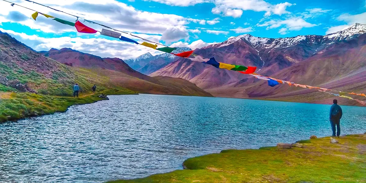
The Baralacha La to Chandratal trek is a high-altitude expedition in the remote Lahaul and Spiti valleys of Himachal Pradesh. Starting near the 16,100 ft Baralacha La pass, this challenging route descends through glacial valleys, traversing rugged terrain and crossing formidable glacier-fed streams like Tokpo Yongma and Tokpo Gongma. It culminates at the magnificent Chandratal, the Moon Lake, at 14,100 ft. With no civilization along the route, this trek demands excellent physical fitness, acclimatization, and self-sufficiency, offering an unparalleled alpine experience for seasoned trekkers.
Quick Facts
Duration
Max Altitude
Difficulty
Best Time
Trek Distance
Trail Atmosphere
Stargazing
Class 2 Dark Sky
Scent Profile
Silence Level
~25 dB
Vertigo Factor
3 / 10
Iconic Spots
Chandra Tal North Shore Dawn (14,100 ft)
Lalanti Shepherd Meadow at Sunset
Environment
Nature & Culture
Flora & Fauna
Flora
Fauna
Chandra Tal (Moon Lake) is named for its crescent shape visible from the southern ridge — in Lahauli tradition it is the lake where the moon rests during the day, explaining its cool, silver-blue color.
— Local folklore
Spiritual & Cultural Significance
Chandratal is considered sacred. Local legends say it is the spot from where Yudhishthira was taken to heaven.
🕐 Shrine Timings: N/A
Temple Protocols
Technical Details
Challenge & Preparation
Primarily a altitude exposure and cardio demand challenge
A capable trekker's route dominated by extreme altitude exposure.
Personal Readiness
Am I ready?
Planning
Logistics & Trail Intel
Getting There
Route to Base
Overnight Volvo buses from Delhi to Manali
Base Village
Manali / Keylong
6,700 ft
Nearest Railhead
Rishikesh Railway Station
Nearest Airport
Jolly Grant Airport, Dehradun
Last ATM
Manali. Carry all cash.
Nearest Medical Facility
Manali or Keylong
Mobile Signal
BSNL works at Losar/Kaza, none at Chandratal.
Water Sources
Chandra river and high meadow streams. Chandra Tal lake water (treat).
Charging
Gramphoo guesthouse only.
For Drivers
Road Condition
Rohtang road is crowded and steep. Atal Tunnel alternative recommended.
Tandi
Trail Culinary & Diet
Don't miss the Shepherd-offered fresh salty butter from Lalanti yak churning — one of the finest high-altitude dairy products in India
Buy specialized diet items at Manali. Gramphoo has basic dhaba.
The Content & Remote Hub
Video Calls
none
Est. 5 Mbps
UPI Reliability
2/10
Permits and Regulations
Rohtang Pass permit needed if traveling from Manali. Inner line permits generally not required for Indian nationals, but registration at local checkposts (Darcha/Batal) is necessary.
Learn more about how we vet operators and ensure transparency on our why MountRoutes page.
Packing List
Lake and Meadow Camp
- Warm sleeping bag (-15C minimum — night temperatures plummet)
- Windproof expedition tent
- Water crossing sandals (for glacial streams like Tokpo Gongma)
- Trekking poles for river crossings and loose scree
Cultural
- Small gifts for shepherd families
- Cash for dairy purchase from Lalanti shepherds
Deep Dives
Explore Further
Editor's Notes
The Chandra Tal north shore — accessible only on foot via routes like this circuit — is a completely different experience from the car-accessible south viewpoint. The north shore is silent, bird-dense, and utterly pristine. On a still morning, the lake is a perfect mirror reflecting the surrounding peaks with zero disturbance.
Explore In Detail
Day by Day Itinerary
6-day route reaching 15,200ft. Covers 64km of varied terrain.
→ See full itinerary with altitude profileDifficulty & Fitness
Rated moderate. High altitude cold desert, severe glacial river crossings, loose scree, and prolonged high altitude exposure.
→ See difficulty breakdown and fitness guideCost & Pricing
Packages range from ₹24,000 – ₹32,000. Inclusions and hidden costs vary by operator tier.
→ See full cost breakdownFrequently Asked Questions
How difficult is the Baralacha La to Chandratal Trek?
It is classified as a hard trek. The extreme altitude (staying above 14,000 ft), severe weather, and difficult river crossings make it demanding.
What is the risk of Acute Mountain Sickness (AMS)?
Very high. The trek starts at nearly 16,100 ft (Baralacha La) and never drops below 14,000 ft. Strict acclimatization in Manali or Keylong/Jispa is required before starting.
When is the absolute best time?
July to September. Mid-July to August offers the best conditions before late-season snowstorms.
Will I get mobile network?
Zero connectivity on the trail. The last reliable network is at Keylong/Jispa.
Are river crossings dangerous?
Yes, streams like Tokpo Gongma and Tokpo Yongma are glacier-fed. They must be crossed early in the morning before sun melt increases the water volume and speed.
Is drinking water safe?
Glacial streams are abundant but must be treated with tablets or boiled before drinking.
Where is the last ATM?
Manali or Keylong.
What permits are required?
Standard Lahaul-Spiti access permits or Rohtang pass permits if coming via Manali.
What is the emergency evacuation protocol?
Evacuation is very difficult due to no road access mid-trail. Satellite phones or PLBs are highly recommended. Nearest road access is at Baralacha La or Batal.
Nearest hospital?
Keylong or Manali, both hours away by road from the trailheads.
Still deciding?
Compare routes side-by-side to find the perfect match for your fitness, dates, and budget.
Everything you need to know, in one place. Someone else in your group needs to see this.
Planning Baralacha La to Chandratal Trek?
Get route conditions, operator updates, and season windows before booking.
Don't miss out! Follow us for route updates@mountroutes|LinkedIn
No spam. Only useful trek updates.
Ready to walk this route?
You’ve read the guide, now find the perfect local team to take you there. Compare our verified list of operators.
Compare verified operators