
Explore
Intelligence
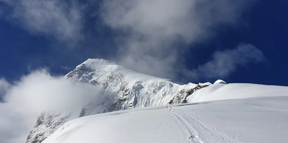
Summit Safety & Risk
Satopanth Peak Expedition — Safety Guide
AMS thresholds, glacier hazards, summit day go/no-go decision framework, and emergency contacts.
Summit Day Protocol
GO Conditions
- ✓ Wind speed below 40km/h
- ✓ Good visibility
- ✓ Stable snow pack
NO-GO Conditions
- ✗ Whiteout
- ✗ Heavy snow fall
- ✗ Winds above 50km/h
Hard Turn-Around: 12:00 PM
High winds and exhaustion risk on descent.
Primary Hazards
Crevasse falls on glacier approach
Acute Mountain Sickness (AMS) / HACE / HAPE
Exposed ridge slips
Extreme sub-zero temperatures and high winds
Historical Safety Record
We publish verified incident records to help trekkers and operators make informed decisions. Names and personal identifiers are anonymized.
Documented
6
verified incidents
Fatalities
1
recorded
Near Misses
4
logged
We have analysed 6 documented incidents for this expedition to extract critical safety lessons.
Due to the nature of mountaineering — where most non-fatal incidents go unreported — experts estimate 15+ total historical incidents on this route. Estimated historical fatalities: 3. We present the documented record as-is rather than speculate on undocumented cases.
Fatal incidents have occurred on Satopanth Peak Expedition
This route has recorded 1 fatal incident. Review all incidents below, understand the lessons, and discuss your operator's safety protocols before booking.
Year
2023
Weather Stranding
Outcome
Rescue by external team
Contributing Cause
Poor weather forecasting and late summit departure
Key Safety Lesson
Always sat phones save lives. Always carry reliable comms to call for heli-evac if stranded.
Year
2019
Weather Stranding
Outcome
Self-recovered
Contributing Cause
Poor weather forecasting and late summit departure
Key Safety Lesson
Never push for the summit in zero visibility. The descent is where most fatalities happen.
Year
2018
Crevasse Fall
Outcome
Fatal
Contributing Cause
Contributing factors not fully documented
Key Safety Lesson
Always the knife-edge ridge to the summit is notorious. A fall here on the ice cannot be arrested.
Year
2017
HACE — High Altitude Cerebral Edema
Outcome
Assisted descent by team
Contributing Cause
Continued ascent despite severe AMS symptoms
Key Safety Lesson
Always acclimatization cannot be rushed. Do not ignore severe headaches.
Year
2014
Equipment Failure
Outcome
Self-recovered
Contributing Cause
Pre-departure gear check not performed
Key Safety Lesson
Never rely entirely on a single supply cache. Storms can destroy high camps.
Year
2013
Equipment Failure
Outcome
Self-recovered
Contributing Cause
Pre-departure gear check not performed
Key Safety Lesson
Check all technical gear before the climb. A broken crampon on blue ice is a death sentence.
Source: Public Records / News Reports
Why estimates differ from records: IMF and news sources only capture permitted expeditions and helicopter rescues. Non-fatal near-misses (AMS, frostbite, falls with self-rescue) are almost never filed. Peaks with multi-decade climbing histories compound these gaps significantly.
Glacier Hazards — Chaturangi Glacier
Crevasse Zone
Upper glacier plateau
Crevasse Zone
Approach below headwall
Avalanche Path
Summit couloir
Avalanche Path
East Face slopes
Bergschrund
Bergschrund crossing located at the base of the Mt. Satopanth summit headwall.
Altitude Physiology — SpO₂ by Camp
Camp 1 (Sundar Bamak)
85
SpO₂
Base Camp
80
SpO₂
Summit
60
SpO₂
Turn-Around Threshold
SpO₂ < 60%
Descend immediately if reading drops below this at rest
Diamox (Acetazolamide)
Recommended
Use standard 250mg dosage under medical advice.
⚠️ Golden Rule: Descend immediately to Base Camp or lower.
Expedition Medical Kit
AMS Protocol
A mandatory acclimatization day is scheduled at Vasuki Tal Base Camp (16000ft). Climatization rotations (load ferry to Camp 1 (Sundar Bamak)) are strictly enforced.
Emergency Contacts
Evacuation Route
Retreat to Vasuki Tal Base Camp, manual carry to road head at Gangotri, drive to nearest district hospital or AIIMS Rishikesh.
Solo Advisory
Strictly prohibited. All high-altitude peaks require IMF permits and certified mountain guide supervision.
Medical Evacuation Intelligence
Nearest ICU
AIIMS Rishikesh / Max Super Speciality Hospital, Dehradun
Blood Bank Hub
Dehradun District Hospital / AIIMS Rishikesh
O₂ Refill at Base
Available
Insurance Requirements
Altitude Cover
21,000 ft
Heli Rescue
Required
Mandatory Operator Equipment
Verify this equipment is included before booking. Compare operator safety standards →
Plan Your Expedition:
Still deciding?
Compare routes side-by-side to find the perfect match for your fitness, dates, and budget.
Knowledge Integrity
Help us keep this data ground-truth accurate.
This encyclopedia entry for Satopanth Peak Expedition is curated from a mix of public survey records, first-hand climber accounts, and official permit logs. However, mountains are dynamic. If you have been on this route recently and noticed a change in terrain, water availability, or local regulations, we want to hear from you.
Community Vetted
Last Verified: May 2026
EXPEDITION DATABASE
Step 5: Cost & Logistics
You understand the risks.
Now see what the IMF peak fees, logistics, and operator services actually cost.
View Cost Breakdown