
Explore
Intelligence
Detailed Route
Ranglana Peak Expedition Itinerary — Day by Day Route & Camps
Standard RouteThis is the baseline pacing strategy for this expedition. Expedition leaders frequently modify rotation schedules, add reserve weather days, or adjust high camps based on real-time mountain conditions. Consult the operator's expedition dossier for their precise approach.
Duration
18 Days
Total Distance
0.0 KM
Max Altitude
18,222 FT
Trek Type
circuit
Permits Required Before You Go
Permit Cost
Day by Day Breakdown
Camp Alt
6,400 ft
Day Gain
+4,300 ft
Drive to Sankri
Drive deep into the Garhwal mountains to the trekking hub of Sankri (6,400 ft). Finalize permits with the Forest Department.
The route ascends from the lower foothills into dense pine and deodar forests along the Tons river valley.
Camp Alt
8,500 ft
Day Gain
+2,100 ft
Drive to Jakhol & Trek to Obra Thatch
A short drive to Jakhol village, where the road ends. Begin the approach march through thick pine forests alongside the Obra river to camp at Obra Thatch (8,500 ft).
Vehicle road gives way to traditional footpaths as cedar forests thicken along the Obra river corridor.
Camp Alt
10,800 ft
Day Gain
+2,300 ft
Reach Bhawa Waterfall
Ascend further up the valley, crossing meadows and patches of birch forest. Camp near the roaring Bhawa Waterfall (10,800 ft).
Tree line thins into scattered birch groves as the Obra valley narrows around vertical granite rock faces.
Camp Alt
13,400 ft
Day Gain
+2,600 ft
Reach Devkyara
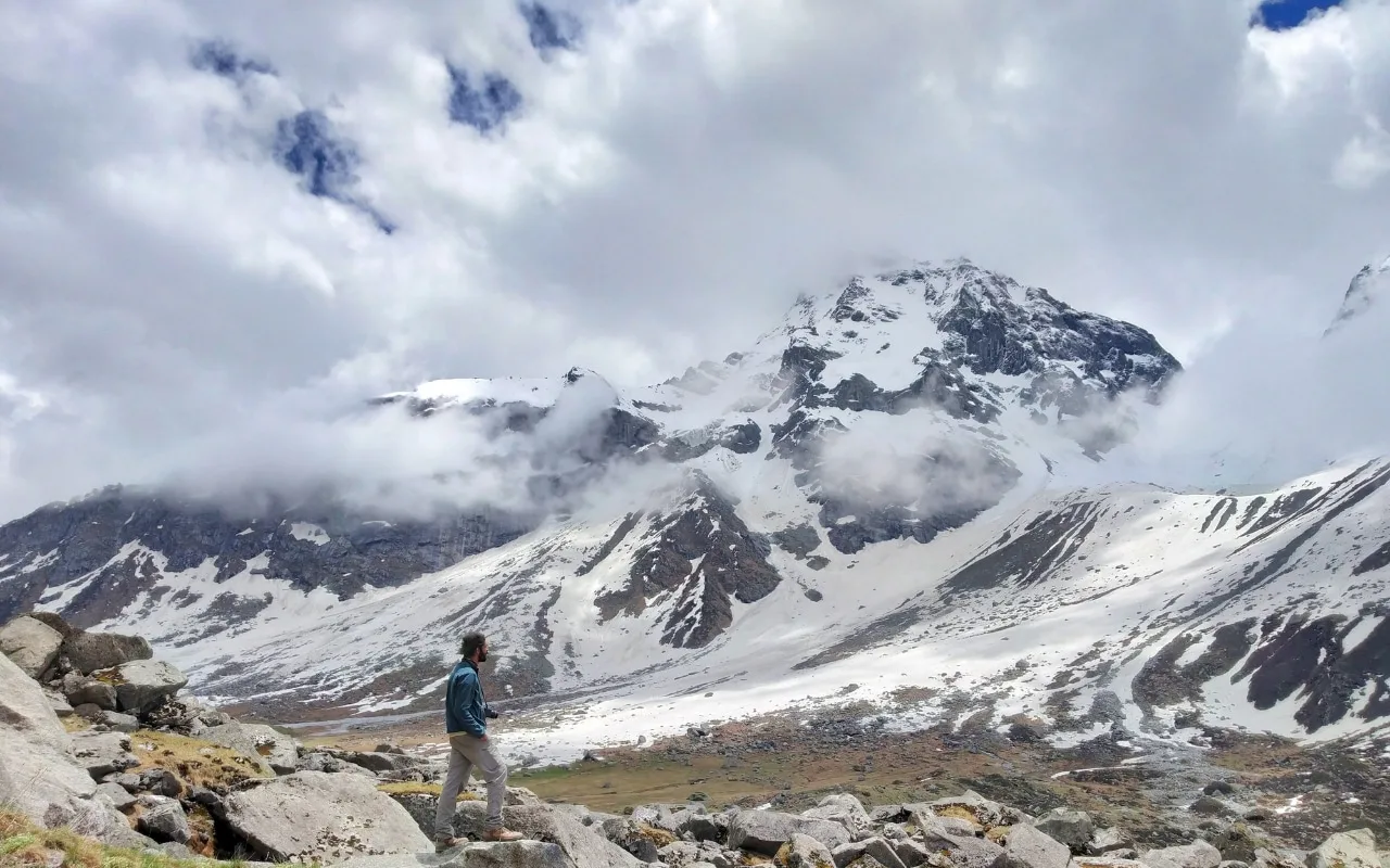
The valley opens up spectacularly. You walk across the massive, flat Devkyara meadows (13,400 ft) with Mt. Ranglana looming directly ahead.
Forest vegetation disappears completely as the valley broadens into an expansive high-altitude meadow basin beneath the Ranglana massif.
Field Notes
Use Trekking Poles
Trekking poles are highly recommended to save your knees on the descent.
INFOSlower Progress
Progress will be significantly slower and more taxing on your ankles than trail distance suggests.
Camp Alt
13,800 ft
Day Gain
+400 ft
Reach Base Camp
Leave the grass behind. The trail turns into a brutal march over glacial moraine and boulders to reach Base Camp (13,800 ft) at the snout of the glacier.
Alpine grass transitions to barren glacial debris and moraine deposits near the active snout of the Obra glacier.
Field Notes
Use Trekking Poles
Trekking poles are highly recommended to save your knees on the descent.
INFOSlower Progress
Progress will be significantly slower and more taxing on your ankles than trail distance suggests.
Camp Alt
13,800 ft
Day Gain
0 ft
Rest & Acclimatization
Critical rest day. Sort out technical climbing gear, practice jumar/descender techniques on nearby ice walls, and review rescue protocols.
The immediate environment remains anchored within the rocky ablation zone beneath the upper ice basin.
Field Notes
Use Trekking Poles
Trekking poles are highly recommended to save your knees on the descent.
INFOSlower Progress
Progress will be significantly slower and more taxing on your ankles than trail distance suggests.
Camp Alt
13,800 ft
Day Gain
0 ft
Load Ferry to Advance Base Camp
Carry tents, ropes, and food up the glacier to establish ABC (15,400 ft). Navigate the lower crevasses, drop the loads, and return to Base Camp to sleep low.
The route breaches the lower icefall corridor where lateral moraines give way to crevassed glacial ice.
Field Notes
KEY ACTIONRoped Travel
Requires roped glacier travel.
KEY ACTIONStart Early
Start before sunrise to ensure snow bridges remain solid.
KEY ACTIONIce Gear
Crampons and ice axe proficiency required to safely navigate steep, icy inclines.
Use Trekking Poles
Trekking poles are highly recommended to save your knees on the descent.
INFOSlower Progress
Progress will be significantly slower and more taxing on your ankles than trail distance suggests.
Camp Alt
15,400 ft
Day Gain
+1,600 ft
Shift to Advance Base Camp
Permanently move up to ABC. The route is now entirely on ice and snow.
Exposed rock disappears as the expedition ascends into the permanent glaciated basin of the upper watershed.
Field Notes
KEY ACTIONRoped Travel
Requires roped glacier travel.
KEY ACTIONStart Early
Start before sunrise to ensure snow bridges remain solid.
KEY ACTIONIce Gear
Crampons and ice axe proficiency required to safely navigate steep, icy inclines.
Camp Alt
15,400 ft
Day Gain
0 ft
Load Ferry to Camp 1
Ferry critical summit gear to Camp 1 (16,500 ft). The climbing becomes significantly steeper, requiring front-pointing on ice.
Glacial basin terrain steepens into vertical ice headwalls framed by high mountain ridges.
Camp Alt
16,500 ft
Day Gain
+1,100 ft
Shift to Camp 1
Move to Camp 1. This is the highest camp on the mountain. Prepare for the summit push tonight.
The expedition ascends onto the upper glaciated shelf overlooking the entire Obra and Devkyara valley systems.
Camp Alt
16,500 ft
Day Gain
0 ft
Route Opening & Rope Fixing
Sherpas and lead climbers go ahead to fix ropes on the final summit ridge, assessing cornice safety and rockfall risk.
Ice slope terrain meets the shattered granite skyline ridge defining the upper watershed divide.
Camp Alt
16,500 ft
Day Gain
0 ft
Today's Objective
🏔 Summit Ranglana Peak
Start at 1:00 AM. Ascend via fixed ropes over 60-degree ice sections, transitioning to a highly exposed mixed rock ridge. Reach the summit of Mt. Ranglana (18,222 ft). Immediately begin the dangerous rappel back down to Camp 1.
The route follows the crest of the watershed divide revealing panoramic views across the Govind Pashu Vihar and Kinnaur mountain ranges.
Field Notes
KEY ACTIONRoped Travel
Requires roped glacier travel.
KEY ACTIONStart Early
Start before sunrise to ensure snow bridges remain solid.
KEY ACTIONIce Gear
Crampons and ice axe proficiency required to safely navigate steep, icy inclines.
Camp Alt
16,500 ft
Day Gain
0 ft
Reserve Summit Day
Buffer day in case of bad weather, high winds, or exhaustion on Day 12.
High altitude glaciated environment subject to rapid barometric shifts and high winds along the ridge.
Field Notes
KEY ACTIONRoped Travel
Requires roped glacier travel.
KEY ACTIONStart Early
Start before sunrise to ensure snow bridges remain solid.
KEY ACTIONIce Gear
Crampons and ice axe proficiency required to safely navigate steep, icy inclines.
Camp Alt
13,800 ft
Day Gain
-2,700 ft
Descend to Base Camp
Dismantle Camp 1 and ABC. Carry all gear and trash back down the glacier to Base Camp.
Permanent snow and ice fields give way as the descent re-enters the ablation moraine basin.
Field Notes
KEY ACTIONRoped Travel
Requires roped glacier travel.
KEY ACTIONStart Early
Start before sunrise to ensure snow bridges remain solid.
KEY ACTIONIce Gear
Crampons and ice axe proficiency required to safely navigate steep, icy inclines.
Use Trekking Poles
Trekking poles are highly recommended to save your knees on the descent.
INFOSlower Progress
Progress will be significantly slower and more taxing on your ankles than trail distance suggests.
Camp Alt
13,400 ft
Day Gain
-400 ft
Descend to Devkyara
Leave the harsh rocks and ice behind. Return to the beautiful green meadows of Devkyara.
Glacial debris transitions back into open alpine grass within the broad Devkyara valley floor.
Field Notes
Use Trekking Poles
Trekking poles are highly recommended to save your knees on the descent.
INFOSlower Progress
Progress will be significantly slower and more taxing on your ankles than trail distance suggests.
Camp Alt
8,500 ft
Day Gain
-4,900 ft
Descend to Obra Thatch
A long walk back down the valley, passing Bhawa Waterfall and entering the tree line.
High alpine meadows narrow into forested river terraces as tree line vegetation reappears.
Camp Alt
6,400 ft
Day Gain
-2,100 ft
Trek to Jakhol & Drive to Sankri
The final walk through the pine forests to Jakhol roadhead. Board vehicles and drive back to Sankri.
Coniferous pine forests give way to village settlements and agricultural terraces along the roadhead.
Camp Alt
2,100 ft
Day Gain
-4,300 ft
Drive to Dehradun
Drive back to Dehradun.
Mountain valley topography transitions into lower foothill river plains.
Plan Your Expedition:
Ready to book? Compare verified operators for Ranglana Peak Expedition — transparent pricing, no paid rankings.
Still deciding?
Compare routes side-by-side to find the perfect match for your fitness, dates, and budget.
Day by day, camp by camp. Send this to your group so everyone's on the same page.
Step 4: Safety & Framework
You understand the route.
Now understand the hazards, physiology, and Go/No-Go decision framework.
View Safety Framework