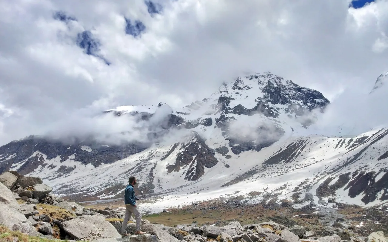
Ranglana Peak Expedition expedition
Summit Peak

Compare operators for Ranglana Peak Expedition

18 Days18,222ft maxHimachal PradeshChallenging

No operators listed yet

Interested in this expedition?

We are currently vetting local partners for Ranglana Peak Expedition to ensure the highest safety standards. Be the first to know when it's open for booking.

Are you a local operator?

Join our platform to list your verified packages for Ranglana Peak Expedition and reach thousands of climbers directly.

Apply to join
Mandatory Pre-Check

Summit Readiness Audit

Before booking your expedition, run your profile through our clinical safety checks. Generate your gear manifest and AMS protocol.

About Ranglana Peak Expedition

18 Days
18,222 FT
Challenging

The Ranglana Peak Expedition is a technical ascent of Mount Ranglana (5,554 m / 18,222 ft) in Govind Pashu Vihar National Park. Combining glacier travel, steep snow and ice slopes, and mixed alpine terrain, it is an excellent objective for experienced mountaineers seeking a challenging Garhwal peak.

Expedition Highlights

Mount Ranglana Summit (5,800m+)

Dramatic high-altitude summit panorama overlooking the Swargarohini and Bandarpoonch ranges.

Devkyara Alpine Meadows

Expansive emerald green alpine bugyals situated at the head of the Obra Valley.

Obra River Gorge

Pristine glaciated river valley cutting through dense deodar forests and rocky moraines.

Ranglana Glacier Wall

Technical ice walls and crevassed glacier basins approached from Advance Base Camp.

View Complete Guide

Common Questions

What mountaineering certifications are required for this expedition?
An Advanced Mountaineering Course (AMC) certificate from a recognized Indian institute (NIM, HMI, JIM) is strictly mandatory, along with previous experience on at least one 5,000m+ technical peak.
Is the route to the summit fixed?
No. Unlike commercial peaks like Stok Kangri or Yunam, Ranglana is rarely climbed. Your Sherpa/HAP team will have to dynamically open the route, navigate crevasses, and fix ropes on the ice walls.
Where is the Base Camp located?
Base Camp is established above the Devkyara meadows, at approximately 13,800 ft, right at the snout of the glacier feeding the Obra river.
How many high camps are established?
Typically two camps above Base Camp: Advance Base Camp (ABC) around 15,400 ft, and Camp 1 (Summit Camp) around 16,500 ft, depending on snow conditions.
What is the rock/ice ratio on the summit push?
The final 1,000 ft is a highly technical mixed climb. You will face 60-degree blue ice slopes transitioning into loose, shattered rock ridges before the summit cornice.
Are there rescue helicopters available?
While air rescue is technically possible, the extreme weather and narrow topography of the upper Obra valley make helicopter landings highly unreliable. Ground evacuation to Sankri is the primary protocol.
Do I need to carry my own gear to high camps?
Yes. This is an expedition-style climb. You will participate in load ferrying (carrying tents, ropes, and rations) from Base Camp to ABC and Camp 1.
What happens if the weather turns bad on summit day?
We have two reserve days built into the 18-day itinerary specifically to wait out storms. If the window closes completely, the expedition will be aborted for safety.
What mountaineering certifications are required for this expedition?
An Advanced Mountaineering Course (AMC) certificate from a recognized Indian institute (NIM, HMI, JIM) is strictly mandatory, along with previous experience on at least one 5,000m+ technical peak.
Is the route to the summit fixed?
No. Unlike commercial peaks like Stok Kangri or Yunam, Ranglana is rarely climbed. Your Sherpa/HAP team will have to dynamically open the route, navigate crevasses, and fix ropes on the ice walls.
Where is the Base Camp located?
Base Camp is established above the Devkyara meadows, at approximately 13,800 ft, right at the snout of the glacier feeding the Obra river.
How many high camps are established?
Typically two camps above Base Camp: Advance Base Camp (ABC) around 15,400 ft, and Camp 1 (Summit Camp) around 16,500 ft, depending on snow conditions.
What is the rock/ice ratio on the summit push?
The final 1,000 ft is a highly technical mixed climb. You will face 60-degree blue ice slopes transitioning into loose, shattered rock ridges before the summit cornice.
Are there rescue helicopters available?
While air rescue is technically possible, the extreme weather and narrow topography of the upper Obra valley make helicopter landings highly unreliable. Ground evacuation to Sankri is the primary protocol.
Do I need to carry my own gear to high camps?
Yes. This is an expedition-style climb. You will participate in load ferrying (carrying tents, ropes, and rations) from Base Camp to ABC and Camp 1.
What happens if the weather turns bad on summit day?
We have two reserve days built into the 18-day itinerary specifically to wait out storms. If the window closes completely, the expedition will be aborted for safety.

Are you a local operator?

Join our platform to list your verified packages for this expedition.

Apply to join
MountRoutes Dispatch

Get Trek Intelligence Before You Book

Route conditions, operator changes, and the best season windows — once a week.

Don't miss out! Follow us for route updates@mountroutes|LinkedIn

No spam. Only useful trek updates.