Detailed Route
Kang Yatse 1 Peak Expedition Itinerary — Day by Day Route & Camps
15-day expedition through Markha Valley with a rotation cycle to ABC at 5,700m before the summit push.
Standard RouteThis is the standard mountain pacing for this trek. Specific operators may add an acclimatization day or alter the starting point. Check individual operator schedules for their exact logistics.
Duration
15 Days
Total Distance
95 KM
Max Altitude
20,997 FT
Trek Type
Standard
Permits Required Before You Go
Permit Cost
Foreigner Process
Expedition visa setup required if going via recognized bodies, though basic IMF peak fees act as a blanket cover for most commercial teams.
Nearest Embassy Hub
New Delhi
Day by Day Breakdown
Arrive Leh — Rest
Mandatory rest. No exertion at 3,500m.
Acclimatization — Leh
Light sightseeing only. SpO2 check.
Key Landmarks
Drive to Chilling & Trek to Skiu
Enter Markha Valley.
Key Landmarks
Trek: Skiu to Markha Village
Canyon walking through the heart of the valley.
Key Landmarks
Trek: Markha to Thachungtse
Wide meadows. Kang Yatse massif comes into full view.
Trek: Thachungtse to Nimaling
High plateau acclimatization camp. Short climb to 5,000m in the afternoon.
Key Landmarks
Trek: Nimaling to KY1 Base Camp
Establish base camp at the foot of the KY massif.
Technical Training Day at Base Camp
Full day of crampon, rope, ice-axe, and self-arrest training on live glacier terrain.
Load Ferry: Base Camp to Advance Camp (ABC)
Carry a portion of gear to ABC at 5,700m. Return to BC to sleep (rotation).
Rest Day at Base Camp
Recovery and weather assessment. Briefing on summit day protocol.
Move to Advance Camp
Establish at 5,700m. Early dinner and sleep by 7 PM for alpine start.
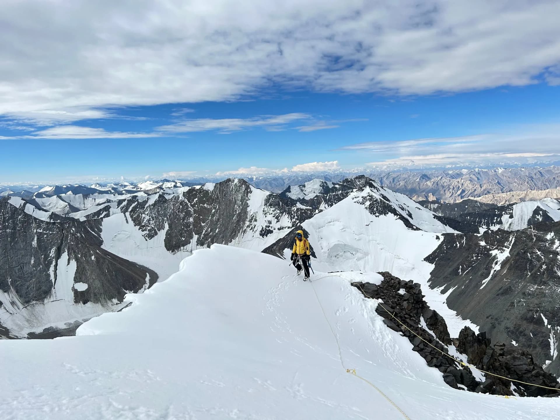
SUMMIT DAY: ABC to KY1 Summit & back to BC
Alpine start at 1–2 AM. Glacier crossing, bergschrund, steep ice slope (45-55°), knife-edge ridge to summit at 6,400m. Turnaround hard at 10 AM. Return to Base Camp.
Key Landmarks
Rest at Base Camp — weather buffer
Buffer day if summit not achieved on Day 12.
Trek: Base Camp to Chilling & drive to Leh
Descent via Kongmaru La or retrace Markha.
Departure from Leh
End of expedition.
Trek Extensions & Add-ons
Suraj Tal Exploration
+0 DayOn Day 3, walk down to the nearby Suraj Tal, a stunning emerald green glacial lake right on the highway.
Also on this trek
Ready to book? Compare verified operators for Kang Yatse 1 Peak Expedition — transparent pricing, no paid rankings.
Still deciding?
Compare routes side-by-side to find the perfect match for your fitness, dates, and budget.
Day by day, camp by camp. Send this to your group so everyone's on the same page.
Love this itinerary?
Find operators who follow this exact route with verified acclimatization days.
Find matching operators