Detailed Route
Kanamo Peak Expedition Itinerary — Day by Day Route & Camps
A 7-day Spiti expedition starting from Manali, with mandatory acclimatization in Kaza and Kibber before the summit push.
Standard RouteThis is the standard mountain pacing for this trek. Specific operators may add an acclimatization day or alter the starting point. Check individual operator schedules for their exact logistics.
Duration
7 Days
Total Distance
38 KM
Max Altitude
19,600 FT
Trek Type
circuit
Permits Required Before You Go
Permit Cost
Where to Get
Kaza SDM Office / Online (ILP)
Documents
Aadhaar / Passport, Medical fitness declaration
Foreign Nationals
ILP required; obtainable at Shimla or Rekong Peo. Apply at least 5 days in advance.
Foreigner Process
Inner Line Permit (ILP) required for Spiti. Apply online at hpilp.nic.in or at Rekong Peo/Shimla offices.
Nearest Embassy Hub
Delhi
Day by Day Breakdown
Drive: Manali to Kaza via Kunzum Pass
An epic drive through three distinct ecosystems. The road crosses Kunzum Pass at 14,931 ft — your first real acclimatization test. The landscape transitions from lush Kullu pine forests to the stark brown rock-desert of Spiti. Drink 3L of water during the drive. Safety: Do not rush. If you feel a headache at Kunzum, take a Diamox and rest.
Key Landmarks
Staying At
Kaza Acclimatization — Key Monastery & Village Walk
Critical rest day. Walk to Key Monastery (short drive + easy walk to 13,668 ft) and return. This gentle altitude exposure is mandatory. Oximeter check morning and evening. Target SpO2: 85%+. Stay hydrated.
Key Landmarks
Staying At
Drive: Kaza to Kibber & Acclimatization Walk to 15,000 ft
Drive to Kibber — one of the highest motorable villages in the world. In the afternoon, walk up the Kanamo trail to ~15,000 ft and return to Kibber to sleep low. This 'climb high, sleep low' protocol is the cornerstone of acclimatization.
Key Landmarks
Staying At
Trek: Kibber to Kanamo Base Camp
A gradual but relentless climb through the high-alpine desert of Spiti. The vegetation disappears above 15,000 ft, leaving only the stark mountain canvas. The Base Camp sits in a dramatic cirque with the summit pyramid towering above. Glacial stream water is available (filter mandatory). Safety: AMS monitoring. Oximeter check immediately on arrival. SpO2 below 80%: Do not proceed.
Key Landmarks
Staying At
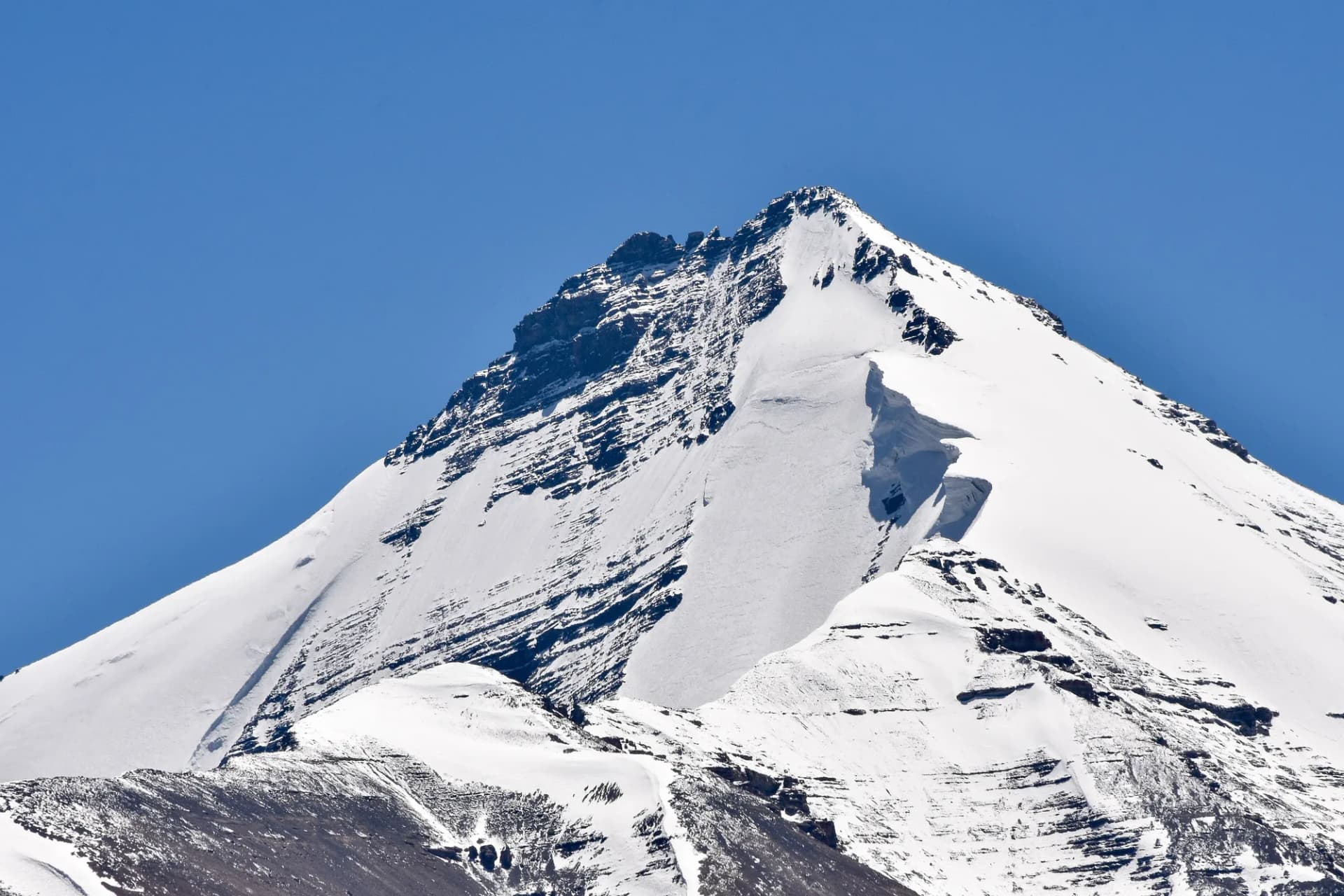
Summit Day: Kanamo Base Camp to Summit (19,600 ft) & Descent to Kibber
Start at 3 AM with headlamps. The first 2 hours are on the known trail. Above 17,500 ft the terrain opens into a vast scree bowl. The final ridge is narrow with exposure on both sides — micro-spikes may be needed depending on season. The summit view is unparalleled: Tibet to the east, Pin Valley below, and Kinner Kailash on the horizon. Descend all the way to Kibber for a celebratory hot meal. Safety: Hard turnaround time is 10 AM. Summit winds can hit 60 kmph after mid-morning.
Key Landmarks
Staying At
Drive: Kibber to Kaza (Rest & Debrief)
Expedition debrief and recovery day. Celebrate with local Spitian food. Descent to Kaza allows the body to naturally decompress.
Key Landmarks
Staying At
Drive: Kaza to Manali
Return drive. The descent from Spiti back into lush Kullu valley is a dramatic contrast. Recovery advised for 2 days post-expedition.
Key Landmarks
Trek Extensions & Add-ons
Pin Valley National Park Walk
+2 DaysDescend into the Pin Valley via a 2-day extension to spot Snow Leopards and Ibex in their natural habitat.
Chicham–Kibber Ridge Walk
+1 DayAcclimatization walk along the dramatic ridge connecting Chicham and Kibber with views of the gorge below.
Also on this trek
Ready to book? Compare verified operators for Kanamo Peak Expedition — transparent pricing, no paid rankings.
Still deciding?
Compare routes side-by-side to find the perfect match for your fitness, dates, and budget.
Day by day, camp by camp. Send this to your group so everyone's on the same page.
Love this itinerary?
Find operators who follow this exact route with verified acclimatization days.
Find matching operators