
Explore
Intelligence
Essential Planning Guide
Charang La Pass Expedition — Complete Guide (2026)
Vibe & Scenery
The Experience
Introduction
Rising to approximately 5,280 m (17,320 ft), Charang La is one of Kinnaur's highest traditional crossover routes, linking the ancient village of Charang with the Baspa Valley near Chitkul. Historically used for trade and pilgrimage, it also forms the most demanding stage of the legendary Kinnaur Kailash Parikrama.
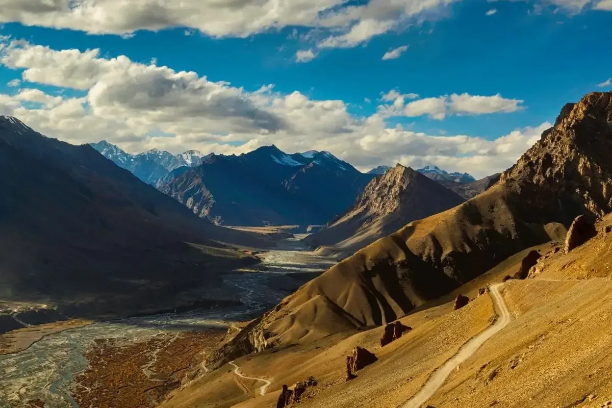
The expedition progresses from fertile Kinnauri villages through high grazing grounds before entering loose scree slopes, snowfields, glacial terrain, and the steep ascent to the pass. Beyond the summit, the landscape transforms dramatically into the cold-desert environment that characterizes the upper Baspa and Spiti regions.
Suitable for experienced high-altitude trekkers and expedition teams, Charang La is celebrated for its blend of living Himalayan culture, ancient trade history, and spectacular trans-Himalayan scenery.
Quick Facts
Duration
Max Altitude
Difficulty
Best Time
Trek Distance
Trail Atmosphere
Iconic Spots
Charang La Pass (5,200m)
Kinnaur Valley Transition
Rangrik Tungma Gompa
Tirung Gad Gorge
Indo-Tibetan Border Ridge
Environment
Nature & Culture
Flora & Fauna
Flora
Fauna
Revered by Hindu and Buddhist communities. Home to the 11th-century Rangrik Tungma Temple and Charang Monastery. Legend says Goddess Rangrik Tungma protects the valley.
— Local folklore
Spiritual & Cultural Significance
Temple Protocols
Technical Details
Challenge & Preparation
Primarily a cardio demand and joint & muscle impact challenge
A demanding expedition with extreme cardio demand and joint & muscle impact.
Personal Readiness
Am I ready?
Planning
Logistics & Trail Intel
Getting There
Nearest Railhead
Chandigarh Railway Station (IXC)
Nearest Airport
Kullu-Manali Airport, Bhuntar (KUU) / Chandigarh (IXC)
Nearest Medical Facility
Reckong Peo Regional Hospital
Mobile Signal
No signal on trail
For Drivers
Trail Culinary & Diet
The Content & Remote Hub
Permits and Regulations
Highly regulated due to the proximity to the sensitive Indo-Tibetan border and extreme altitude.
Learn more about how we vet operators and ensure transparency on our why MountRoutes page.
Packing List
Clothing
- Three-layer system
- Moisture-wicking base layers
- Fleece mid-layers
- Heavy-duty down jacket
- Waterproof trek pants
Footwear & Gear
- Waterproof trekking boots with ankle support
- 40-50L rucksack with rain cover
- Polarized sunglasses
- Warm woolen cap
- Sleeping bag rated to -10°C
Deep Dives
Explore Further
Editor's Notes
Because the terrain is unstable and near the Indo-Tibetan border, experienced local guides and mandatory permits from Reckong Peo are required.
Explore In Detail
Day by Day Itinerary
7-day route reaching 17,198ft. Covers 65km of varied terrain.
→ See full itinerary with altitude profileDifficulty & Fitness
Rated challenging. Rugged and diverse. Transitions from lush forests to stark high-altitude alpine terrain with glacial moraines, loose scree, and unstable chossy slopes.
→ See difficulty breakdown and fitness guideCost & Pricing
Packages range from ₹36,000 – ₹61,000. Inclusions and hidden costs vary by operator tier.
→ See full cost breakdownFrequently Asked Questions
How difficult is the Charang La Pass Expedition?
The Charang La Pass is considered a very difficult and technical expedition. It involves long trekking days, crossing high-altitude passes over 5200m, steep ascents, and walking over moraines and glaciers. It is recommended only for experienced trekkers with excellent physical fitness and prior high-altitude exposure.
What is the best time to do the Charang La Pass trek?
The best time to undertake the Charang La Pass expedition is during the post-monsoon months of late August to early October. During this window, the weather is relatively stable, and the pass has less snow, making the crossing safer and more manageable.
Is prior high-altitude experience required for Charang La?
Yes, prior high-altitude trekking experience is absolutely mandatory for the Charang La Pass. Trekkers should have completed at least two or three treks above 4,500m to understand how their body acclimatizes to thin air and to handle the demanding terrain.
What are the fitness requirements for Charang La Pass?
Trekkers must be in peak physical condition. You should be able to jog 5 km in under 30 minutes and have strong cardiovascular endurance. Core strength and leg muscle endurance are crucial for navigating the steep, rocky terrains and long trekking hours.
Do I need special permits for the Charang La Pass Expedition?
Yes, since the Charang La Pass is located close to the Indo-Tibetan border in the Kinnaur region, you require an Inner Line Permit (ILP) to undertake this expedition. This permit can be obtained from the district magistrate's office in Reckong Peo.
How cold does it get at Charang La Pass?
Temperatures at higher camps and at the pass can be extremely harsh. During the trekking season, daytime temperatures range from 10°C to 15°C, while nighttime temperatures can drop well below freezing, often reaching -5°C to -10°C. High-quality winter layering is essential.
What kind of trekking gear is essential for Charang La?
Essential gear includes a high-quality down jacket, waterproof trekking boots with excellent ankle support, micro-spikes or crampons depending on snow conditions, a -10°C rated sleeping bag, trekking poles, and a robust layering system for unpredictable mountain weather.
Are there water sources available along the Charang La route?
Water sources are available at lower camps, typically fed by glacial streams. However, as you climb higher towards the pass, water becomes scarce. Trekkers must carry at least 2 liters of water each day and use water purification tablets or filters before drinking.
Can I do the Charang La Pass trek solo?
No, solo trekking is highly discouraged and often not permitted due to the remote nature of the terrain, objective hazards like crevasses and rockfalls, and the requirement of Inner Line Permits. A certified guide and an organized expedition team are highly recommended.
What are the symptoms of altitude sickness to watch out for during this expedition?
Trekkers must monitor for symptoms of Acute Mountain Sickness (AMS), which include severe headache, nausea, dizziness, shortness of breath, and fatigue. If symptoms escalate to HAPE or HACE (fluid in lungs or brain), immediate descent and medical attention are mandatory.
Route Intelligence
Routes With Similar Character
Routes that share the character of Charang La Pass Expedition.
Still deciding?
Compare routes side-by-side to find the perfect match for your fitness, dates, and budget.
Everything you need to know, in one place. Someone else in your group needs to see this.
Planning Charang La Pass Expedition?
Get route conditions, operator updates, and season windows before booking.
Don't miss out! Follow us for route updates@mountroutes|LinkedIn
No spam. Only useful trek updates.
Ready to walk this route?
You’ve read the guide, now find the perfect local team to take you there. Compare our verified list of operators.
Compare verified operators