
Explore
Intelligence
Detailed Route
Bhyundar Khal Expedition Itinerary — Day by Day Route & Camps
A 9-day hardcore traverse from Govindghat, through the Valley of Flowers, over the Tipra and Rataban glaciers, crossing the 16,732 ft Bhyundar Khal.
Standard RouteThis is the baseline pacing strategy for this expedition. Expedition leaders frequently modify rotation schedules, add reserve weather days, or adjust high camps based on real-time mountain conditions. Consult the operator's expedition dossier for their precise approach.
Duration
9 Days
Total Distance
37.0 KM
Max Altitude
16,732 FT
Trek Type
circuit
Permits Required Before You Go
Permit Cost
Foreigner Process
Requires X-Mountaineering Visa, IMF clearance, and Inner Line Permit for Niti Valley.
Nearest Embassy Hub
New Delhi
Day by Day Breakdown
Camp Alt
6,300 ft
Day Gain
+5,200 ft
Drive to Govindghat
A long, scenic drive along the Alaknanda river. Govindghat serves as the bustling basecamp for the Valley of Flowers and Hemkund Sahib.
Key Landmarks
Staying At
The mountain road follows the Alaknanda river corridor, gradually entering the steep-sided valleys that characterize the approach to the Garhwal high country.
Camp Alt
10,200 ft
Day Gain
+3,900 ft
Drive to Pulna & Trek to Ghangaria
5km shared jeep ride from Govindghat to Pulna is the actual trek start. Continuous ascent alongside the roaring Pushpawati river. Well-marked trail with tea shops and snack stalls throughout. Ghangaria is the base for all explorations — Valley of Flowers and Hemkund Sahib both accessible from here. Helicopter service available from Govindghat to Ghangaria at extra cost (weather dependent).
Key Landmarks
Staying At
The motorable road ends at Pulna, where the route transitions onto a forested trail alongside the Pushpawati river, entering the lush lower reaches of the Bhyundar Valley.
Field Notes
KEY ACTIONRiver Crossings
Plan to cross early in the day before snowmelt swells the water levels. Unclip backpack waist belts before crossing.
Camp Alt
12,140 ft
Day Gain
+1,940 ft
Trek to Tipra Kharak
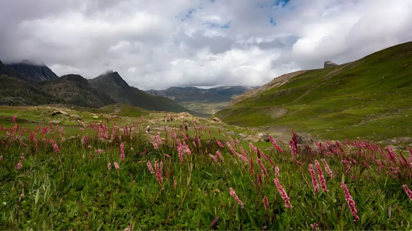
Leaving the pilgrim crowds behind, the team enters the stunning Valley of Flowers National Park. Beyond the official park limits, the trail becomes rugged, leading to the alpine meadows of Tipra Kharak at the snout of the Tipra Glacier.
Key Landmarks
Staying At
Leaving the vibrant flora of the Valley of Flowers behind, the landscape shifts abruptly into rugged alpine terrain, culminating in the barren meadows of Tipra Kharak near the glacier snout.
Field Notes
KEY ACTIONHelmet Mandatory
Helmet mandatory. Move quickly and quietly through the rockfall zone without stopping to rest.
Use Trekking Poles
Trekking poles are highly recommended to save your knees on the descent.
INFOSlower Progress
Progress will be significantly slower and more taxing on your ankles than trail distance suggests.
Camp Alt
14,108 ft
Day Gain
+1,968 ft
Reach Bhyundar Icefall Camp
The terrain shifts entirely from lush meadows to barren rock and ice. The team ascends the massive lateral moraine of the Tipra glacier. Navigation is complex over loose boulders.
Key Landmarks
Staying At
Alpine meadows vanish entirely as the environment transforms into a desolate expanse of loose boulders and fractured ice along the massive lateral moraine of the Tipra Glacier.
Field Notes
KEY ACTIONRoped Travel
Requires roped glacier travel.
KEY ACTIONStart Early
Start before sunrise to ensure snow bridges remain solid.
KEY ACTIONHelmet Mandatory
Helmet mandatory. Move quickly and quietly through the rockfall zone without stopping to rest.
Use Trekking Poles
Trekking poles are highly recommended to save your knees on the descent.
INFOSlower Progress
Progress will be significantly slower and more taxing on your ankles than trail distance suggests.
Camp Alt
15,092 ft
Day Gain
+984 ft
Reach Bhyundar Khal Base Camp
Technical glacier travel begins. Teams rope up to navigate the crevasses of the upper Tipra glacier. The camp is set directly beneath the pass headwall in a severe, freezing environment.
Key Landmarks
Staying At
The topography transitions strictly to technical glacier travel, ascending deep into a severe, freezing ice basin directly beneath the looming Bhyundar Khal headwall.
Field Notes
KEY ACTIONRoped Travel
Requires roped glacier travel.
KEY ACTIONStart Early
Start before sunrise to ensure snow bridges remain solid.
Use Trekking Poles
Trekking poles are highly recommended to save your knees on the descent.
INFOSlower Progress
Progress will be significantly slower and more taxing on your ankles than trail distance suggests.
Camp Alt
14,000 ft
Day Gain
-1,092 ft
Today's Objective
🏔 Summit Bhyundar Khal Peak
The Crux. An alpine start (2:00 AM). The team ascends the steep snow/ice headwall, often using fixed ropes, to reach Bhyundar Khal (16,732 ft). The descent is a steep glacier descent onto the Rataban glacier, requiring extreme caution.
Key Landmarks
Staying At
Crossing the 16,732 ft pass bridges two massive glacial systems, shifting the expedition from the Tipra basin over the watershed divide and down onto the heavily broken Rataban Glacier.
Field Notes
KEY ACTIONRoped Travel
Requires roped glacier travel.
KEY ACTIONStart Early
Start before sunrise to ensure snow bridges remain solid.
KEY ACTIONHarness Gear
Harness-compatible gear is mandatory.
Use Trekking Poles
Trekking poles are highly recommended to save your knees on the descent.
INFOPacing Delays
Slower pacing expected due to bottlenecking on fixed lines.
Camp Alt
12,796 ft
Day Gain
-1,204 ft
Descend to Edi Udiyar
Navigating the heavily broken Rataban glacier. The team exits the glacier snout and descends into the alpine scrub, reaching the shepherd cave shelter at Edi Udiyar.
Key Landmarks
Staying At
The fractured ice of the Rataban glacier yields to rocky moraine, eventually descending back into sparse alpine scrub near the shepherd shelters of Edi Udiyar.
Field Notes
KEY ACTIONRoped Travel
Requires roped glacier travel.
KEY ACTIONStart Early
Start before sunrise to ensure snow bridges remain solid.
KEY ACTIONHelmet Mandatory
Helmet mandatory. Move quickly and quietly through the rockfall zone without stopping to rest.
Use Trekking Poles
Trekking poles are highly recommended to save your knees on the descent.
INFOSlower Progress
Progress will be significantly slower and more taxing on your ankles than trail distance suggests.
Camp Alt
6,150 ft
Day Gain
-6,646 ft
Trek to Govindghat & Drive to Joshimath
The final trek follows the Amrit Ganga river down a steep gorge to the remote border village of Ghamsali. From here, vehicles transport the team back to civilization in Joshimath.
Key Landmarks
Staying At
Following the Amrit Ganga river through a steep gorge, the high alpine wilderness transitions back into civilization at the remote border village of Ghamsali in the Niti Valley.
Field Notes
KEY ACTIONHelmet Mandatory
Helmet mandatory. Move quickly and quietly through the rockfall zone without stopping to rest.
KEY ACTIONRiver Crossings
Plan to cross early in the day before snowmelt swells the water levels. Unclip backpack waist belts before crossing.
Camp Alt
1,100 ft
Day Gain
-5,050 ft
Drive to Rishikesh / Dehradun
Conclusion of the expedition with the long drive back to the plains.
The stark high-altitude topography of the Dhauli Ganga and Alaknanda valleys softens into the sub-tropical forested foothills of the lower Ganges basin.
Expedition Extensions & Add-ons
Twin Passes Traverse (Gupt Khal)
+4 DaysAfter crossing Bhyundar Khal into the Bankund glacier system, elite teams cross the 19,052 ft Gupt Khal before descending to Ghamsali.
Camp-by-Camp Details
Govindghat
Start Town
Water
Municipal
Wind
low
Night Temp
15°C
Toilet
Western
Hotel accommodation.
Tipra Kharak
meadow_camp
Water
Glacial Stream
Wind
moderate
Night Temp
2°C
Toilet
Dry Pit
Beautiful grassy meadows before the glacier begins.
Bhyundar Khal Base Camp
glacier_camp
Water
Melted Snow
Wind
extreme
Night Temp
-10°C
Toilet
Dry Pit
Tents pitched directly on ice and moraine. Leveling with ice axes is required.
Navigation & Route Data
Magnetic Declination
+1.5°
Key Waypoints
Critical Navigation Notes
Glacier moraines shift annually. Visual route-finding by expert guides is mandatory.
Plan Your Expedition:
Ready to book? Compare verified operators for Bhyundar Khal Expedition — transparent pricing, no paid rankings.
Still deciding?
Compare routes side-by-side to find the perfect match for your fitness, dates, and budget.
Day by day, camp by camp. Send this to your group so everyone's on the same page.
Step 4: Safety & Framework
You understand the route.
Now understand the hazards, physiology, and Go/No-Go decision framework.
View Safety Framework