
Explore
Intelligence
Essential Planning Guide
Bara Bhangal Grand Traverse Expedition — Complete Guide (2026)
Vibe & Scenery
The Experience
Introduction
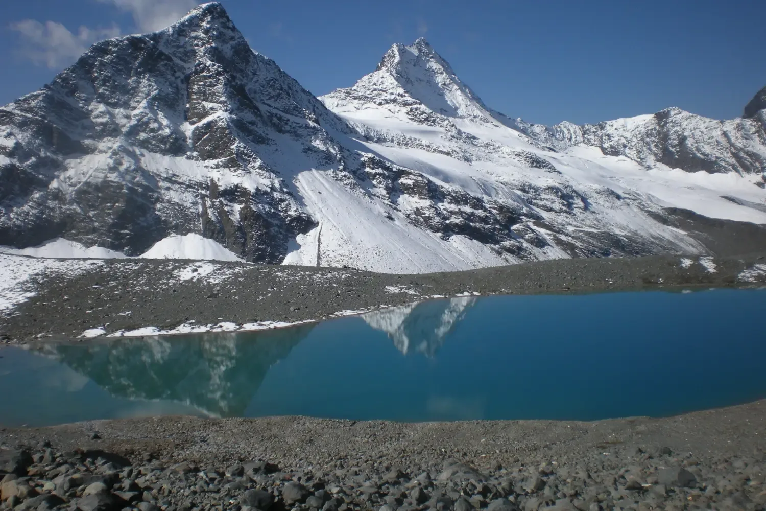
The Bara Bhangal Grand Traverse is among the longest, toughest, and most rewarding expeditions in the Western Himalayas. Linking the Kullu Valley with Kangra through the remote tribal settlement of Bara Bhangal, the route crosses two formidable mountain barriers—Kalihani Pass and Thamsar Pass—while traversing some of Himachal Pradesh's wildest alpine terrain.
Beginning near Manali, the expedition climbs through forests, alpine meadows, glaciers, and vast moraine systems before crossing Kalihani Pass into the isolated Ravi watershed. After reaching Bara Bhangal—a village that remains inaccessible by road and cut off by snow for much of the year—the journey continues across the challenging Thamsar Pass before descending into the lush Kangra Valley near Bir.
Combining extreme remoteness, demanding alpine terrain, and one of the richest living mountain cultures in the Himalayas, the Bara Bhangal Grand Traverse stands among India's greatest expedition journeys.
Quick Facts
Duration
Max Altitude
Difficulty
Best Time
Trek Distance
Trail Atmosphere
Iconic Spots
Kalihani & Thamsar Passes
Bara Bhangal Village
Riyali Thach Meadows
Kangra Valley Descent
Ravi River Gorge
Environment
Nature & Culture
Flora & Fauna
Flora
Fauna
Reverence for the Mountain Gods at Thamsar Pass. Bara Bhangal village is an isolated sanctuary for the semi-nomadic Gaddi shepherd tribe.
— Local folklore
Spiritual & Cultural Significance
Temple Protocols
Technical Details
Challenge & Preparation
Primarily a cardio demand challenge
A demanding expedition dominated by extreme cardio demand.
Personal Readiness
Am I ready?
Planning
Logistics & Trail Intel
Getting There
Nearest Railhead
Chandigarh Railway Station (IXC)
Nearest Airport
Kullu-Manali Airport, Bhuntar (KUU) / Chandigarh (IXC)
Nearest Medical Facility
Bir PHC
Mobile Signal
No signal on trail
For Drivers
Trail Culinary & Diet
The Content & Remote Hub
Permits and Regulations
Strict regulations apply due to the extreme isolation and high altitude of the traverse.
Learn more about how we vet operators and ensure transparency on our why MountRoutes page.
Packing List
High-Isolation Survival
- Satellite Messenger (Garmin inReach/Zoleo) - Mandatory. There is no rescue infrastructure.
- Medical trauma kit including AMS injectables and broad-spectrum antibiotics
- Water purification pump (Not just drops; filtering glacial silt is required)
Dual-Pass Technical Gear
- Crampons and short ice axes (Both Kalihani and Thamsar are heavily glaciated)
- Crevasse rescue harness and pulleys (If traversing in early summer)
- Minimum 2 pairs of high-durability trekking boots per team member
Deep Dives
Explore Further
Editor's Notes
Psychology breaks people before muscles do. Waking up in a freezing tent on Day 9 knowing you still have a 15,000 foot pass ahead destroys weak minds. Be mentally armored.
Explore In Detail
Day by Day Itinerary
12-day route reaching 15,994ft. Covers 85km of varied terrain.
→ See full itinerary with altitude profileDifficulty & Fitness
Rated challenging. Varied and taxing. Involves thick alpine forests, steep ridges, glacial moraines, ice fields, and river crossings over two major passes (Kalihani and Thamsar).
→ See difficulty breakdown and fitness guideCost & Pricing
Packages range from ₹51,000 – ₹76,000. Inclusions and hidden costs vary by operator tier.
→ See full cost breakdownFrequently Asked Questions
How difficult is the Bara Bhangal Trail Extension Trek?
It is classified as a hard trek. It takes 12 days and reaches a maximum altitude of 16000 ft. Trekkers should have steady cardiovascular endurance.
What is the risk of Acute Mountain Sickness (AMS) on the Bara Bhangal Trail Extension Trek?
Since the trail climbs up to 16000 ft, there is a distinct risk of AMS. Proper hydration, progressive pacing, and gradual acclimatization are highly advised.
When is the absolute best time to do Bara Bhangal Trail Extension Trek?
The window is microscopically thin. Both Kalihani and Thamsar MUST be relatively clear of soft snow. The only realistic times are late August through September.
Will I get mobile network or internet connectivity during Bara Bhangal Trail Extension Trek?
Connectivity is highly sporadic. The last reliable mobile signal is at Drops heavily on Day 1. Complete absolute dead-zone until Day 12 at Bir.. Expect complete digital isolation on the trail.
Where is the last reliable ATM before starting the Bara Bhangal Trail Extension Trek?
The last active ATM is located at Manali. It is strongly recommended to withdraw sufficient cash at major transit hubs before starting.
Is the drinking water safe on the Bara Bhangal Trail Extension Trek trail?
Fresh stream water is abundant, but water treatment is mandatory. Boil and filter.
Can I rent trekking gear at Manali (Kullu)?
Rental options at Manali (Kullu) are extremely limited. It is best to rent or purchase all essential gear in major hubs before reaching the base.
What permits are required for the Bara Bhangal Trail Extension Trek?
Multi-district permit required. You need forest clearances from Manali (Kullu), Chamba (for Bara Bhangal), and Dharamshala (Kangra). A police waiver is almost always demanded by operators.
What is the emergency evacuation protocol on the Bara Bhangal Trail Extension Trek?
True isolation. Deep in the Ravi gorge, helicopters are useless due to narrow canyon walls. In case of extreme emergencies, helicopter evacuation can be coordinated if weather allows.
Where is the nearest specialized ICU or hospital for Bara Bhangal Trail Extension Trek?
The nearest specialized ICU is Manali (Start) / Kangra (Exit). For minor injuries, the nearest primary health center is located at Mission Hospital Manali (Start) / Baijnath Hospital (Exit).
Is it safe to do the Bara Bhangal Trail Extension Trek as a solo female or solo traveler?
Absolutely, unequivocally prohibited. The local communities are exceptionally welcoming and hospitable, but having a guide is highly recommended.
Are foreign nationals allowed to do the Bara Bhangal Trail Extension Trek?
Yes, foreign nationals are fully permitted with standard tourist permits and passport logging at regional checkpoints.
What kind of food is served during the Bara Bhangal Trail Extension Trek?
We serve highly nutritious, warm vegetarian meals suitable for high altitudes. You will also get to taste N/A on the trail.
Are digital UPI/online payments accepted at the base village of Manali (Kullu)?
While some local shops accept UPI at Manali (Kullu), connection is highly unreliable due to network dropouts. Make sure to carry physical cash.
What is the local cultural significance or folklore associated with Bara Bhangal Trail Extension Trek?
Bara Bhangal is said to have been founded by fugitives who crossed the mountains to escape persecution, finding a valley so remote no army could ever reach them.
Still deciding?
Compare routes side-by-side to find the perfect match for your fitness, dates, and budget.
Everything you need to know, in one place. Someone else in your group needs to see this.
Planning Bara Bhangal Grand Traverse Expedition?
Get route conditions, operator updates, and season windows before booking.
Don't miss out! Follow us for route updates@mountroutes|LinkedIn
No spam. Only useful trek updates.
Ready to walk this route?
You’ve read the guide, now find the perfect local team to take you there. Compare our verified list of operators.
Compare verified operators