Essential Planning Guide
Yunam Peak Expedition — Complete Guide (2026)
Introduction
Yunam Peak (20,046 ft) is one of the rarest anomalies in the Himalayas: a massive 6,000-meter peak that can be climbed entirely without technical mountaineering equipment. Located near the Baralacha La pass on the Manali-Leh highway, it offers fit trekkers the ultimate prize of breaking the 20,000 ft barrier without needing ropes, crampons, or ice axes. The ascent is mostly an agonizingly steep slog over endless scree, loose boulders, and hard-packed snow. The summit offers a staggering, unobstructed 360-degree view dominating the C.B. Range, the Mulkila range, and the vast Zanskar mountains. It is the perfect bridge for trekkers who want to transition into high-altitude mountaineering.
Ready to book? Compare verified operators for Yunam Peak Expedition — transparent pricing, no paid rankings.
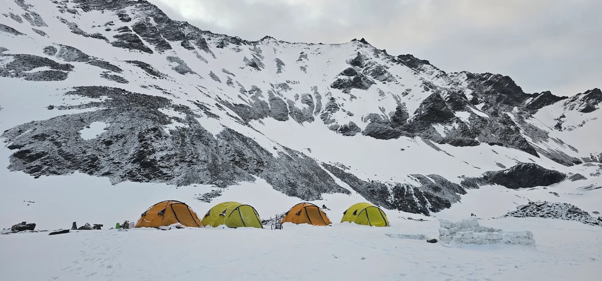
Iconic Spots
Yunam Summit (20,046 ft)
Quick Facts
Duration
10 Days
Max Altitude
20,050 ft
Difficulty
Extreme
Best Time
The climbing window is restricted entirely to late...
Trek Distance
35 km
Trail Atmosphere
Stargazing
Class 1 Dark Sky
Scent Profile
Silence Level
~10 dB
Vertigo Factor
8 / 10
Getting There
Route to Base
Private expedition vehicle from Manali
Base Village
Bharatpur (Highway stop)
15,000 ft
Last ATM
Keylong
Nearest Medical Facility
Keylong Hospital
Mobile Signal
None.
Water Sources
Snow melting required at Base Camp.
Charging
Zero charging points after Keylong.
For Drivers
Road Condition
Manali to Darcha is excellent highway. Darcha to Bharatpur is steep, unpaved highway traversing sheer cliffs.
Keylong / Jispa
Trail Culinary & Diet
Don't miss the High altitude noodle soups for fast carb absorption
Buy specialized diet items at Manali
The Content & Remote Hub
No DronesStrictly banned due to extreme high altitude and proxy to military checkposts.Top Vlog Spots
Video Calls
none
Est. 0 Mbps
UPI Reliability
1/10
Guide Wisdom
Caution
Keep your water bottles inside your down jacket near your chest on summit night. If they are in your backpack side pockets, they will freeze solid by 3 AM.
Explore In Detail
Best Time to Visit
The climbing window is restricted entirely to late summer when the snowpack is hardest and the Leh-Manali highway is guaranteed open.
→ See month-by-month season guideDay by Day Itinerary
10-day route reaching 20,050ft. Covers 35km of varied terrain.
→ See full itinerary with altitude profileDifficulty & Fitness
Rated Extreme. It is essentially a massively tilted mountain of gravel and loose rocks. Two steps up, sliding one step down.
→ See difficulty breakdown and fitness guideCost & Pricing
Packages range from ₹35,000 to ₹45,000. Inclusions and hidden costs vary by operator tier.
→ See full cost breakdownPermits and Regulations
IMF (Indian Mountaineering Foundation) peak booking fees apply because the altitude crosses 6000 meters. A heavily monitored police checkpoint at Darcha records all climber passport/Aadhar details.
Learn more about how we vet operators and ensure transparency on our why MountRoutes page.
Packing List
Expedition Clothing
- Summit Down Jacket (-25°C rating mandatory)
- Waterproof breathable alpine trousers
- Heavyweight thermal baselayers (Upper & Lower)
- Fleece mid-layers
- Balaclava/Face mask (To prevent frostbite from summit winds)
Footwear & Navigation
- Category C or D Expedition Boots (Must be extremely stiff-soled)
- Gaiters (For walking through the deep snow on the upper ridges)
- Micro-spikes (Operator usually provides crampons if ice is hard)
Wilderness Survival Gear
- Category 4 Glacier glasses (Mandatory)
- Trekking poles with snow baskets
- Heavy-duty expedition mitts (Not just gloves)
Flora & Fauna
Flora
Fauna
The high peaks of Lahaul are often seen as meditating ascetic monks by the locals, unbothered by the mortal world below.
— Local folklore
Spiritual & Cultural Significance
Low. Purely a mountaineering challenge.
🕐 Shrine Timings: N/A
Frequently Asked Questions
If it is 20,000 ft, why are ropes not needed?
The geological profile of Yunam forms a massive, long ascending ridge entirely made of scree and snow. There are no vertical ice walls or heavily crevassed glaciers requiring roped-up travel, making it a extremely high-altitude 'trek' rather than a technical 'climb'.
Can I do Yunam Peak as my first trek?
Absolutely NOT. Pushing above 20,000 ft requires deep physiological adaptation. You must have completed at least two treks above 15,000 ft (like Goechala, Roopkund, or Pin Bhabha) before attempting Yunam.
Where does the trek start?
You drive from Manali all the way up the Leh highway past Darcha to Bharatpur Tent Colony, right before Baralacha La. The trek essentially starts at an insane 15,000 ft directly from the highway.
What is the AMS risk?
Critical. Because you drive directly to 15,000 ft, rapid altitude sickness is almost guaranteed if you don't deliberately spend a few days acclimatizing in Keylong or Jispa beforehand.
How long does summit day take?
It is a brutal 12 to 15-hour day. You will wake up at 1:00 AM, climb for 8 hours in the dark to reach the summit by 9:00 AM, and spend 5 hours descending.
Is there mobile network anywhere?
Not after Keylong. You will be entirely cut off from the outside world once you cross Darcha.
What temperatures should I expect on summit night?
Ambient temperatures on the final summit push drop to -15°C to -20°C. With the wind chill at 20,000 ft, it can feel like -30°C.
Do I need to carry my own heavy backpack on summit day?
No. From the advanced base camp, you only carry a small daypack with water, snacks, and extra layers. Your main luggage stays in the tents.
What if the weather turns bad on summit day?
Because it is an expedition, there is usually a buffer day built into the itinerary. If a whiteout occurs, the guides will hold at base camp and use the buffer day for the summit push.
Are there any river crossings?
The approach to the base camp involves crossing shallow but violently cold glacial streams. Neoprene socks are highly recommended.
Other Expeditions Guides
Everything you need to know, in one place. Someone else in your group needs to see this.
Planning Yunam Peak Expedition?
Get route conditions, operator updates, and season windows before booking.
No spam. Only useful updates.
Ready to walk this route?
You’ve read the guide, now find the perfect local team to take you there. Compare our verified list of operators.
Compare verified operators