
Explore
Intelligence
Essential Planning Guide
Sara Umga Pass Trek — Complete Guide (2026)
Vibe & Scenery
The Experience
Introduction
The Sara Umga Pass Trek is one of Himachal Pradesh's lesser-known high-altitude crossover routes, connecting Tosh in Parvati Valley with the Chandra Valley in Lahaul. Although often compared with nearby Pin Parvati Pass, Sara Umga offers a quieter expedition through equally dramatic mountain terrain.
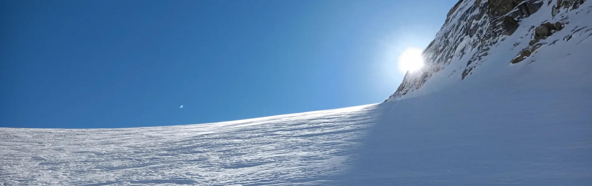
The trail climbs from dense conifer forests into alpine meadows before crossing glaciers, moraines, and the remote Sara Umga Pass at around 16,500 ft. The descent into Lahaul reveals a striking transition from the green valleys of Kullu to the cold, arid landscapes of the Greater Himalaya.
Glacier travel, sustained altitude, and rough terrain make this an expedition suitable only for experienced trekkers with excellent fitness and prior high-altitude experience.
Quick Facts
Duration
Max Altitude
Difficulty
Best Time
Trek Distance
Trail Atmosphere
Stargazing
Class 1 Dark Sky
Scent Profile
Silence Level
~10 dB
Vertigo Factor
9 / 10
Iconic Spots
Tosh Glacier Snout
Sara Umga Pass Summit
Environment
Nature & Culture
Flora & Fauna
Flora
Fauna
The pass was traditionally an ancient trade and shepherd route connecting the lush Kullu valley with the high Tibetan plateau regions of Spiti and Lahaul, heavily steeped in local folklore.
— Local folklore
Spiritual & Cultural Significance
The Parvati valley holds deep significance in Hindu mythology as the meditation ground of Lord Shiva and Parvati.
🕐 Shrine Timings: N/A
Temple Protocols
- •Maintain ecological purity on the glacier.
Technical Details
Challenge & Preparation
Primarily a cardio demand challenge
A demanding expedition dominated by extreme cardio demand.
Personal Readiness
Am I ready?
Planning
Logistics & Trail Intel
Getting There
Route to Base
Drive from Manali through Kullu, Bhuntar, and Kasol to the road-head at Tosh
Base Village
Tosh
7,800 ft
Last ATM
Kasol. Do not rely on Tosh for ATMs.
Nearest Medical Facility
District Hospital Kullu / Manali
Mobile Signal
Complete dead zone from Day 2 until Chota Dhara.
Water Sources
Abundant in Parvati valley. On the glacier and in Lahaul, water is sourced from glacial melt streams. Must be heavily filtered for glacial silt.
Charging
Zero charging points after Tosh. Carry multiple power banks.
For Drivers
Road Condition
The drive to Tosh is winding and narrow. The exit from Chota Dhara involves driving over riverbeds and severe off-road conditions until the Atal Tunnel highway.
Manali / Kullu
Trail Culinary & Diet
Don't miss the High-altitude Khichdi for easy digestion at 14,000 ft.
Buy specialized diet items at Manali
The Content & Remote Hub
No DronesDrones are strictly banned in Lahaul and Spiti border regions. Confiscation and heavy fines apply.Top Vlog Spots
Video Calls
none
UPI Reliability
3/10
Base WiFi Available
Permits and Regulations
Expedition permits are required from the Kullu District Forest Office. Because the trek exits into the Lahaul/Spiti valley, Inner Line Permits may be required for foreign nationals depending on the current geopolitical regulations. A registered, certified local guide is mandatory. Strict Leave No Trace policies must be adhered to, especially on the glacier.
Learn more about how we vet operators and ensure transparency on our why MountRoutes page.
Packing List
High-Altitude Mountaineering Clothing
- Expedition-grade down jacket rated to -20°C
- Waterproof and windproof hardshell jacket and pants (Gore-Tex)
- 3 pairs of merino wool thermal baselayers
- 2 heavy fleece mid-layers
- Waterproof alpine gloves with thermal liners
- Fleece balaclava and UV-protective neck gaiter
- 5 pairs of heavy woolen/synthetic trekking socks
Technical Footwear & Gear
- Sturdy, crampon-compatible waterproof mountaineering boots (Category B2 or C)
- Microspikes and potentially 10-point crampons (operator dependent)
- Ice Axe (for the pass crossing depending on snow conditions)
- Waterproof high-ankle gaiters (crucial for glacier walking)
- 2 anti-shock trekking poles with snow baskets
- 60L expedition backpack with rain cover
Survival & Safety Equipment
- Four-season sleeping bag rated to -15°C (if carrying personal gear)
- High-lumen headlamp with spare lithium batteries (cold drains batteries fast)
- Category 4 UV Polarized Glacier Glasses (essential to prevent snow blindness)
- Comprehensive Personal First Aid Kit with Diamox, Dexamethasone, and Nifedipine
- High SPF Sunscreen (50+) and zinc oxide lip balm
- Insulated water thermos (1 Liter)
Deep Dives
Explore Further
Editor's Notes
Explore In Detail
Day by Day Itinerary
7-day route reaching 16,500ft. Covers 52.0km of varied terrain.
→ See full itinerary with altitude profileDifficulty & Fitness
Rated challenging. The terrain shifts from soft mud trails in Tosh to lethal, crevassed glacier ice at Shamshi Thach, ending in dry, unstable scree in Lahaul. Route finding on the glacier is a massive challenge.
→ See difficulty breakdown and fitness guideCost & Pricing
Packages range from ₹28,000 – ₹40,000. Inclusions and hidden costs vary by operator tier.
→ See full cost breakdownFrequently Asked Questions
How difficult is the Sara Umga Pass compared to Pin Parvati?
Sara Umga is technically similar but physically shorter. However, it is far less frequented, meaning the trails are almost non-existent on the glacier. It requires true route-finding skills and is graded as Difficult.
Is this the same as the Sar Pass Trek?
No. Sar Pass is a popular, lower-altitude (13,800 ft) commercial trek for beginners. Sara Umga Pass (16,500 ft) is a serious mountaineering expedition requiring glacier travel and high-altitude endurance.
Are there crevasses on the Tosh Glacier?
Yes. The Tosh Glacier is heavily crevassed, especially late in the season (September). Trekkers will need to navigate carefully, and ropes are often required for safety.
Can I attempt this trek solo?
Absolutely not. The route is unmapped, the glacier shifts, and the weather is highly unpredictable. A certified high-altitude mountaineering guide and a roped team are mandatory for survival.
What is the AMS risk on this trek?
Extremely high. You will be sleeping above 13,000 ft at Kuta Thach before pushing to 16,500 ft. Proper acclimatization, hydration, and carrying portable oxygen are non-negotiable.
Where do we exit the trek?
The trek descends into the Lahaul/Spiti region, ending at Chota Dhara or Putiruni on the banks of the Chandra River. From there, you drive back to Manali via the Rohtang or Atal Tunnel.
Do we need to carry our own camping gear?
Most premium operators provide the central camping gear (tents, food). However, you must carry your personal clothing and sleeping bag unless you hire a personal high-altitude porter.
Will we see other trekkers?
It is highly unlikely. Sara Umga is a pristine, isolated route. You might go the entire 7 days without seeing another team.
Still deciding?
Compare routes side-by-side to find the perfect match for your fitness, dates, and budget.
Everything you need to know, in one place. Someone else in your group needs to see this.
Planning Sara Umga Pass Trek?
Get route conditions, operator updates, and season windows before booking.
Don't miss out! Follow us for route updates@mountroutes|LinkedIn
No spam. Only useful trek updates.
Ready to walk this route?
You’ve read the guide, now find the perfect local team to take you there. Compare our verified list of operators.
Compare verified operators