
Explore
Intelligence
Detailed Route
Rumtse Tso Moriri Trek Itinerary — Day by Day Route & Camps
A 7-day, 98km wilderness traverse starting from Rumtse, crossing vast nomadic plains and high passes to connect the stunning high-altitude lakes of Tso Kar and Tso Moriri.
Standard RouteThis is the standard mountain pacing for this trek. Specific operators may add an acclimatization day or alter the starting point. Check individual operator schedules for their exact logistics.
Duration
7 Days
Total Distance
98.0 KM
Max Altitude
17,847 FT
Trek Type
linear
Permits Required Before You Go
Permit Cost
Where to Get
DC Office, Leh or online via LAHDC portal
Documents
Aadhar Card / Passport, Passport Photos
Foreign Nationals
Foreigners must apply through a registered local agency in groups of 2 or more to access the Changthang region.
Foreigner Process
Protected Area Permit (PAP) required for the Changthang region. Must be processed by a local agent in groups of 2+.
Nearest Embassy Hub
New Delhi
Day by Day Breakdown
Camp Alt
14,763 ft
Day Gain
+3,263 ft
Drive to Rumtse & Trek to Kyamar Camp
After a scenic 75km drive from Leh along the Indus River to the village of Rumtse, the trek begins. You will walk through a lush valley before the landscape transitions into the arid Changthang. The trail involves a few river crossings before reaching the grazing grounds of Kyamar.
Key Landmarks
Staying At
Vegetation gives way to barren glacial debris as the route enters the expansive moraine basin and ablation zone of the glaciated upper watershed.
Field Notes
KEY ACTIONRiver Crossings
Plan to cross early in the day before snowmelt swells the water levels. Unclip backpack waist belts before crossing.
Camp Alt
16,076 ft
Day Gain
+1,313 ft
Cross Kyamar La & Mandalchan La, Reach Tisaling
A day crossing two major passes. The ascent to Kyamar La is steep and steep due to the altitude. After descending, you immediately begin the climb to Mandalchan La. The camp at Tisaling is situated in a high, windswept valley used by Changpa nomads.
Key Landmarks
Staying At
The route navigates the high-altitude passs at Kyamar La and Mandalchan La before dropping into the Tisaling basin.
Camp Alt
14,927 ft
Day Gain
-1,149 ft
Cross Shibuk La & Reach Ponganagu (Tso Kar)
Start the day with a steep, two-hour climb to Shibuk La. From the pass, you get your first magnificent view of the vast, white salt flats of Tso Kar lake. The long, sweeping descent takes you to the camp at Ponganagu, near the lake shores where Kiang are often spotted.
Key Landmarks
Staying At
The Tisaling pastures transition to an alpine pass crossing, descending into the Tso Kar basin.
Camp Alt
15,091 ft
Day Gain
+164 ft
Reach Nuruchan
A relatively flat and easy day that allows your body to recover. The trail follows the shores of Tso Kar lake, offering surreal landscapes of salt crusts and wetlands. The day ends at the small nomadic settlement of Nuruchan.
Key Landmarks
Staying At
Vegetation gives way to barren glacial debris as the route enters the expansive moraine basin and ablation zone of the glaciated upper watershed.
Camp Alt
16,076 ft
Day Gain
+985 ft
Cross Horlam La & Reach Rachungkaru
A short but steady climb takes you over the gentle Horlam La pass. The descent brings you to Rachungkaru, a prominent summer camp for the Tibetan nomads (Changpas). You can often see large herds of pashmina goats and yaks grazing in the area.
Key Landmarks
Staying At
Crossing the high-altitude pass bridges two distinct watershed systems, shifting the expedition over the glaciated divide and down into a new river basin.
Field Notes
Use Trekking Poles
Trekking poles are highly recommended to save your knees on the descent.
INFOSlower Progress
Progress will be significantly slower and more taxing on your ankles than trail distance suggests.
Camp Alt
16,896 ft
Day Gain
+820 ft
Cross Kyamayuri La & Kartse La, Reach Gyamalpari
The longest and most exhausting day of the trek. You will cross two massive, 17,500+ ft passes back-to-back. The trail is barren, exposed to fierce winds, and the oxygen level is extremely low. Camp is set in a high, desolate valley at nearly 17,000 ft.
Key Landmarks
Staying At
Crossing the high-altitude pass bridges two distinct watershed systems, shifting the expedition over the glaciated divide and down into a new river basin.
Camp Alt
14,850 ft
Day Gain
-2,046 ft
Today's Objective
💧 Reach Tso Moriri
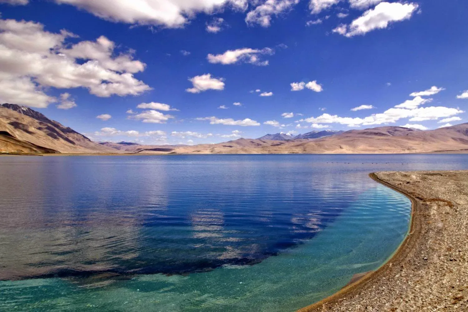
The final trekking day. A tough morning ascent leads to the highest point of the trek, Yalung Nyau La at 17,847 ft. The reward is an awe-inspiring, sweeping view of the deep blue Tso Moriri lake set against snow-capped peaks. A long, dusty descent brings you into the ancient village of Korzok on the lake's shores.
Key Landmarks
Staying At
The route crosses the final crosses the watershed at Yalung Nyau La, dropping into the Tso Moriri lake basin.
Trek Extensions & Add-ons
Korzok Monastery and Tso Moriri Rest
+1 DaySpend an extra day in Korzok after the trek to visit the ancient Korzok Monastery and relax by the shores of Tso Moriri before the long drive back to Leh.
Plan Your Trek:
Ready to book? Compare verified operators for Rumtse Tso Moriri Trek — transparent pricing, no paid rankings.
Still deciding?
Compare routes side-by-side to find the perfect match for your fitness, dates, and budget.
Day by day, camp by camp. Send this to your group so everyone's on the same page.
Step 4: Cost & Logistics
You understand the route.
Now see what services, permits, and logistics actually cost.
View Cost Breakdown