Detailed Route
Prashar Lake Trek Itinerary — Day by Day Route & Camps
Standard RouteThis is the standard mountain pacing for this trek. Specific operators may add an acclimatization day or alter the starting point. Check individual operator schedules for their exact logistics.
Duration
2 Days
Total Distance
14 KM
Max Altitude
8,960 FT
Trek Type
circuit
Day by Day Breakdown
Drive Mandi to Baggi & Trek to Prashar Lake
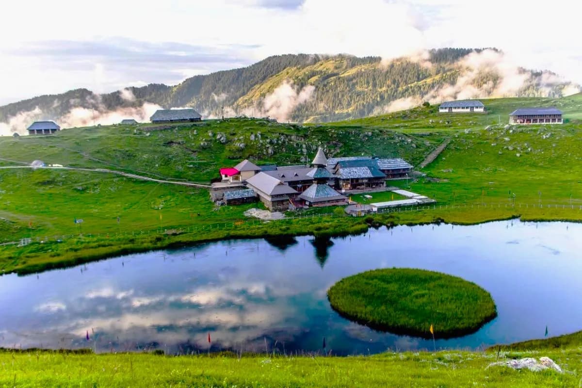
Camp near the lake. Sunset and sunrise at Prashar are the main events. The temple pujari may offer blessings and a simple prasad meal. Technical: Drive from Mandi to Baggi takes 1.5 hours on a narrow mountain road. The trek is a gentle 7 km uphill through a dense mixed forest (pine, deodar, oak). Trail is wide and well-marked. No technical sections. In winter (Dec-Feb), the trail can be snowy — basic shoes with grip are sufficient. Landscape: The Kath-Kuni temple at the lake is believed to have been constructed from a single deodar tree by a master craftsman in one night. Local folklore says the lake was created when Bhima (of the Mahabharata) struck the ground with his elbow, creating the crater. The floating island is believed to be a 'divine vessel' that moves with the prayers of the faithful. Safety: Simple and safe day. No altitude risk. Carry 1.5L water. In winter, the trail can be icy — use caution on the last 1 km descent to the lake.
Staying At
Descent: Prashar Lake to Baggi & Drive to Mandi
Reach Mandi by afternoon. The descent from Prashar is straightforward but can feel slippery in winter or after rain. Return drive offers expansive views over the Mandi valley and Dhauladhar ranges.
Key Landmarks
Trek Extensions & Add-ons
Tunga Mata Temple Hike
+1 DayShort extension to a higher ridge temple for bird's eye views of the entire Mandi valley.
Also on this trek
Ready to book? Compare verified operators for Prashar Lake Trek — transparent pricing, no paid rankings.
Still deciding?
Compare routes side-by-side to find the perfect match for your fitness, dates, and budget.
Day by day, camp by camp. Send this to your group so everyone's on the same page.
Love this itinerary?
Find operators who follow this exact route with verified acclimatization days.
Find matching operators