
Explore
Intelligence
Essential Planning Guide
Chasak Bhatori Trek — Complete Guide (2026)
Vibe & Scenery
The Experience
Introduction
Deep within the isolated Pangi Valley lies Chasak Bhatori, one of the highest permanently inhabited villages in Himachal Pradesh and one of the region's most distinctive trekking destinations. Unlike routes focused solely on summits or passes, this trek combines high-altitude landscapes with the opportunity to experience a living Himalayan culture that has remained largely unchanged for generations.
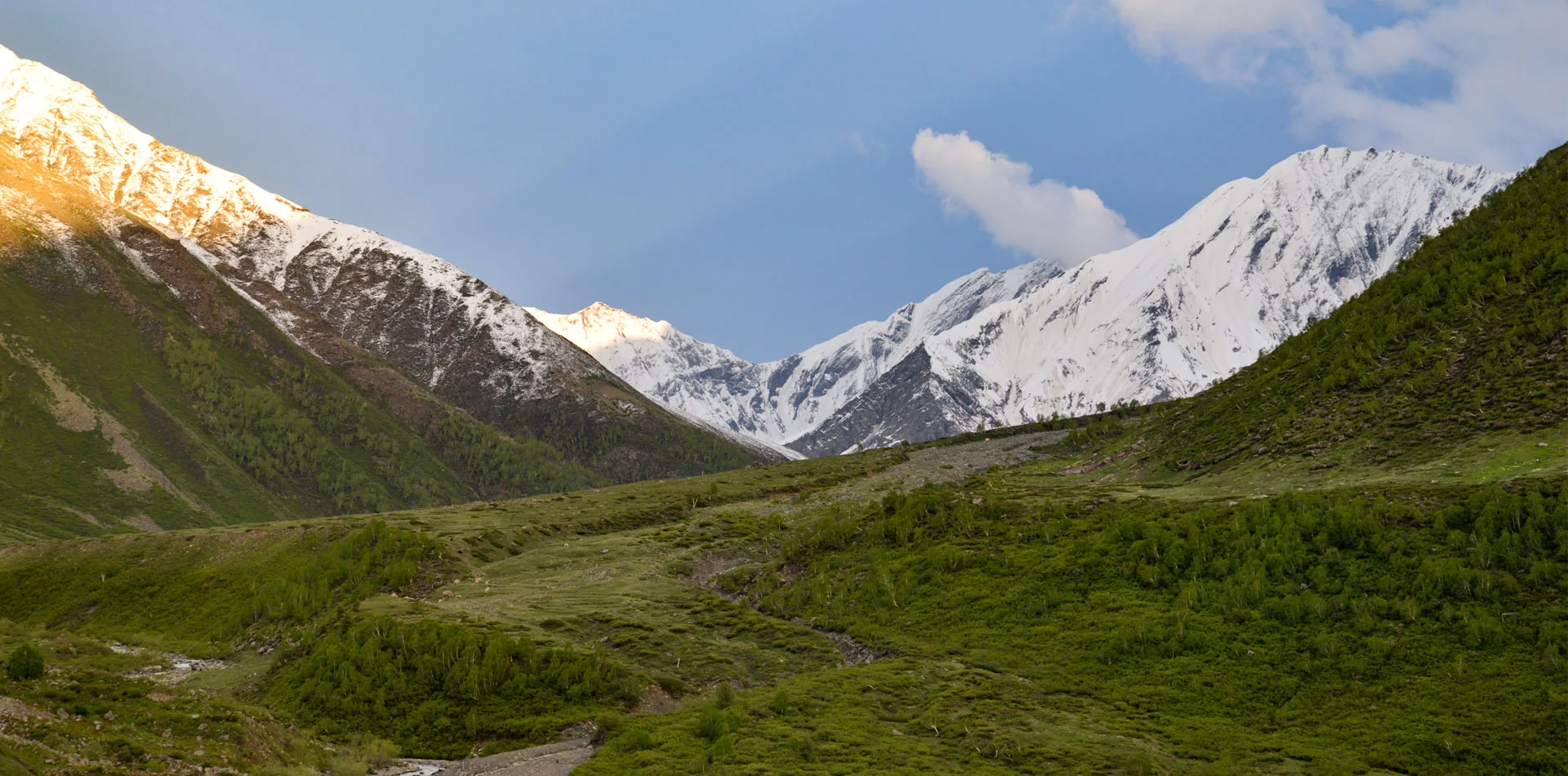
Beginning from Chasak village, the trail climbs through forests of Himalayan birch before emerging into alpine meadows overlooking glaciers and rugged mountain ridges. The destination is home to the Bhoti community, whose centuries-old traditions are reflected in wooden homes, an ancient gompa, and a historic Buddhist stupa.
Although the trek is relatively short, its remote location, altitude, and limited infrastructure require careful planning. For trekkers seeking cultural depth alongside dramatic Himalayan scenery, Chasak Bhatori offers an experience found on very few trekking routes in India.
Quick Facts
Duration
Max Altitude
Difficulty
Best Time
Trek Distance
Trail Atmosphere
Stargazing
Class 1 Dark Sky
Scent Profile
Silence Level
~20 dB
Vertigo Factor
8 / 10
Iconic Spots
Singhmarh Dhar Glacier
Ancient Stupa
Environment
Nature & Culture
Flora & Fauna
Flora
Fauna
The Bhot people of the valley are believed to be descendants of Tibetans who crossed the high passes centuries ago. The local Gomphas are deeply sacred.
— Local folklore
Spiritual & Cultural Significance
A deeply spiritual settlement for the Bhot people, maintaining centuries-old Tibetan Buddhist traditions.
🕐 Shrine Timings: Daytime
Temple Protocols
- •Do not touch religious artifacts without permission.
- •Walk around stupas in a clockwise direction.
Festivals & Dates
Technical Details
Challenge & Preparation
Primarily a joint & muscle impact challenge
A capable trekker's route dominated by extreme joint & muscle impact.
Personal Readiness
Am I ready?
Planning
Logistics & Trail Intel
Getting There
Route to Base
Killar is one of the most remote towns in India
It is reached either from Chamba (crossing the Sach Pass), from Manali (via Keylong and Udaipur), or from Kishtwar (Jammu & Kashmir) via the notorious 'Cliffhanger' road
Base Village
Killar
8,500 ft
Last ATM
Killar (Highly unreliable. Carry cash from Manali or Chamba).
Nearest Medical Facility
Basic PHC in Killar. Nearest major hospital is in Manali or Chamba (10+ hours away).
Mobile Signal
None.
Water Sources
Limited on the steep ascent. Carry enough water from Chasak Village. Glacial streams available at the Bhatori.
Charging
Rare to none. Some solar power may exist in the village, but do not rely on it.
For Drivers
Road Condition
The roads in Pangi Valley are among the most dangerous in the world. Unpaved, narrow ledges with massive drops.
Killar (Confirm stock before relying on it)
Trail Culinary & Diet
Don't miss the Thukpa and local butter tea.
Buy specialized diet items at Manali or Chamba
The Content & Remote Hub
Top Vlog Spots
Video Calls
none
Est. 0 Mbps
UPI Reliability
1/10
Permits and Regulations
Foreign nationals require Inner Line Permits (ILP) to travel through certain parts of the Pangi Valley. Indian nationals must carry valid ID. Trekkers must strictly respect the Buddhist customs in the village—no loud music, no alcohol near the Gompha, and seek permission before photographing locals.
Learn more about how we vet operators and ensure transparency on our why MountRoutes page.
Packing List
Clothing & Outerwear
- Heavy expedition down jacket (-10°C to -15°C rating)
- Gore-Tex windproof and waterproof hardshell
- Trekking pants and waterproof over-trousers
- Merino wool baselayers (top and bottom)
- Fleece mid-layers
- Fleece balaclava and UV-protective Buff
- Waterproof alpine gloves with thermal liners
Footwear
- High-ankle waterproof trekking boots with stiff soles
- Camp shoes or sturdy sandals for village stay
- Heavy woolen trekking socks (3-4 pairs)
- Moisture-wicking liner socks
Gear & Accessories
- 50-60L trekking backpack with rain cover
- Anti-shock trekking poles
- High-lumen headlamp with spare lithium batteries
- Category 4 UV protection sunglasses
- Insulated Nalgene water bottles (2L capacity)
Health & Hygiene
- Personal First Aid Kit (Diamox, Dexamethasone, standard meds)
- High SPF (50+) sunscreen and zinc oxide lip balm
- Biodegradable wet wipes and water purification tablets
- Personal toiletries
- Oximeter
Deep Dives
Explore Further
Editor's Notes
Explore In Detail
Day by Day Itinerary
3-day route reaching 14,058ft. Covers 12.0km of varied terrain.
→ See full itinerary with altitude profileDifficulty & Fitness
Rated moderate. The trek distance is short, but the gradient is severe. The trail consists of rocky, uneven steps through the forest, opening up to high-altitude dirt paths.
→ See difficulty breakdown and fitness guideCost & Pricing
Packages range from ₹15,000 - ₹25,000. Inclusions and hidden costs vary by operator tier.
→ See full cost breakdownFrequently Asked Questions
What is a 'Bhatori'?
A Bhatori is a traditional high-altitude village inhabited by the Buddhist Bhot people in the Pangi and Lahaul regions. They are characterized by their unique wooden architecture, monasteries (Gomphas), and distinct Tibetan-influenced culture.
How long is the actual trek?
The main trekking section from the roadhead at Chasak village to Chasak Bhatori is relatively short—about 6 kilometers—but it is a steep, strenuous climb that takes 2.5 to 3 hours due to the high altitude (14,058 ft).
Is it safe to drive to the basecamp?
The roads in Pangi Valley, specifically the dirt track from Saichu to Chasak village, are notorious for being narrow, unpaved, and highly dangerous. A high-clearance 4x4 vehicle and an experienced local driver are absolutely mandatory.
Are there medical facilities nearby?
No. The Pangi Valley is extremely remote. The nearest basic primary health center is in Killar, which is hours away over bad roads. Trekkers must be self-sufficient with first aid and oxygen.
Can we do this trek in the winter?
No. Chasak Bhatori is completely cut off and buried under several feet of snow during the winter. The locals often migrate to lower altitudes. The trek is strictly a summer/early autumn objective.
Will I get mobile network?
Expect zero mobile connectivity for the duration of the trek and in the village. You might get patchy BSNL network in Killar, far below the valley.
Do I need a local guide?
Yes. While the distance is short, the terrain is remote, and the cultural sensitivity of the village makes a local guide from Pangi essential for navigation and interaction.
Where do we stay in Chasak Bhatori?
Accommodation is limited to very basic local homestays or setting up your own expedition tents on the outskirts of the village.
Still deciding?
Compare routes side-by-side to find the perfect match for your fitness, dates, and budget.
Everything you need to know, in one place. Someone else in your group needs to see this.
Planning Chasak Bhatori Trek?
Get route conditions, operator updates, and season windows before booking.
Don't miss out! Follow us for route updates@mountroutes|LinkedIn
No spam. Only useful trek updates.
Ready to walk this route?
You’ve read the guide, now find the perfect local team to take you there. Compare our verified list of operators.
Compare verified operators