
Explore
Intelligence
Detailed Route
Beas Kund Trek Itinerary — Day by Day Route & Camps
Beas Kund Trek is a 4-day out-and-back from Solang Valley, with the glacial lake at 12,900ft reached on Day 3.
Standard RouteThis is the standard mountain pacing for this trek. Specific operators may add an acclimatization day or alter the starting point. Check individual operator schedules for their exact logistics.
Duration
4 Days
Total Distance
14 KM
Max Altitude
12,500 FT
Trek Type
linear
Day by Day Breakdown
Camp Alt
10,720 ft
Day Gain
+4,020 ft
Drive to Dhundi & Trek to Bakarthach
First camp in tents. The clearing at Bakarthach offers a 180-degree view of the mountain wall ahead. Technical: Drive from Manali to Dhundi (beyond Solang) takes about 1 hour. The trek from Dhundi is a gentle climb through a thick birch forest. Trail is wide and well-marked. The last 500m opens into the Bakarthach meadow — a vast, flat campsite used by shepherds. Landscape: Bakarthach was historically a resting point for Gaddi shepherds driving their flocks between Kangra and Lahaul. The stone shelters you see are centuries old. The name means 'place of the goats'. Safety: Gradual altitude gain. No risk today. Ensure you hydrate well — the dry mountain air dehydrates faster than you realize. Set up camp by 3 PM to enjoy the evening light on the Pir Panjal wall.
Key Landmarks
Staying At
The Dhundi roadhead leads into a forested trail following the Beas river gorge.
Field Notes
KEY ACTIONRiver Crossings
Plan to cross early in the day before snowmelt swells the water levels. Unclip backpack waist belts before crossing.
Camp Alt
10,720 ft
Day Gain
0 ft
Today's Objective
💧 Reach Beas Kund
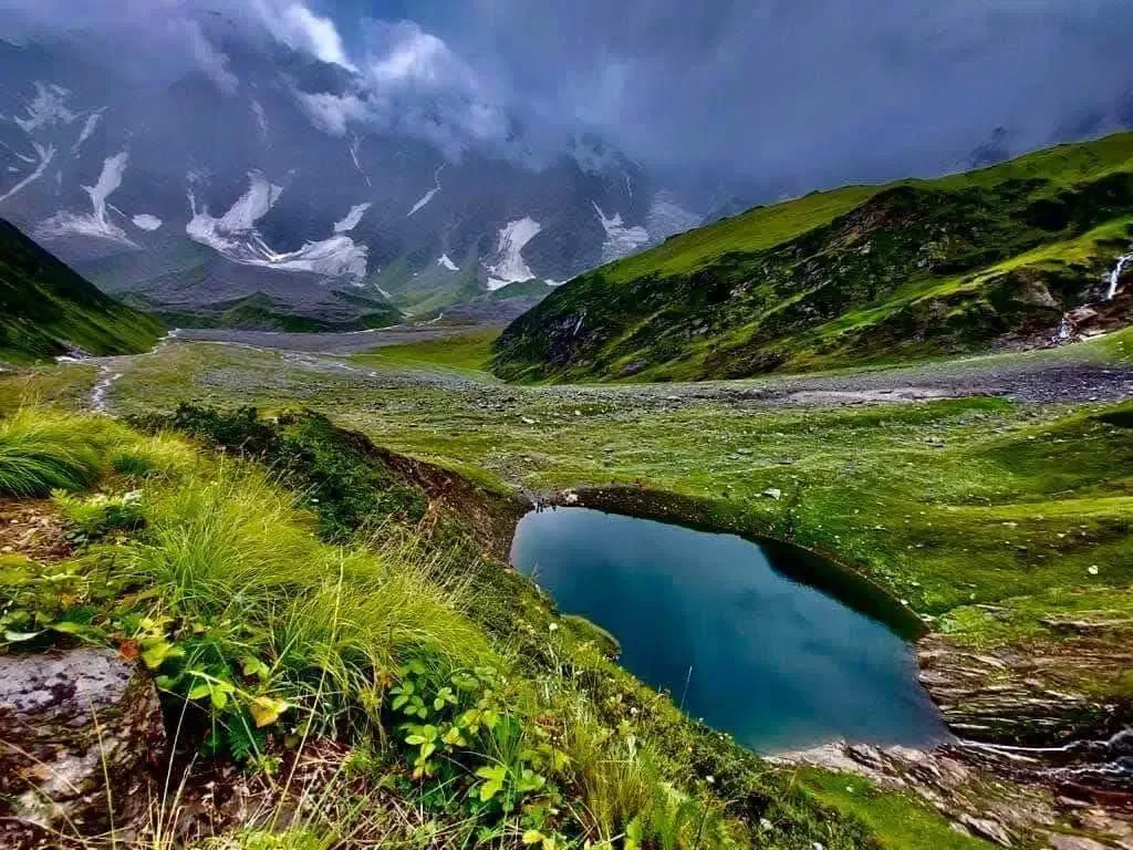
The return to Bakarthach follows the same route. Total walking time ~7 hours. Rest well tonight. Technical: The trail beyond Bakarthach turns into a boulder field. Navigation is by cairns. In June, large snow patches cover the boulders, making footing treacherous. The final 1 km to the lake is a steep scramble over moraine. The lake itself is small but deeply blue, fed by meltwater from the glacier above. Spend max 1 hour at the lake — the cirque funnels wind aggressively. Landscape: According to the Puranas, Rishi Vyas (Veda Vyasa) meditated here after writing the Mahabharata. The Beas River takes its name from him — 'Vyas' became 'Beas' over centuries. The lake is considered sacred; locals do not fish or bathe in it. Safety: AMS check before the final push. The boulder field has no shade — carry sufficient water (2L minimum). Sun glare off snow is extreme — UV sunglasses mandatory. Turnback time is 1:30 PM.
Key Landmarks
Staying At
Crossing the high-altitude pass bridges two distinct watershed systems, shifting the expedition over the glaciated divide and down into a new river basin.
Field Notes
KEY ACTIONRiver Crossings
Plan to cross early in the day before snowmelt swells the water levels. Unclip backpack waist belts before crossing.
Use Trekking Poles
Trekking poles are highly recommended to save your knees on the descent.
INFOSlower Progress
Progress will be significantly slower and more taxing on your ankles than trail distance suggests.
Camp Alt
6,700 ft
Day Gain
-4,020 ft
Trek to Dhundi & Drive to Manali
Reach Manali by 1 PM. Vashisht hot springs are a 10-minute walk from the Mall Road — perfect for post-trek recovery. Technical: Fast descent. Easy on the trail. Hard on the knees if you rush. Use poles. Reach Dhundi by 11 AM for the drive back to Manali. Landscape: The return through the birch forest offers a completely different perspective — you're walking towards the green Kullu Valley spread below. Safety: Knee Strain Alert on steep descents. Take it slow. Hydrate well.
Key Landmarks
The Bakarthach pastures drop back down the forested gorge to the Dhundi roadhead.
Field Notes
KEY ACTIONRiver Crossings
Plan to cross early in the day before snowmelt swells the water levels. Unclip backpack waist belts before crossing.
Trek Extensions & Add-ons
Friendship Peak Base Camp
+1 DayShort extension to the mountaineer's base camp for closer glacier views.
Plan Your Trek:
Ready to book? Compare verified operators for Beas Kund Trek — transparent pricing, no paid rankings.
Still deciding?
Compare routes side-by-side to find the perfect match for your fitness, dates, and budget.
Day by day, camp by camp. Send this to your group so everyone's on the same page.
Step 4: Cost & Logistics
You understand the route.
Now see what services, permits, and logistics actually cost.
View Cost Breakdown