Explore
Intelligence
Difficulty & Readiness Guide
Is Beas Kund Trek Difficult? — Fitness & Altitude Guide
Beas Kund Trek is graded Easy-Moderate — the steep boulder stretch just before the kund is the one real crux.
The Question
Can I do this trek?
Preparation Required
Intermediate
Prior Experience
Recommended: 1-2 easy Himalayan treks or regular hiking experience.
Expert Verdict
Highly technical trek requiring physical and mental preparation.
Route Knowledge
Why is it difficult?
Exertion Index
Primary Challenge
Route Identity
Endurance-focused route with significant physical taxation across a trek featuring loose moraine.
Primary Drivers
- Maximum sleeping altitude of 10,720 ft
- Grueling summit push with 1,980 ft of elevation gain
- 3 consecutive high-output trekking days
- Peak daily distance of 12 km
View Full Route Analysis
Physiological Demand
Challenging daily distances and steady climbs. Good cardiovascular fitness is required.
Comfortable pacing with good recovery options.
Well-defined, stable trails with no technical maneuvers required.
Below the major effects of altitude sickness. Air remains relatively dense.
Rolling or gradual terrain with minimal harsh impact on joints.
Terrain Breakdown
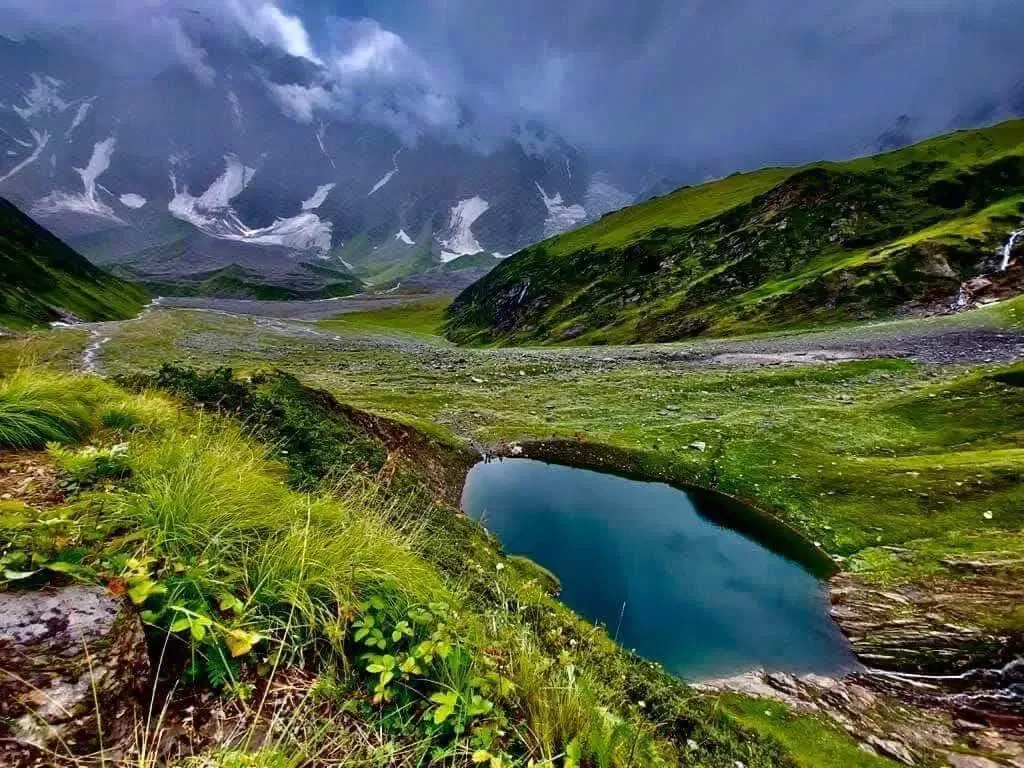
Forest trail (Day 1), then boulder fields and moraine (Day 2). The boulder field is the technical crux — rocks shift underfoot and require careful balance. No ropes or climbing needed.
Summit Day Notes
Altitude: 12,500ft. The final moraine scramble is steep and loose. Oxygen approx 65%. Take small, rhythmic steps.
The Descent
Boulder-hopping in reverse is harder. Focus on stable footholds. Descend slowly.
Trail Performance Data
Max Gradient
30%
Hydration
0.4L per km recommended
Loose Surface Sections
- •Final rise to the lake (boulders/moraine)
Personal Readiness
Am I ready?
What this route demands
People who feel comfortable on this route can usually:
Who Can Do This Trek?
Min Age
8+
Max Age
60
Western Toilets at Base
Yes
Solo Female Travelers
Very High; popular group trek and close to Manali tourism hub.
Hazard Profile
What goes wrong?
Common Mistakes on Beas Kund Trek
Most injuries and failures on this trail can be avoided by making smarter decisions early on.
Wearing flat-sole shoes — the boulders demand grip.
Not carrying enough water to the lake.
Trying to reach the glacier above the lake — it's highly unstable.
Starting late — afternoon clouds rob you of the view.
Ignoring sun protection — the reflection off snow and boulders is intense.
Safety & Medical Risks
Key Risks
Unstable boulders — ankle/knee twist risk
Snow bridge collapse in early June
Sun glare and UV burn at 12k ft
Rapid weather change at the lake cirque
AMS (Altitude Sickness)
Low risk. 12,500ft is well-tolerated by most with proper hydration.
Evacuation Route
Walk to Dhundi (2 hours). Jeep to Manali (1 hour).
Solo Trekking
Safe for experienced solo hikers. Trail is well-trafficked in season. The boulder field can be confusing in fog — follow cairns.
Common Trail Ailments
🏥 Nearest ICU: Lady Willingdon Hospital, Manali
Tactical Emergency Hub
> 1.5 hr walk to Dhundi roadhead from Bakarthach. 30 min drive to Manali Mission Hospital. Very accessible rescue zone.
Auditability
How is this calculated?
Understand This Route Further
Before attempting this route:
Still deciding?
Compare routes side-by-side to find the perfect match for your fitness, dates, and budget.
Still think it's doable? Share this with your trek mate and see if they agree.
Step 2: Seasonal Safety
You know how demanding this route is.
Now find the safest and most reliable season to attempt it.
Check Best Time to Go