
Explore
Intelligence
Essential Planning Guide
Bamsaru Khal Trek — Complete Guide (2026)
Vibe & Scenery
The Experience
Introduction
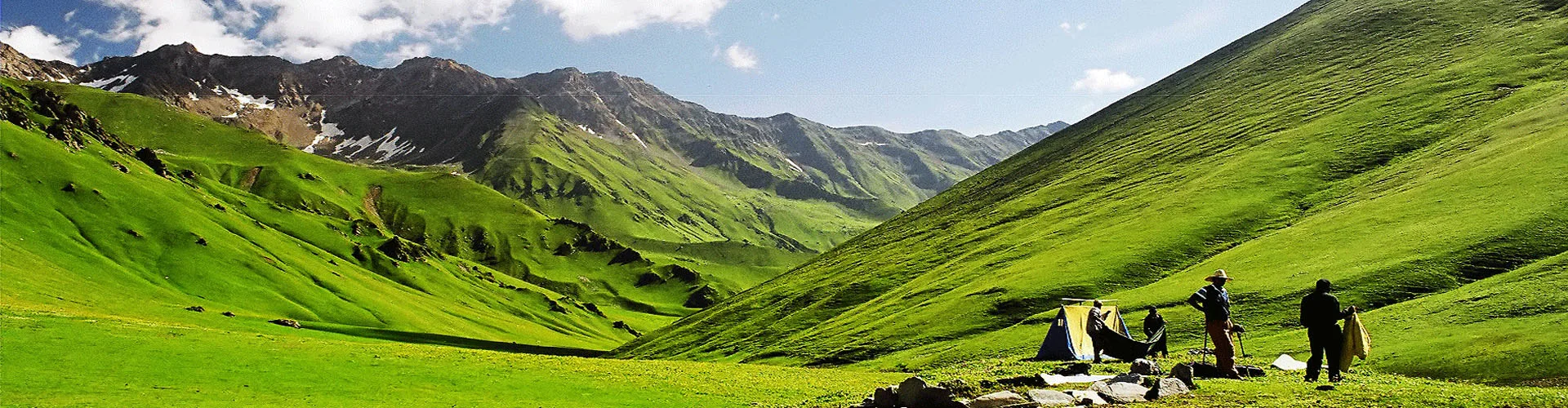
The Bamsaru Khal Trek is one of Garhwal's lesser-known crossover expeditions, connecting the forests around Dodital with the isolated valleys beyond Bamsaru Khal. Unlike popular trekking circuits, this route spends most of its journey in remote mountain terrain where long walking days, self-sufficiency, and changing weather become part of the experience.
After following the trail towards Darwa Pass, the expedition gradually leaves established trekking routes behind and enters increasingly rugged alpine landscapes of boulder fields, glacial moraines, snow slopes, and exposed ridgelines. Crossing Bamsaru Khal at around 15,100 ft is the defining challenge of the trek, rewarding trekkers with expansive views of the Bandarpoonch massif, Black Peak (Kalanag), and surrounding Garhwal ranges.
This is not a trek chosen for famous campsites or crowds. It appeals to experienced trekkers seeking a genuine wilderness crossing where route commitment, endurance, and mountain judgement matter as much as fitness.
Quick Facts
Duration
Max Altitude
Difficulty
Best Time
Trek Distance
Trail Atmosphere
Stargazing
Class 1 Dark Sky
Scent Profile
Silence Level
~15 dB
Vertigo Factor
8 / 10
Iconic Spots
Darwa Pass Ridge
Bamsaru Khal Summit
Environment
Nature & Culture
Flora & Fauna
Flora
Fauna
Dodital is revered as the birthplace of Lord Ganesha. The lake waters are sacred, and the surrounding forests are considered protected by local deities. The pass itself was an ancient, highly dangerous shepherd shortcut.
— Local folklore
Spiritual & Cultural Significance
Dodital is a major pilgrimage site. The pass itself crosses ancient mythological boundaries.
🕐 Shrine Timings: Dodital temple open daylight hours.
Temple Protocols
- •Strictly vegetarian zone.
- •Remove shoes near Dodital temple premises.
Technical Details
Challenge & Preparation
Primarily a cardio demand and cumulative fatigue challenge
A demanding expedition dominated by extreme cardio demand.
Personal Readiness
Am I ready?
Planning
Logistics & Trail Intel
Getting There
Route to Base
Drive from Dehradun via Mussoorie and Uttarkashi to the road-head at Sangam Chatti
Base Village
Sangam Chatti
4,500 ft
Last ATM
Uttarkashi.
Nearest Medical Facility
District Hospital Uttarkashi
Mobile Signal
Complete dead zone. Zero connectivity.
Water Sources
Abundant up to Dodital. In Bingad and Songad, water is sourced from glacial melt streams. Must be heavily filtered for glacial silt.
Charging
Zero charging points after Uttarkashi/Sangam Chatti. Carry multiple power banks.
For Drivers
Road Condition
Good highways up to Uttarkashi. The exits from Sukki/Harsil are military-grade roads but prone to landslides.
Uttarkashi
Trail Culinary & Diet
Don't miss the High-altitude Khichdi for easy digestion at 14,000 ft.
Buy specialized diet items at Uttarkashi
The Content & Remote Hub
No DronesDrones are strictly banned in Gangotri National Park. Confiscation and fines apply.Top Vlog Spots
Video Calls
none
UPI Reliability
4/10
Permits and Regulations
Trekking this route requires permits from the Uttarkashi Forest Department, covering both the Asi Ganga and the Gangotri National Park boundaries. A registered, highly experienced local guide is legally mandatory. Strict 'Leave No Trace' policies apply. Foreign nationals require inner line clearance since the descent drops into the sensitive Harsil/Gangotri border region.
Learn more about how we vet operators and ensure transparency on our why MountRoutes page.
Packing List
High-Altitude Layering
- Heavyweight down jacket rated to -15°C (mandatory for Bamsaru Base Camp)
- Gore-Tex or equivalent hardshell jacket and pants for ridge winds
- 3 pairs of merino wool thermal baselayers
- 2 thick fleece mid-layers
- Waterproof alpine gloves and lightweight thermal liners
- Fleece balaclava and UV-protective neck gaiter
- 4 pairs of heavy woolen trekking socks
Mountaineering & Terrain Footwear
- Sturdy waterproof mountaineering/trekking boots with aggressive Vibram soles
- Professional Microspikes (mandatory for the Darwa and Bamsaru descent)
- Waterproof high-ankle gaiters (for snow and scree)
- 2 sturdy anti-shock trekking poles
- Camp sandals or lightweight shoes
Survival & Safety Equipment
- Four-season sleeping bag rated to -15°C
- High-lumen headlamp with extra lithium batteries (cold drains batteries fast)
- UV400 Polarized Category 4 Sunglasses (essential for pass crossing)
- Comprehensive Personal First Aid Kit with Diamox and Dexamethasone
- High SPF Sunscreen (50+) and zinc oxide lip balm
- Insulated water thermos (1 Liter)
Deep Dives
Explore Further
Editor's Notes
Explore In Detail
Day by Day Itinerary
8-day route reaching 15,100ft. Covers 66.0km of varied terrain.
→ See full itinerary with altitude profileDifficulty & Fitness
Rated challenging. The trek throws every Himalayan terrain at you: paved mule tracks, dense root-filled forests, alpine grass, riverbed boulder hopping, deep snow, and treacherous scree.
→ See difficulty breakdown and fitness guideCost & Pricing
Packages range from ₹18,000 – ₹26,000. Inclusions and hidden costs vary by operator tier.
→ See full cost breakdownFrequently Asked Questions
Is the Bamsaru Khal Trek suitable for beginners?
Absolutely not. This is a difficult, high-altitude expedition crossing two major passes (Darwa at ~13,600 ft and Bamsaru at ~15,100 ft). It requires excellent cardiovascular fitness and prior experience with high-altitude treks.
Is this the same as the Dodital Trek?
Dodital is just the warm-up. While commercial Dodital treks end at the lake or Darwa Top and return, the Bamsaru Khal expedition pushes much further into the unmapped Bingad and Songad valleys to cross the Bamsaru pass.
What kind of terrain can I expect on the pass crossing?
The final climb to Bamsaru Khal involves navigating steep, unstable scree, boulder fields, and often deep snow depending on the season. The descent towards Songad is notoriously sharp and hard on the knees.
Are ropes required for Bamsaru Khal?
Usually, fixed ropes are not mandatory in the peak season (September). However, in early June, when snow is deep on the descent, guides may fix a safety rope for a brief section near the cornices of the pass.
Where is the last point of mobile connectivity?
You will lose all mobile network (BSNL/Jio) shortly after leaving Sangam Chatti. You will be completely off-grid for the next 6 to 7 days until you reach Sukki or Harsil.
Is Acute Mountain Sickness (AMS) a major risk here?
Yes. The jump to Bamsaru Base Camp (~13,500 ft) and the pass (~15,100 ft) poses a significant AMS risk. The itinerary is designed to acclimatize you at Dodital and Bingad first.
Are there river crossings?
Yes, particularly in the Bingad and Songad valleys. Depending on the snowmelt, these glacial streams can run high and freezing cold in the afternoons.
Why is this trek so rarely done compared to Roopkund or Goechala?
Bamsaru Khal is logistically complex, requires pristine navigation as trails disappear in the upper valleys, and lacks the commercialized infrastructure of popular routes. It is reserved for purists.
Still deciding?
Compare routes side-by-side to find the perfect match for your fitness, dates, and budget.
Everything you need to know, in one place. Someone else in your group needs to see this.
Planning Bamsaru Khal Trek?
Get route conditions, operator updates, and season windows before booking.
Don't miss out! Follow us for route updates@mountroutes|LinkedIn
No spam. Only useful trek updates.
Ready to walk this route?
You’ve read the guide, now find the perfect local team to take you there. Compare our verified list of operators.
Compare verified operators